
Directions
From Seattle Travel on 1-5 south to Olympia, take highway 101 N toward Aberdeen. Take state highway 8, this turns into highway 12 which will get you to Aberdeen. From Aberdeen, WA travel 40 miles north on Highway 101 to South Shore Road. Take South Shore road 1.5 miles to Willaby Campground. Entrance to campground is from the South Shore Road just beyond the Quinault Rain Forest Nature Trailhead.
Phone
360-288-0203
Activities
HIKING, SWIMMING
Keywords
WILLABY CAMPGROUND,WILLABY
Related Link(s)
Overview
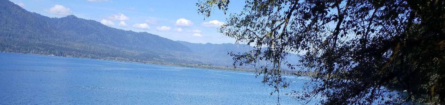
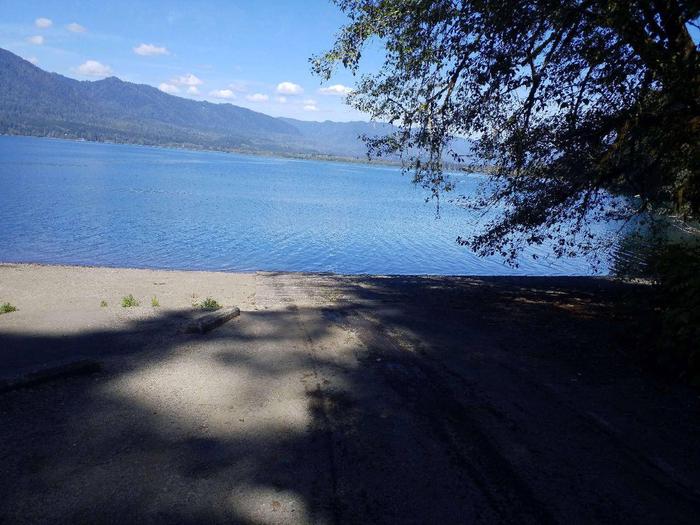
With all campsites located near the shoreline of glacially carved Lake Quinault, visitors are sure to enjoy the beautiful shoreline and interpretive opportunities in the area. From old-growth trees in the surrounding rain forest to excellent fishing, Willaby Campground’s location is ideal for outdoor enthusiasts.
Recreation
The forest features 10 miles of hiking trails and many waterfalls within walking distance of the campground. Lake Quinault is part of the Quinault Indian Nation As such,You must have a fishing permit and or boat permit through the Quinault Indian Nation. Both may be purchased through local merchants. Lake Quinault Lodge offers boat and kayak rentals as well as a number of interpretive tours.
Facilities
There are 21 campsites that can accommodate tents, trailers and RVs up to 16 feet in length, however no hook ups are provided. Some sites are in wooded areas and others are not; many of the sites have a view of the lake. The campground has a potable water system. The site also has a barrier-free flush toilet as well as several accessible camp and picnic sites.
Natural Features
The forested slopes of Olympic National Park provide a scenic backdrop across Lake Quinault. Towering conifers including Sitka spruce, Douglas-fir, western hemlock and western red cedar provide dense shade for this beautiful setting. The forest floor is covered with lush rain forest plants including moss, ferns, false lily-of-the-valley and oxalis.
Nearby Attractions
Nearby, Lake Quinault Lodge offers a restaurant and gift shop. Short trails in the area include the Big Spruce Tree Trail, Forest Service Nature Trail, Kestner Homestead Trail and the Maple Glade Trail. Explore the ocean beaches close-by as well as the National Fish Hatchery. For a more adventuresome day, drive up the valley to hike along the rivers or climb the 4,200 ft. Colonel Bob Peak for expansive views of the mountains and valleys on a clear day.