GREEN VALLEY, CA Campground Reservation, Info, Images, Map, Directions

GREEN VALLEY, California Campground Images, Info & Reservations

Directions

From Running Springs, travel east on Highway 18 about 3 miles to Green Valley Lake Road. Turn left and continue about 6 miles to the campground.

Phone

909-866-8550

Activities

BOATING, CAMPING, FISHING, HIKING, SWIMMING SITE

Keywords

GREV,GREEN VALLEY San Bernardino,SAN BERNARDINO NF – FS

Related Link(s)

Rec Area Info & Images

California State Road Conditions

Forest Service Concessionaire

California State Tourism

Overview

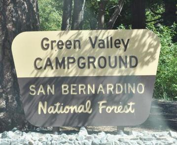
Green Valley Campground is located near Arrowbear in the San Bernardino National Forest in Southern California. It is centered between Lake Arrowhead and Big Bear Lake, providing ample recreational opportunities in the area’s pine-covered mountains. Green Valley Lake, known for its exceptional trout fishing, is located about a mile from this beautiful mountain campground.

Recreation

Green Valley Lake, which is known for its trout fishing, is located just minutes away. Boating and swimming are popular activities as well. The high elevation lake also provides access to a variety of hiking trails.

Facilities

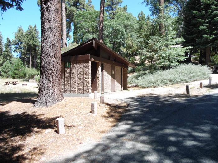
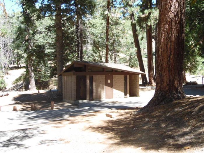
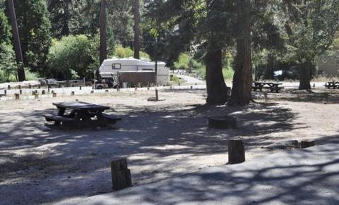
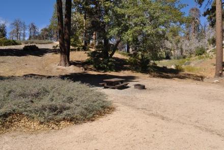
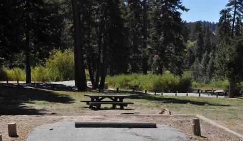
The campground offers single-family sites for tent and RV camping. Some sites are available on a first-come, first-served basis. Each site is equipped with a table and campfire ring with grill. Flush toilets and drinking water are provided. No overflow parking is available.

Natural Features

The campground is situated in a forest of pine, fir and cedar trees, mixed with open spaces filled shrubbery and grassy meadows. It overlooks a seasonal mountain creek and sits at an elevation of 7,200 feet.

Nearby Attractions

Lake Arrowhead is about 16 miles west and Big Bear Lake is about 15 miles east. A variety of services and recreational activities are available at each place.

Reservation

More from CampingHiking.net:

CARETAKERS CABIN, Oregon Campground Images, Info & Reservations

Directions From Pendleton, Oregon: Travel south on Highway 395 for 50 miles to the Ukiah exit. Turn left on Highway 244 to Ukiah. Turn right (south) just before the city park; this road becomes Forest Service Road (FSR) 52 at the Forest boundary. Travel 50 miles to the small town

PRAIRIE FLOWER RECREATION AREA, Iowa Campground Images, Info & Reservations

Directions From I-35, take exit 90 to Ankeny/Oralabor Road and go west for 4.8 miles. The road turns into Highway 415, continue and follow signs to the campground. Phone 515-984-6925 Activities BIKING, BOATING, CAMPING, FISHING, HIKING, HUNTING, WATER SPORTS, SWIMMING SITE Keywords PRAF,SAYLORVILLE LAKE,PRAIRIE FLOWER NORTH,PRAIRIE FLOWER SOUTH,ASTER,BLAZINGSTAR,CONEFLOWER,DOGBANE,ELDERBERRY,FLEABANE,GOLDENROD,HONEYSUCKLE,IRONWEED,JUNEBERRY,KNAPWEED,LEADPLANT,MAYWEED,NIPPLEWORT,OXEYE,SAYLORVILLE LAKE Related

BERRY BEND EQUESTRIAN, Missouri Campground Images, Info & Reservations

Directions From Z Highway, travel approximately 2 miles south on the Berry Bend Access Road. Phone 660-438-7317 Activities BOATING, CAMPING, FISHING, HIKING, HORSEBACK RIDING, FISH HATCHERY Keywords BERE,TRUMAN LAKE,BERRY BEND NORTH,HARRY S TRUMAN Related Link(s) Rec Area Info & Images Missouri State Road Conditions Missouri State Tourism Overview BERRY BEND

BLUE LAKE CAMPGROUND, Colorado Campground Images, Info & Reservations

Directions From Colorado Highway 12 south of the Town of Cuchara, take FSR 422 4 miles west to the campground. Phone FOR RESERVATIONS CALL (877) 444-6777, FOR OTHER, NON REAL TIME INFORMATION, CALL (719) 269-8500. Activities BIKING, CAMPING, FISHING Keywords Related Link(s) Rec Area Info & Images Colorado State Road

MOOSE MANOR, Colorado Campground Images, Info & Reservations

Directions From Grand Junction, CO, take I-70 east for 13 miles. Take exit 49 to Highway 65 South toward Grand Mesa. Continue for 25 miles and turn right into Mesa Lakes Recreation Area. Take the second right toward Day Use Parking, and look for Mesa Lakes Ranger Station on the

CALPINE LOOKOUT, California Campground Images, Info & Reservations

Directions From Sierraville, the lookout is approximately 10 miles north on State Highway 89. Renters will be given a renters packet after check-in with the best access or parking based on current weather conditions. During the winter months, access is by snowshoes, skiis or snowmobiles on a 2 mile trail