CRAIGS CREEK GROUP AREA, KY Campground Reservation, Info, Images, Map, Directions

CRAIGS CREEK GROUP AREA, Kentucky Campground Images, Info & Reservations

Directions

From London, Kentucky, take Exit 38 from I-75. Take Kentucky 192 west for 12.2 miles. Turn left onto Forest Road 62 and drive 2 miles to the Craig’s Creek site.

Phone

606-528-6156

Activities

BIKING, CAMPING, FISHING

Keywords

CRAS,CRAIGS CREEK CAMPGROUND,CRAIGS CREEK SHELTER,CRAIGS CREEK PICNIC SHELTER,LAUREL RIVER LAKE,LAUREL LAKE,DANIEL BOONE NF-FS

Related Link(s)

Rec Area Info & Images

Forest Service Concessionaire

Kentucky State Tourism

Kentucky State Road Conditions

Overview

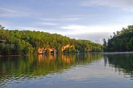
Craigs Creek Group Area is perched near Laurel River Lake in the Daniel Boone National Forest. Here, group campers find hours of fun playing on the sports field, firing up the grills and exploring the beautiful lake.

Daniel Boone National Forest protects 23 species listed as federally threatened or endangered. Species range from the magnificent bald eagle to the small Indiana bat and the Cumberland Sandwort.

Recreation

The hiking and biking trail at Craig’s Creek is an easy, half-mile path that features several views of the lake.

Picnicking, boating and fishing are popular pastimes for visitors. Fish species include crappie, catfish, small and largemouth bass and rainbow trout.

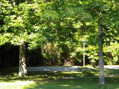
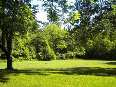
A spacious sports field with a volleyball net and horseshoe pits lies near the picnic shelter.

Facilities

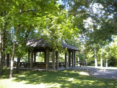
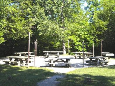
Group sites are for tent camping only and do not have electricity. The day-use picnic shelter fits 60 guests, and the group campsites fit up to 30 and 60 guests, depending on the location.

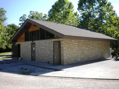
Each group camp area comes with a campfire circle, large grill, picnic tables and a lantern pole. Modern vault toilets and a shower house are available.

Natural Features

The campground sits on Craig’s Creek, which flows into an arm of Laurel River Lake across from Holly Bay Campground. The group site lies in a somewhat open space surrounded by woods.

Set in the Appalachian foothills, plenty of hills and valleys create a beautiful backdrop for the lake area.

Reservation

More from CampingHiking.net:

KAIBAB LAKE SITES AND GROUP AREAS, Arizona Campground Images, Info & Reservations

Directions From Williams, Arizona, take I-40 east to exit 165. Turn north onto State Highway 64 toward Grand Canyon and go a mile to the campground entrance on the left. Phone 928-699-1239 Activities BOATING, CAMPING, INTERPRETIVE PROGRAMS, FISHING, HIKING, HORSEBACK RIDING, WILDLIFE VIEWING, DAY USE AREA Keywords KAIB,Kaibab Picnic Area,Kaibab

SHERIDAN, Montana Campground Images, Info & Reservations

Directions From U.S. Highway 212, turn off at Eastside Road and go 2 miles to the campground. The entrance is on the left. Phone 406-587-9054 Activities BIKING, BOATING, CAMPING, FISHING, HIKING Keywords SHDN,CUSTER NF – FS,SHERIDAN Related Link(s) Rec Area Info & Images Overview Sheridan Campground is located seven miles

MIDDLE DANGEROUS RIVER CABIN, Alaska Campground Images, Info & Reservations

Directions The cabin is located 30 miles southeast of Yakutat, 200 feet east of Dangerous River. Access is by jetboat or a 4-mile ATV trail from the Dangerous River Bridge at the end of Forest Highway 10. Phone (907) 784-3359 Activities BOATING, CAMPING, HIKING, HUNTING, WILDLIFE VIEWING Keywords MIDR,TONGASS NF

EAST DAVIS CAMPGROUND, Oregon Campground Images, Info & Reservations

Directions From Crescent, OR: Travel 8.8 miles west on County Road 61, then 7.7 miles north on Highway 46, then 2.6 miles west on Forest Road 4600 850. Phone 541-323-1746 Activities CAMPING Keywords Related Link(s) Rec Area Info & Images Oregon State Tourism Oregon State Road Conditions Overview East Davis