DEVILS ELBOW, ID Campground Reservation, Info, Images, Map, Directions

DEVILS ELBOW, Idaho Campground Images, Info & Reservations

Directions

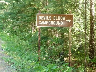
From I-90, take Exit 43 (Kingston) and travel 20 miles north on FH9 to Prichard. Continue 11 miles north on Forest Road 208 to the campground.

Phone

435-245-6521

Activities

CAMPING, FISHING, SWIMMING SITE

Keywords

DEV2,DEVIL S ELBOW,IDAHO PANHANDLE NF – FS

Related Link(s)

Rec Area Info & Images

Forest Service Concessionaire

Idaho State Road Conditions

Idaho State Tourism

Overview

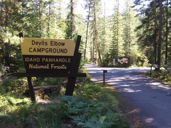
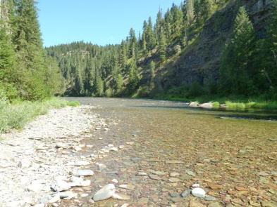
Devil’s Elbow Campground is perched on the banks of the North Fork Coeur d’Alene River, providing a perfect escape for a warm summer weekend. Here, visitors can camp in tents or RVs and spend their days fishing or floating the river.

Recreation

Rafting, swimming and kayaking are favorite activities on the river. Rafters will find class I-III rapids further down the river. Catch-and-release cutthroat trout fishing is also popular.

Visitors also enjoy explore the river valley on foot to see nearby Downey Creek or Valitons Creek.

Facilities

Devil’s Elbow Campground has 20 campsites including one host site and a group site. The group site can accommodate up to 50 people. Amenities include hand-pump drinking water and vault toilets.

Campground roads are paved and parking spurs are short but wide enough for parking two vehicles alongside a trailer.

Natural Features

    The campground sits among lodgepole and other mixed pines along the river at an elevation of 2,600 feet. The area is located in the Coeur d’ALene Mountains, 69 miles from popular Coeur d’Alene Lake.

    Wildlife watchers and photographers have the chance to see mule deer, moose, osprey and calliope hummingbirds.

Reservation

More from CampingHiking.net:

Lodgepole Campground (MT), Montana Campground Images, Info & Reservations

Directions From Philipsburg travel 10.75 miles south on State Highway 1. The campground is directly across the highway from Georgetown Lake and Red Bridge Boat Launch. Phone 406-210-8199 Activities BIKING, BOATING, CAMPING, FISHING, HIKING, HUNTING, WATER SPORTS, WILDLIFE VIEWING, SWIMMING SITE Keywords LODB,BEAVERHEAD-DEERLODGE NF -FS Related Link(s) Rec Area Info

ROBINSON CREEK NORTH, California Campground Images, Info & Reservations

Directions Take U.S. Highway 395 through Bridgeport. Turn south on Twin Lakes Road at the Shell gas station. Travel 9.3 miles on Twin Lakes Road, then turn left into the campground. Phone 760-932-7092 Activities CAMPING, FISHING, HIKING, WILDLIFE VIEWING Keywords ROBI,HUMBOLDT-TOIYABE NF-FS Related Link(s) Rec Area Info & Images California

TANNERS FLAT, Utah Campground Images, Info & Reservations

Directions From I-215, take the 6200 South exit and travel a mile east to Wasatch Blvd. Take Wasatch Blvd 3 miles south to junction with Little Cottonwood Canyon/Highway 210. Take a left at the junction and travel up Little Cottonwood Canyon for 4.1 miles to the campground. Phone SALT LAKE

SQUAW LAKES, Oregon Campground Images, Info & Reservations

Directions From Jacksonville, Oregon, take Highway 238 west 7 miles and turn left at Ruch on Road 859. Go 14 miles to Applegate Dam, cross over the dam (Road 1075) and continue on pavement 2 miles. When pavement ends, continue 7 miles to the campground. Phone (541) 899-9220 Activities BIKING,