TABLE ROCK, ID Campground Reservation, Info, Images, Map, Directions

TABLE ROCK, Idaho Campground Images, Info & Reservations

Directions

From Idaho Falls, Idaho, take Highway 26 east for 20 miles. Turn onto Heise Road and travel past Kelly Canyon Ski Resort. Take Forest Road 218 for 1 mile to junction with Forest Road 217. At the Y intersection, bear slight right and travel 1.25 miles to the campground.

Phone

208-270-0150 OR 541-351-1182

Activities

BIKING, CAMPING, HIKING

Keywords

TABR,CARIBOU-TARGHEE NF – FS

Related Link(s)

Rec Area Info & Images

Idaho State Road Conditions

Forest Service Concessionaire

Idaho State Tourism

Overview

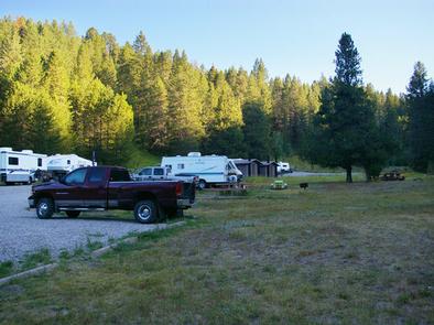
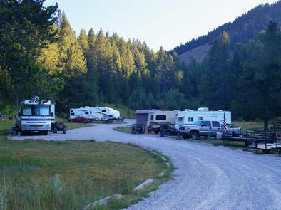
Table Rock Campground is located in a small but scenic canyon near Kelly Canyon Ski Resort, approximately 30 miles from Idaho Falls, Idaho. Hiking, mountain biking and ATV riding are popular activities.

Recreation

Hawley Gulch Trail begins at the campground, offering great opportunities for ATV enthusiasts, hikers and mountain bikers. Numerous forest roads and trails in the area allow ATV travel, hiking, horseback riding and mountain biking.

Facilities

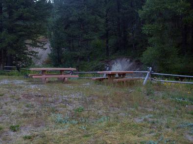
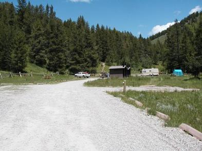
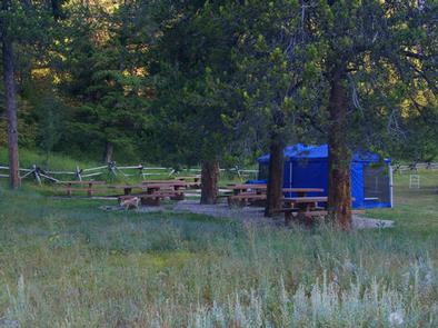
Table Rock is a large group campground that can accommodate up to 200 people. Accessible vault toilets are provided, but there is no electricity. Picnic tables, campfire circles and grills are scattered throughout the site. The road and oversized parking spur are gravel.

Natural Features

The campground is situated in a quiet draw covered by an open grassy meadow dotted with summer wildflowers. Aspens and towering pines border the site, offering partial shade.

Reservation

More from CampingHiking.net:

Toto Creek Campground, Georgia Campground Images, Info & Reservations

Directions Physical address is 154 Toto Creek Park Rd., Dawsonville, GA 30506 From Georgia Highway 400 North, exit left for Harmony Church Rd. heading east; stay straight onto Price Rd.; turn right on Toto Creek Park Rd.; turn right to continue on Toto Creek Park Rd.; road dead ends into

CADDO DRIVE, Arkansas Campground Images, Info & Reservations

Directions From Interstate 30 take exit 78. Merge onto State Highway 7 north for 6 miles. Turn left onto Edgewood Road and continue 3 miles to Caddo Drive. Phone 870-246-5501 Activities BOATING, CAMPING, FISHING, WILDLIFE VIEWING, SWIMMING SITE Keywords CADV,DEGRAY LAKE,DEGRAY LAKE,CADDO,DeGray Lake Related Link(s) Rec Area Info & Images

DEER RIDGE LOOKOUT, Idaho Campground Images, Info & Reservations

Directions Take Highway 95/2 north from the Bonners Ferry Ranger Station for 5 miles. Turn right onto Highway 2 and head east for 2 miles. Turn left onto Meadow Creek Road and head north and east for 10 miles to the bridge over the Moyie River. Turn right onto Road

MORGAN-CASE HOMESTEAD, Montana Campground Images, Info & Reservations

Directions From Missoula, Montana, travel east on Interstate 90 for about 20 miles to exit 126. Drive south on Rock Creek Road for about 30 miles. Rock Creek Road is a hardened surface for 12 miles and the remainder is a gravel, single-lane road, with intermittent pull-outs. It is not