Directions
Rocky Knob Campground is located at Milepost 167.1 on Blue Ridge Parkway, 1.8 miles south of the intersection of the Parkway and State Route 8, about 8 miles (13 km) from the town of Floyd, or about 90 minutes south of Roanoke by car. Visitors are advised that directions from resources like Google Maps and GPS devices are not always correct and should be double-checked.
Phone
540-745-9664 (MAY – OCTOBER)
Activities
CAMPING, INTERPRETIVE PROGRAMS, HIKING, PICNICKING, VISITOR CENTER, WILDLIFE VIEWING, PHOTOGRAPHY, BIRDING, WINERY TOURS
Keywords
Blue Ridge Parkway Rocky Knob
Related Link(s)
Virginia State Road Conditions
Overview
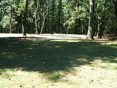
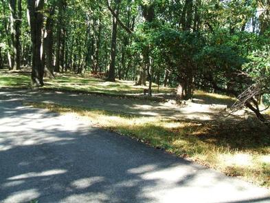
Located on the famous Blue Ridge Parkway in the hills of rural Virginia, Rocky Knob Campground is nestled amid rolling meadowlands with impressive displays of seasonal flowers, endless night skies and green pastures. Numerous nearby overlooks and the winding parkway provide an ideal backdrop for a traditional camping experience.
Recreation
The campground is located in the Rocky Knob Recreation area, surrounded by more than 4,000 acres of forest.
The site offers easy access to the Rock Castle Gorge Trail, a 10.8-mile (17.4 km) loop trail ranging in elevation from 1,700 to 3,572 feet (518 to 1,089 m). Rock Castle Gorge, a 1,500-foot (457 m) ravine carved by the waters of Rock Castle Creek, is the focal point of this trail, offering hikers breathtaking scenery.
Black Ridge Trail: a moderate 3-mile loop passing through the forest on a seldom-used gravel road and through a meadow. Accessed from the Rocky Knob Visitor Center.
Numerous tours and interpretive talks are given near the Gorge and surrounding trails during the summer, offering campers the chance to learn more about the area’s historical significance and abundant plants and wildlife.
Facilities
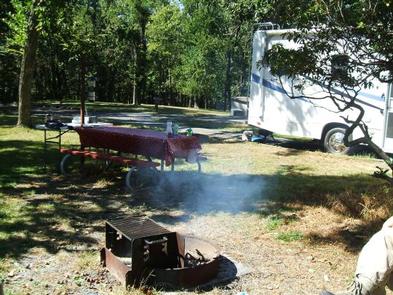
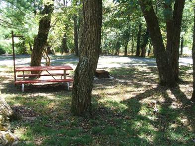
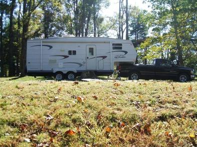
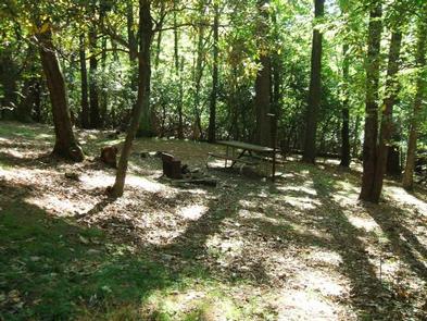
Rocky Knob Campground combines the exhilaration of a traditional outdoor camping experience with modern amenities like flush toilets, dump station, and drinking water. Both RV and tent sites are available, each equipped with picnic tables, lantern poles, and fire rings/grills–perfect for picnics, barbecues or late night s’mores.
The campground almost always has campsites available. In addition to the 44 sites available for advanced reservation, 62 campsites are available on a first-come, first-served basis.
Primitive Backcountry Camping is available at Rock Castle Gorge. Obtain a free permit from the Rocky Knob campground office (May-October) or the Rocky Knob District Office (540-745-9660).
Natural Features
The Blue Ridge Parkway is a scenic byway that stretches almost 500 miles along the crest of the Blue Ridge Mountains through North Carolina and Virginia. It offers plenty of natural attractions and recreational opportunities for visitors, as well as a cross-section of Appalachian mountain history from pre-historic times to early European settlements, and on to today. Rocky Knob Campground, one of the first established sites along the Blue Ridge Parkway, is home to several famous geological attractions. Rock Castle Gorge, known for its beautiful rock crystalline quartz formations, was once home to several mountain families. Visitors can still find remnants of their old apple orchards and abandoned stone chimneys along parkway trails.
Nearby Attractions
The nearby town of Floyd offers entertainment, shopping, food, gas and lodging. There are also multiple wineries nearby that offer tours and tastings.
Visit Mabry Mill at milepost 176 near Meadows of Dan, Virginia.
The campground is about 30 miles from Mount Airy, North Carolina, the birthplace of actor Andy Griffith and the inspiration for the fictional TV-series town of Mayberry. Mount Airy also offers grocery stores, gas stations and medical facilities.

