Directions
From I-90, take Exit 43 (Kingston); travel 23 miles north on Forest Highway 9, then continue straight for 3 miles on Forest Road 208 (2-lane paved highway) to Avery Cabin. The cabin is approximately 200 feet past milepost 26. Avery Picnic Area is directly across Forest Road 208. From Coeur d’Alene, travel time is about 1 hour.
Phone
208-664-2318
Activities
BIKING, BOATING, CAMPING, FISHING, HIKING, WATER SPORTS, SWIMMING SITE
Keywords
Avery Cabin,Avery Guard Station,Avery Creek Guard Station
Related Link(s)
Overview
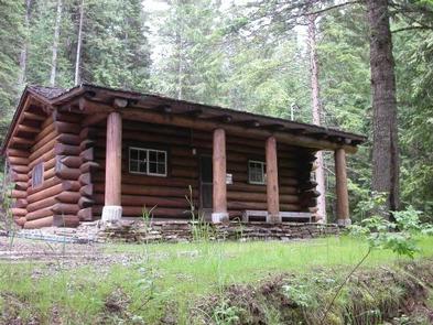
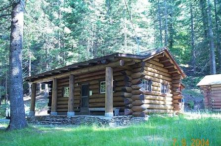
Avery Creek Cabin is located 20 miles northeast of Kingston, Idaho, along Forest Road 208. The fully furnished three-room cabin is adjacent to the North Fork Coeur d’Alene River on the Coeur d’Alene River Ranger District in the Idaho Panhandle National Forests.
The cabin was built between 1926 and 1928 to house Forest Service employees needed for administrative supervision and fire protection. It was built from a standard Forest Service plan known as the firemen’s cabin. In 1935, a picnic area was constructed by the Civilian Conservation Corps across the road from the cabin and adjacent to the North Fork of the Coeur d’Alene River. In 1940, a bathroom was added in a board and batten shed addition to the cabin’s east side, and a rustic log garage was built behind the cabin. The cabin was used for crew housing until 1981.
Newly renovated, the cabin is now fully accessible. Avery Cabin’s central location along the North Fork Coeur d’Alene River provides easy access to the site. Access to the cabin is along paved roadways, making it an easy destination to reach by car. The cabin is available from mid-May through September, and provides many of the comforts of home. Guests only need to bring a few of their own amenities for an enjoyable stay.
Recreation
Guests can enjoy fishing for cutthroat or rainbow trout in the river. Check Idaho Fish and Game regulations for restrictions. Tubing is also a popular river activity.
Hikers can enjoy a short hike to Centennial Falls. Non-motorized trails in the area include Lost Creek Trail, Settler’s Grove Botanical Area and Shoshone Ridge. Motorized trails include Graham and Coal Creek. These trail systems require some travel, but offer a variety of opportunities for outdoor enthusiasts.
Facilities
The cabin can accommodate six people and has a living room, kitchenette, bedroom, bathroom and a covered porch. The kitchenette is equipped with an electric range, refrigerator, basic cookware, dishes and utensils. The sink has hot and cold water. The water is drinkable and supplied by a well system that is not chemically treated. Water quality testing is performed regularly.
A fold-out couch, dining table and four chairs are in the living room. The cabin has electric baseboard heat. The bathroom has a flush toilet, sink, shower stall and mirror. The bedroom is equipped with a double bed and a set of bunk beds.
A picnic table, barbecue grill and campfire ring are provided outside. Four resin chairs are supplied on the front porch.
Guests should bring sleeping bags, flashlights, matches and newspaper, a first aid kit and garbage bags. All trash and food must be packed out, and guests are expected to clean the cabin before leaving.
Natural Features
Located in the heart of the Coeur d’Alene Mountains along the North Fork of the Coeur d’Alene River, Avery Creek Cabin is situated in a small grassy area surrounded by an evergreen forest at an elevation of 3,000 feet.
From lush evergreen mountains to the banks of winding rivers, the Idaho Panhandle National Forests create a tapestry of land and water in northern Idaho. Rich in wildlife, the forest is home to large game such as elk and deer, as well as species such as grizzly bears, wolves and caribou that add to the sense of wildness.


