
Directions
From Albuquerque, drive east on I-40 to Exit 175. Proceed north toward Cedar Crest on State Road 14, about 6 miles to State Road 536. Drive 8 miles up State Road 536. Look for signs on your right. Capulin is located about 2 miles past the Sandia Peak Ski area.
Phone
505-281-3304
Activities
HIKING, PICNICKING, WILDLIFE VIEWING, DAY USE AREA, OBSERVATION SITE, BIRDING, CROSS COUNTRY SKIING, SNOWSHOEING
Keywords
None
Related Link(s)
New Mexico State Road Conditions
Overview
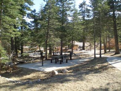
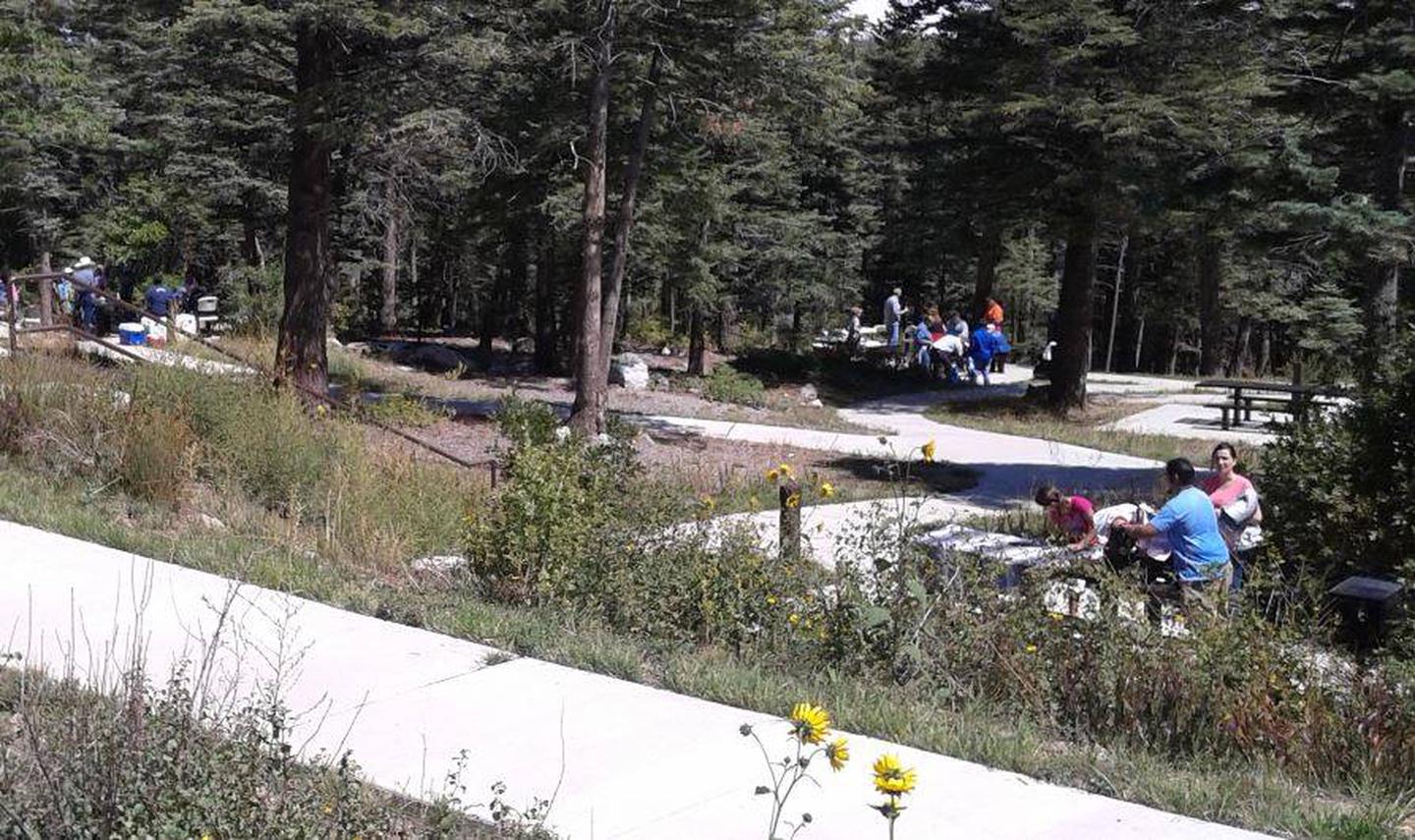
Capulin Spring is a well-loved recreation spot. It accommodates fifty people. This picnic site is surrounded by heavily wooded land that affords shade to escape the heat of the day. The spring at Capulin Spring runs year-round and is a much visited spot by birders, especially in the dry season because thirsty birds flock to this area for a nice, cool drink of water. Look for the big log and you will find beautiful birds of all types, sizes and colors. Remember to bring your camera.
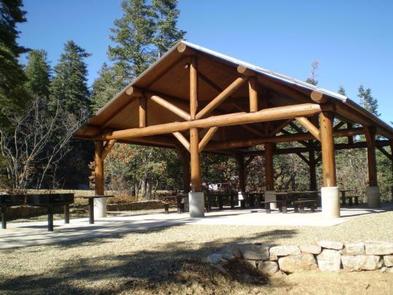
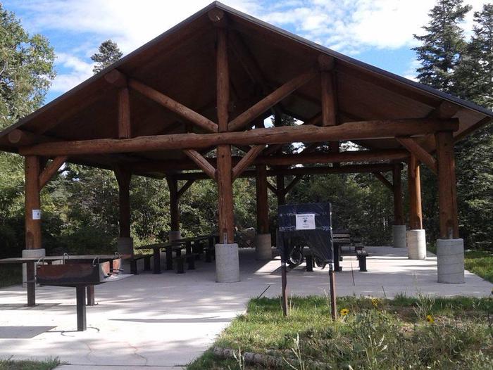
The sheltered area is a replica of a mid-1930s Civilian Conservation Corps design. The Civilian Conservation Corps (CCC) has a rich history and lasting presence throughout the Sandia’s. In their honor, we ask that you take extra care to “leave no trace” when you visit. Please be aware that there is no overnight camping at Capulin Spring.
Recreation
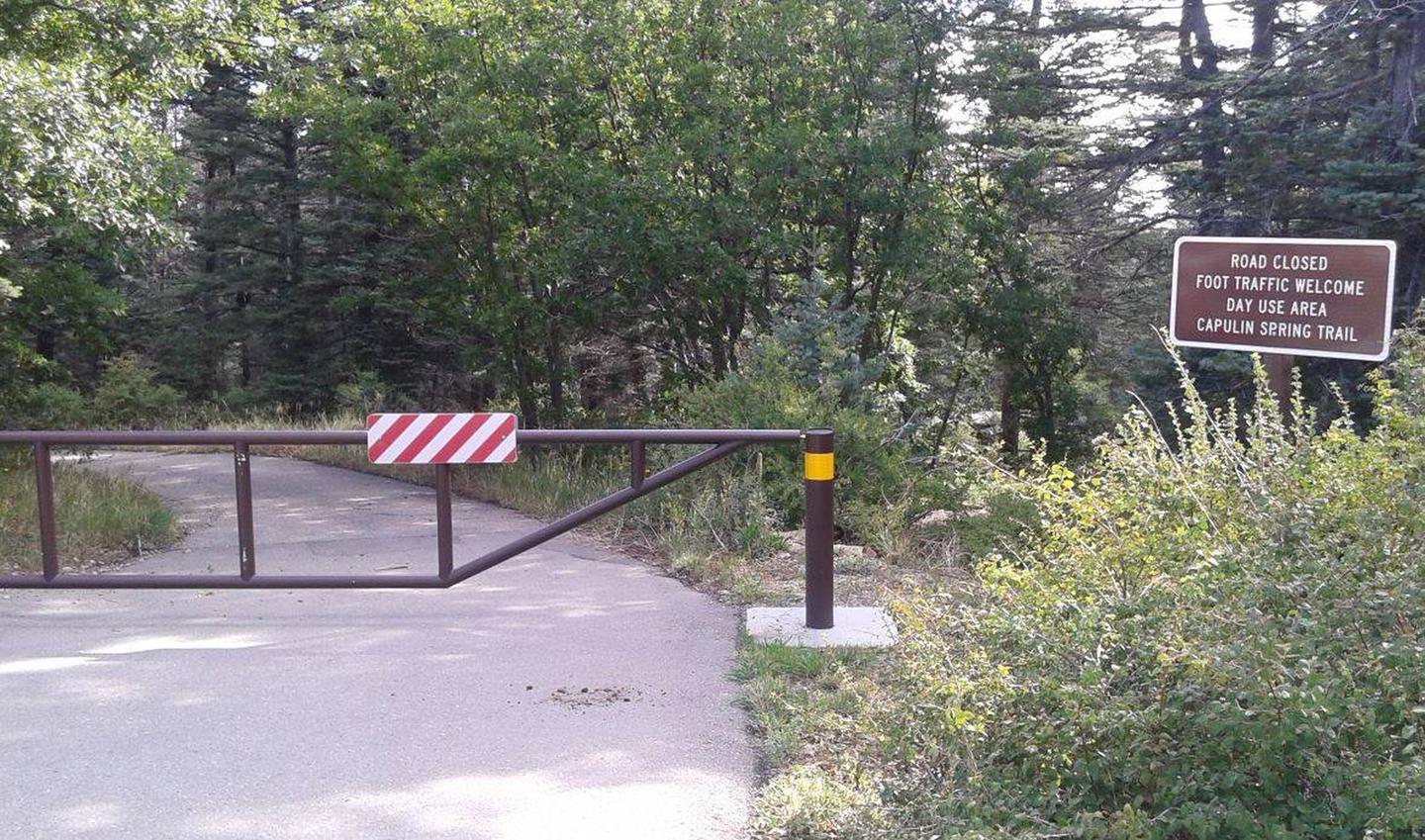
The Capulin Peak Trail starts at the Capulin Snow Play Area parking lot and is about .6 miles to the summit, with only 150 feet of elevation gain. It is shady for the most part but the final leg of the trail is rocky with lots of scrub brush. Just below the summit on the main trail are the ruins of an old mining shack and mining pit. Another option is Capulin Spring trail. It is a short walk down the hill on the service road. It is a popular location for bird watching and photography. These trails are suitable for children and adults to enjoy.
Facilities
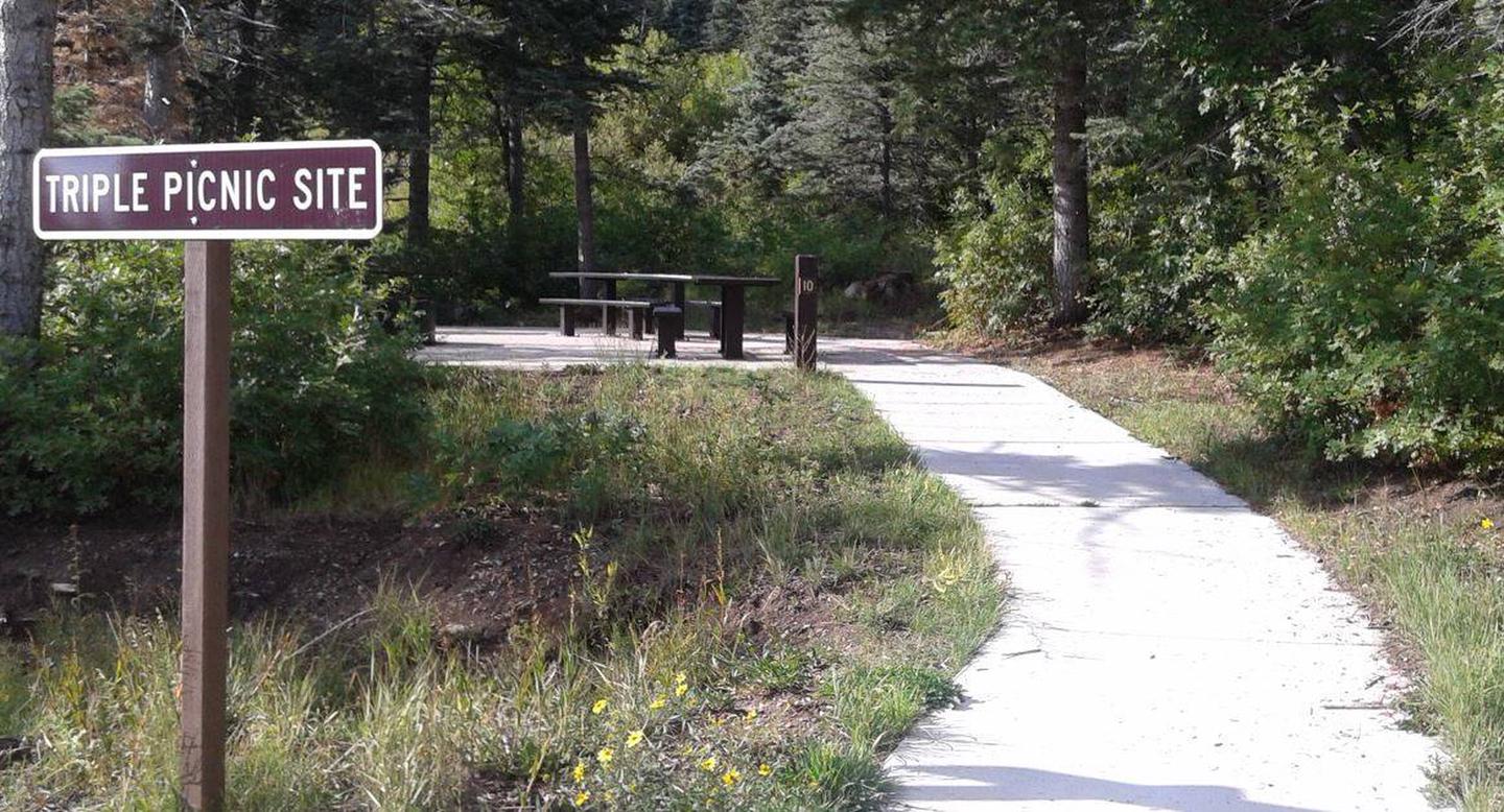
The reservation site can accommodate up to 50 people. Capulin Picnic Site includes a group picnic shelter, that is a modern day version of the Civilian Conservation Corps design found in most all of our picnic areas, six accessible picnic tables, food prep/serving tables and two large pedestal charcoal grills. The picnic pad, pathways and parking area are paved and accessible. **Water and Electricity, firewood /charcoal are not available at the site. Accessible vault toilets and bear proof trash receptacles are provided. PARKING: Each reservation comes with ten day use parking passes which should be picked up before hand, at the Sandia Ranger Station, Monday through Friday between 8:00 a m and 4:30 p m, (505) 281-3304. *Additional dispersed picnic areas, which do not require a reservation, are available on a first-come,first-served basis. Each area can accommodate a small family group and have no covering. Tables and grills are provided.
Natural Features
Capulin Spring is located two miles above Sandia Peak Ski Area at an elevation of 8,740 feet. It has hills and is heavily wooded around the perimeter of the site. There is a year-round spring that runs through it. The Sandia’s are home to mule deer, black bear, mountain lions and many other species of wildlife and birds, including golden eagles often seen soaring overhead.
Nearby Attractions
It is a short trip to the Sandia Crest. Take a right out of the Capulin parking lot and continue up Scenic Byway 536 to the top, for a magnificent view of Albuquerque and surrounding areas from the Sandia Crest overlook. The Crest was voted “Best Place to Pop the Question” in 2010… and it still is! The Kiwanas Cabin was built by the CCC in the 1930s and is located south of the Sandia Crest and can be seen from the Crest observation deck. The Peak area provides two launch pads for hang gliding, which is a popular sport during summer months. On summer weekends the Sandia Peak Ski Area lift makes runs to the top where the Sandia Tram and High Finance Restaurant are perched. Turn left out of Capulin Spring onto State Road 536. The ski area is a short distance down the road and located on the right side of the 536. For more info: (505)242-9052 or (505)856-1532. There are privately owned businesses and restaurants all along NM State Road 14 and a museum on your way up the 536 Scenic Byway.