COON CREEK (IL), IL Campground Reservation, Info, Images, Map, Directions

COON CREEK (IL), Illinois Campground Images, Info & Reservations

Directions

From Shelbyville, Illinois: Go 4.5 miles north of Shelbyville on State Route 128 to County Road 1750 N. Turn right (east) and drive 0.9 miles to County Road 1900 E. Make a left (north) and go 0.35 mile to County Road 1785 N. Turn right (east) and drive 1.75 miles to County Road 2075 E. Turn right (south) and go 1.7 miles to the facility.

Phone

217-774-3951

Activities

BOATING, CAMPING, FISHING, HIKING, VISITOR CENTER, DAY USE AREA, SWIMMING SITE

Keywords

COOC,LAKE SHELBYVILLE,COON CREEK LAKE SHELBYVILLE,LAKE SHELBYVILLE

Related Link(s)

Rec Area Info & Images

Illinois State Tourism

Illinois State Road Conditions

Overview

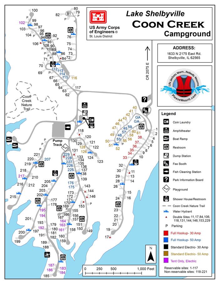
Coon Creek is a large campground that sits on the western shore of Lake Shelbyville in the heart of central Illinois.

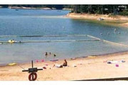
Families enjoy the playground, swimming area and shaded campsites within the facility. The lake and surrounding land offer outdoor activities for people of all ages, including fishing, swimming, picnicking and simply relaxing.

Click Here for the Lake Shelbyville Virtual Tour

Recreation

Lake Shelbyville offers a multitude of fishing opportunities for catfish, crappie, largemouth bass, muskie, walleye, white bass and bluegill. Coon Creek provides a boat ramp, and for those without a boat, several ponds with farmed fish are available around the lake.

Hunting areas within a short drive offer numerous game species, including quail, rabbit, pheasant, deer, dove, turkey, waterfowl and woodcock.

Visitors can also explore the lake shore on foot via a 0.7-mile nature trail within the facility.

Facilities

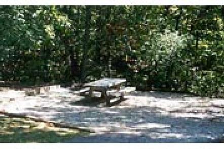
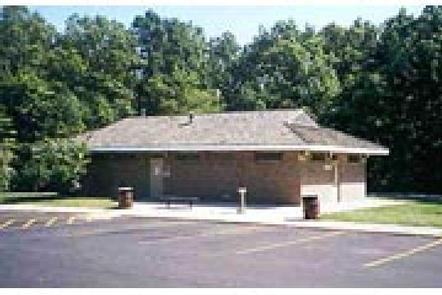
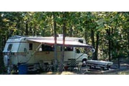
Coon Creek has 181 campsites, about 50 percent of which are reservable. All sites are equipped with electric hookups. The facility has flush toilets, showers, a playground, swimming beach, dump station and boat ramp.

Natural Features

This facility overlooks the lake shore and is heavily forested with plenty of shade.

Oak and hickory are the lake region’s dominant tree species, and foliage turns a variety of red, orange, purple and yellow each fall, while prairie flowers dot the landscape in spring and summer.

Numerous species of songbirds, shorebirds, waterfowl and raptors inhabit the lake area, as do mammals such as cottontail rabbit, white-tail deer, gray and fox squirrel, muskrat and mink.

Nearby Attractions

Wolf Creek State Park, Woods Lake Waterfowl Refuge and Okaw Bluff Wetlands Complex are popular locations for wildlife watching, birding and hunting near Lake Shelbyville.

Reservation

More from CampingHiking.net:

HEBER SPRINGS, Arkansas Campground Images, Info & Reservations

Directions From Heber Springs, AR, travel 2 miles west on SR-110, then .5 miles north on the paved access road. Follow signs to campground. Phone 501-250-0485 Activities BOATING, CAMPING, SWIMMING SITE Keywords HEBE,GREERS FERRY LAKE,GREERS FERRY LAKE Related Link(s) Rec Area Info & Images Arkansas State Tourism Arkansas State Road

BLUE BILL POINT, Oklahoma Campground Images, Info & Reservations

Directions Address for GPS: Blue Bill Point Campground, 67260 S. 307 Rd., Wagoner, Oklahoma 74467. From the intersection of US Highway 69 and State Highway 51 in Wagoner, Oklahoma, travel north on Highway 69 for 5.5 miles. Turn right on East 680 Road and travel east for 1 mile. Follow

NORTH DAVIS CREEK CAMPGROUND, Oregon Campground Images, Info & Reservations

Directions From Bend, OR: Travel 56.2 miles southwest on Cascade Lakes Hwy (46). The campground is on the east side of the highway. Phone 541-323-1746 Activities CAMPING Keywords Related Link(s) Rec Area Info & Images Oregon State Road Conditions Oregon State Tourism Overview North Davis Creek Campground is located on

HOGAN CABIN, Montana Campground Images, Info & Reservations

Directions Travel west on Highway 43 from Wisdom, Montana for approximately 20 miles. Turn north on the Trail Creek Road #106, travel for approximately 6 miles to the cabin. It will be located on the left (west) side of the road. Access 1 This route takes off from the Chief

Gold Bar Group Sites, Utah Campground Images, Info & Reservations

Directions From Moab, drive five miles north on Hwy 191 to the intersection with Hwy 279. Turn left/west on Hwy 279 and drive ten miles to the campground entrance road. Phone 435-259-2100 Activities BIKING, BOATING, CLIMBING, CAMPING, HIKING, OFF HIGHWAY VEHICLE, RECREATIONAL VEHICLES, PHOTOGRAPHY, PADDLING, MOUNTAIN BIKING, OFF ROAD VEHICLE

GREEN CREEK GROUP, California Campground Images, Info & Reservations

Directions From Bridgeport, California, take Highway 395 south 5 miles. Turn west on Forest Road 142 and follow signs for 7 miles to the campground. Phone 760-932-7092 Activities CAMPING, FISHING, HIKING Keywords GREC,HUMBOLDT-TOIYABE NF-FS Related Link(s) Rec Area Info & Images California State Tourism Forest Service Concessionaire California State Road