POTTERS POND, UT Campground Reservation, Info, Images, Map, Directions

POTTERS POND, Utah Campground Images, Info & Reservations

Directions

From Price, Utah, travel south on Highway 10 for 20 miles, to Huntington. Turn right onto Highway 31 and travel northwest for 30 miles. Turn south onto Miller Flat Road and travel 11 miles. Turn right onto Potter Canyon Road and continue for less than a mile to the campground.

Phone

435-384-2372

Activities

BIKING, BOATING, CAMPING, FISHING, HIKING, HORSEBACK RIDING, HUNTING

Keywords

POTT,POTTER S PONDS,MANTI-LASAL NF -FS

Related Link(s)

Rec Area Info & Images

Utah State Tourism

Utah State Road Conditions

Overview

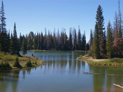
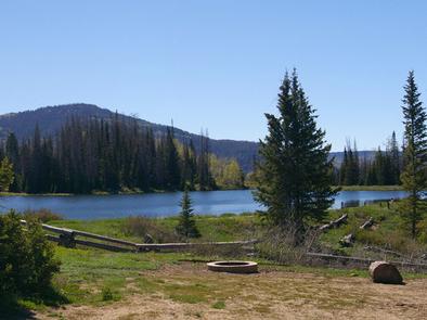
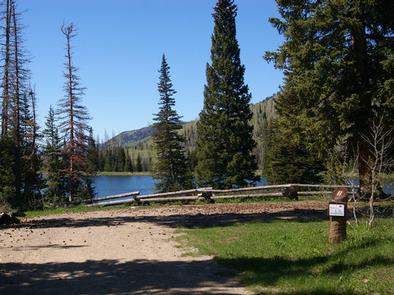
Potters Pond Campground is located in a high mountain valley next to two scenic ponds, at an elevation of 8,900 feet. Visitors enjoy fishing, canoeing, horseback riding and exploring the surrounding off-road vehicle trails.

Recreation

The ponds offer great canoeing and rainbow trout fishing. Horseback riding, hiking and mountain biking are popular in the area as well.

The expansive Arapeen OHV Trail System can be accessed from the campground and has more than 350 miles of designated, well-maintained trails for off-road vehicles. The trails are suitable for all riding levels.

Facilities

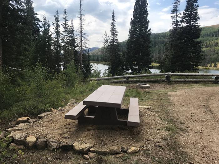
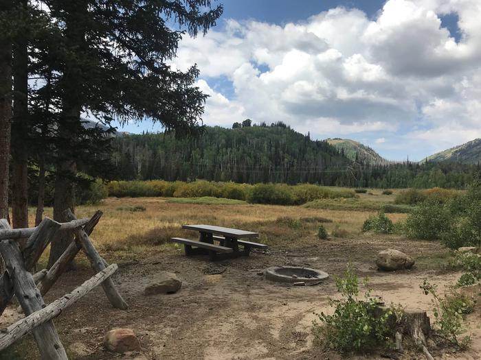
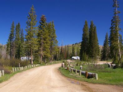
This campground offers a variety of campsites, including single, double and equestrian sites. Some sites have views of the ponds and most sites are shaded.

Sites are equipped with tables and campfire rings with grills. Vault toilets are provided, but there is no water, electricity or trash collection available within the campground. Visitors will need to bring their own water, as well as pack out all garbage.

Roads and parking spurs within the campground are dirt. The campground can be reached via the well-maintained dirt and gravel Miller Flat Road, which provides relatively easy access for cars and RVs.

Natural Features

Potters Pond lies in Upper Joe’s Valley in Central Utah. Pine trees and wild grasses cover the area, while aspens dot the surrounding mountainsides.

Charges & Cancellations

A $10.00 service fee will apply if you change or cancel your reservation. Late cancellations are subject to additional fees. For full details see NRRS Reservation Policy.

Reservation

More from CampingHiking.net:

BLUE MEADOW, West Virginia Campground Images, Info & Reservations

Directions From White Sulphur Springs, travel 8 miles north on State Route 92. Turn left (west) at Alvon, West Virginia, onto State Route 16. Travel 4 miles to the recreation area. Phone 304-536-2144 Activities CAMPING, FISHING, HIKING, WILDLIFE VIEWING, SWIMMING SITE Keywords BLUM,MONONGAHELA NF -FS Related Link(s) Rec Area Info

LOCK A, Tennessee Campground Images, Info & Reservations

Directions From Ashland City, Tennessee, take US 12 and go eight miles west to Cheap Hill. Turn left on Cheatham Dam Road traveling west four miles. Turn left into the campground. Phone 615-792-3715 Activities CAMPING, HIKING, WATER SPORTS Keywords LOCA,CHEATHAM LAKE,CHEATHAM DAM,CHEATHAM L & D Related Link(s) Rec Area Info

DORIS CREEK CAMPGROUND, Montana Campground Images, Info & Reservations

Directions Turn off U.S. Highway 2 at milepost 144 and follow the West Side Hungry Horse Reservoir (Forest Road #895) across the Hungry Horse Dam. The campground is 3 miles south of the Dam. The road is paved to the campground. Phone 406-752-7924 FOR RESERVATIONS CALL: 1-877-444-6777 Activities BOATING, CAMPING,

CAMP 9, California Campground Images, Info & Reservations

Directions From the south, take Highway 99 to Bakersfield. Take the Highway 178 exit and travel east toward the Kern River Canyon. Follow Highway 178 for approximately 40 miles to the town of Lake Isabella. From Lake Isabella, take Highway 155. Continue past the town of Wofford Heights to Kernville.

MCKEEVER CABIN, Michigan Campground Images, Info & Reservations

Directions Mckeever Cabin does not have a physical address. Vehicle access from the North: Take M-28 to FH 13, which is 3 miles east of Munising. Proceed south on FH 13 for 11 miles to FR 2163, located across from the road from Widewaters Campground. Vehicle access from the South: