BIG HANK, ID Campground Reservation, Info, Images, Map, Directions

BIG HANK, Idaho Campground Images, Info & Reservations

Directions

From Kingston on I-90, take Exit 43 to FH-9 and drive 20 miles north to Prichard, then turn left and continue 17 miles north on FH Road 208 to campground.

Phone

435-245-6521

Activities

BIKING, CAMPING, FISHING, HIKING, SWIMMING SITE, BIRDING

Keywords

BHAN,IDAHO PANHANDLE NF – FS

Related Link(s)

Rec Area Info & Images

Idaho State Tourism

Forest Service Concessionaire

Idaho State Road Conditions

Overview

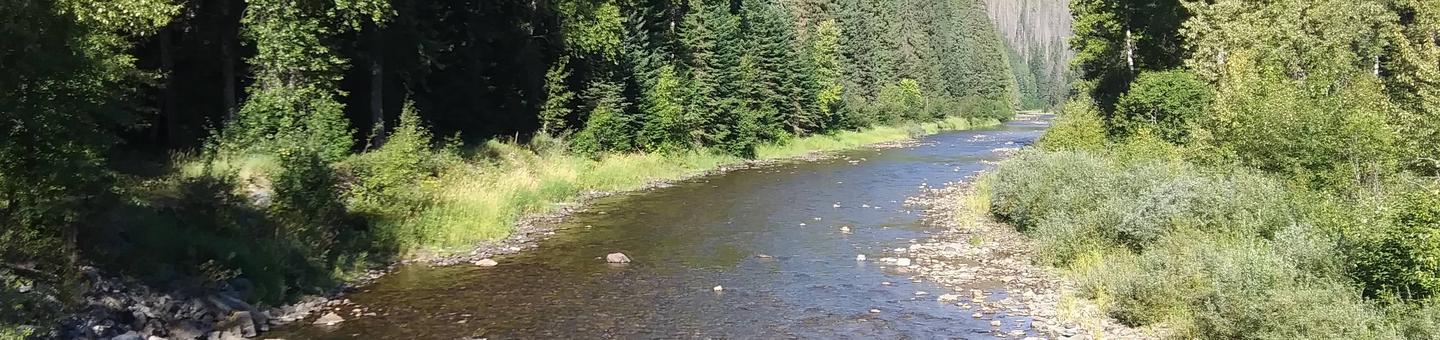
Big Hank Campground is located along the North Fork of the Coeur d’Alene River in Idaho Panhandle National Forest. Shore fishing is a large draw, along with local hiking and biking trails. The campground also provides an excellent base camp for hunters during season.

Wildlife like mule deer, moose, osprey and calliope hummingbirds are often spotted.

Recreation

Tubing on the river is a popular summertime activity, as is cutthroat fishing.

Whitewater rafting enthusiasts enjoy the class I-III rapids down the river.

Hiking, biking and horseback riding trails are a short drive away. Highlights include trails to Centennial Falls, Shadow Falls and Settler’s Grove of Ancient Cedars.
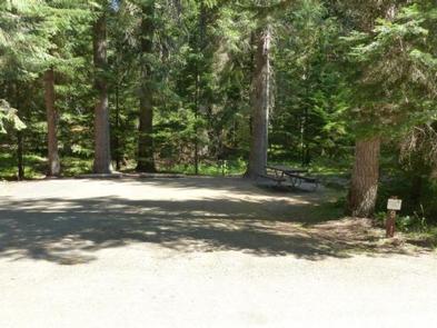
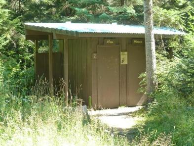
Facilities

Big Hank Campground offers about 30 spacious campsites for tent camping. Drinking water from hand pumps, vault toilets, picnic tables and established fire rings are among the conveniences offered. Roads and campsite parking spurs are paved.

Natural Features

Big Hank is in a heavily wooded area on the banks of the Couer D’ Alene River and Big Hank Creek. At 2,800 feet elevation, the campground sits on the Big Hank Meadow.

Reservation

More from CampingHiking.net:

FORT SPOKANE GROUP SITE, Washington Campground Images, Info & Reservations

Directions Take State Highway 2 west of Spokane for 32 miles. Turn north on State Highway 25 at the town of Davenport and travel 24 miles. Follow the signs to the campground. Phone 509-754-7889 Activities BOATING, HISTORIC & CULTURAL SITE, CAMPING, INTERPRETIVE PROGRAMS, FISHING, HIKING, PICNICKING, VISITOR CENTER, WATER SPORTS,

MCCAIN CABIN, Wyoming Campground Images, Info & Reservations

Directions From Afton, Wyoming, take Highway 89 north about 31 miles to Alpine. At Alpine, turn right (south) onto Greys River Road (Forest Road 10138) and travel about 8 miles to the junction with Little Greys River Road (Forest Road 10124). Turn left (northeast) onto Little Greys River Road and

SHIRTTAIL CREEK, California Campground Images, Info & Reservations

Directions From either east bound or west bound Interstate 80 take exit 121, Auburn Ravine Road to Foresthill. Continue east for 17 miles, to Foresthill. Travel through town, about 9 miles, to Forest Road 10/Sugar Pine Road. Turn left and continue 9 miles to the Sugar Pine Campgrounds road (approximately

SHAKES SLOUGH 1 CABIN, Alaska Campground Images, Info & Reservations

Directions The Shakes Slough Cabins are located in the Stikine-LeConte Wilderness on the north shore of the Stikine River at the Shakes Slough entrance. From Wrangell, the cabin is 20 miles by float plane or 25 miles by shallow draft boat. Low river levels and tides affect access to the

WISHON CABIN, California Campground Images, Info & Reservations

Directions From Porterville,California, take Highway 190 east. Continue through Springville for approximately 8 miles to Wishon Drive. Turn left and travel about 4 miles. The cabin is at the entrance to Wishon Campground on the right hand side of the road. From Bakersfield, California, take Highway 65 North to Highway

NORTH CAMPGROUND, Utah Campground Images, Info & Reservations

Directions From Highway 89 approximately 7 miles south of Panguitch, Utah, travel east on Highway 12 for about 14 miles. Turn south on Highway 63 to the main entrance of Bryce Canyon National Park. North Campground is the first left turn after passing through the fee station. Phone 435-834-5322 Activities