
Directions
From Westcliffe, CO, take State Route 69 south 3 miles to the campground sign (County Road 140). Turn right and go 1.8 miles to the stop sign. Continue straight through the stop sign for 2.8 miles until you hit another stop sign (RD 141). Turn left onto RD 141 and continue 2.1 miles to campground. (Note: RD 141 becomes dirt/gravel after 0.4 miles.)
Phone
FOR RESERVATIONS CALL (877) 444-6777. FOR NON REAL TIME INFORMATION, CALL THE DISTRICT OFFICE AT (719) 269-8500.
Activities
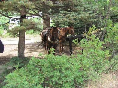
CAMPING, HIKING, HORSEBACK RIDING
Keywords
ALVA,PIKE AND SAN ISABEL NF- FS
Related Link(s)
Colorado State Road Conditions
Overview
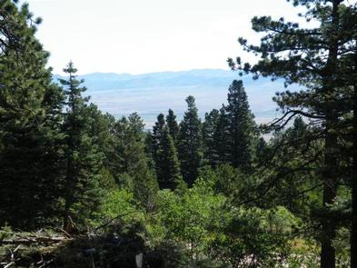
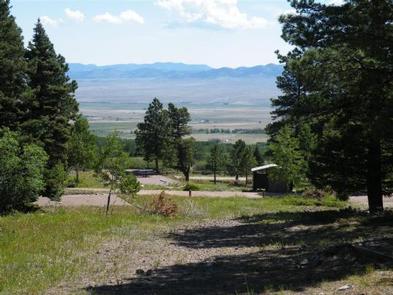
Alvarado Campground, located at an elevation of 9,000 ft., is a prime location for accessing easy to challenging hikes in the Sangre de Cristo Wilderness. The variety of trails lead to high elevation lakes, picturesque waterfalls, and a number of stunning scenic overlooks. Alvarado is designed for a range of campers, with facilities for tent, RV and equestrian campers.
Pike-San Isabel National Forests include over a million acres of wilderness and over half of Colorado’s mountain peaks that reach above 14,000 feet.
Recreation
Near the campground are several trailheads that provide visitors with a variety of recreational opportunities. All trails are open for horseback riding and hiking. The Rainbow Trail is a premier ATV and motorcycle trail. The non-motorized Comanche and Venable Trails lead into the Sangre de Cristo Wilderness where waterfalls and alpine lakes may be enjoyed.
Facilities
Alvarado is divided into three unique areas. The lower level accommodates tents and RVs, the upper level is designed for walk-in tent campers, and part of the middle section caters to equestrian campers. There are no corrals but there is space to put portable corrals for horses.
Parking aprons are dirt and gravel. Tent pads and lantern posts are located in the lower campsites only.
Natural Features
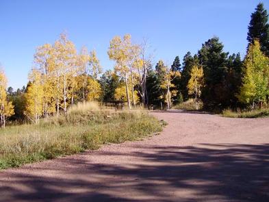
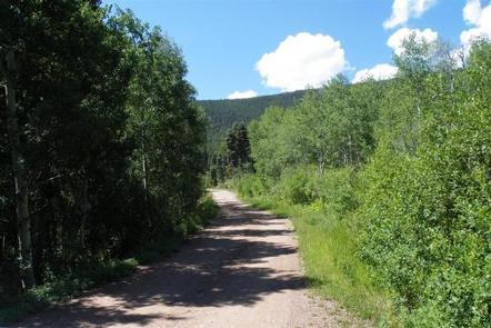
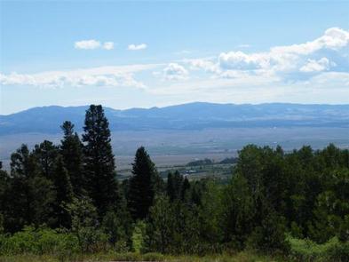
Alvarado is perched on the side of the Sangre de Cristo Mountains among sweet smelling ponderosa pine, aspen, lodgepole and gambel oak trees. Some sites offer views of the Wet Mountain Valley below while others sit beside Alvarado Creek. The campground is within reach of the Sangre de Cristo Wilderness, which spans 226,455 acres with 60 alpine lakes, 400 miles of streams and over 400 miles of trails to explore. Large aspen stands visible in the area today are a result of fires set in the early 1900’s to clear pasture land, expose minerals and produce charcoal.
Nearby Attractions
Explore the Frontier Pathways Scenic and Historic Byway that takes drivers through the Wet Mountains and provides spectacular views of 22 peaks, all within the San Isabel National Forest.