BERRY MOUNTAIN PARK SHELTER, NC Campground Reservation, Info, Images, Map, Directions

BERRY MOUNTAIN PARK SHELTER, North Carolina Campground Images, Info & Reservations

Directions

From Charlotte, North Carolina, take I-77 North (approximately 60 miles) before merging onto Highway 421 North towards Wilkesboro/Boone. Continue to Exit 286B (approximately 20 miles), turn left onto Highway 268 and continue for approximately 4 miles. Berry Mountain Park will be on the right. From Winston-Salem, North Carolina, take Highway 421 North (approximately 55 miles) to Exit 286B, turn left onto Highway 268 and continue for approximately 4 miles. Berry Mountain Park will be on the right.

Phone

336-921-3390

Activities

DAY USE AREA, SWIMMING, WATER ACCESS

Keywords

Related Link(s)

Rec Area Info & Images

North Carolina State Tourism

North Carolina State Road Conditions

Overview

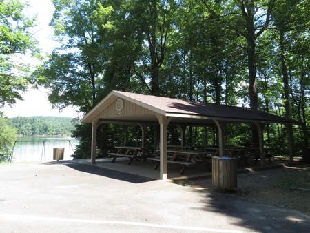
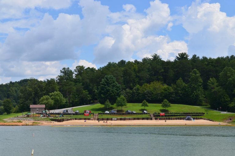
Berry Mountain Park Shelter is located in Berry Mountain Park at W. Kerr Scott Dam and Reservoir in northwestern North Carolina.

Recreation

The 1,475-acre reservoir offers excellent boating, canoeing, kayaking and swimming opportunities. Anglers will find channel catfish, large and smallmouth bass, bluegill, threadfin shad, spotted bass, striped bass, and hybrid striped bass.

Facilities

This ADA-accessible lakefront shelter offers six, 8-foot picnic tables. A water spigot can be found at the shelter but there is no electricity available. You can enjoy other park amenities which include a playground, grill, flush toilets, showers, swim beach and a basketball court.

Natural Features

The gentle Yadkin River flows through its scenic namesake valley in the foothills of the eastern Blue Ridge Mountains. Forests of mixed hardwoods, including sycamore, poplar, oak and hickory, cover the region. Wildlife is abundant in the valley. White-tailed deer, black bear, eastern cottontails and more can be found among the hills. Birds in the area include wild turkey, woodpeckers, Carolina chickadees, red-eyed vireo, ovenbirds, mallards and wood ducks.

Reservation

More from CampingHiking.net:

BAD BEAR CAMPGROUND, Idaho Campground Images, Info & Reservations

Directions Hayfork Group Cg (ID) HIGHWAY 21 Idaho City ID 83706 Phone 208-392-6681 Activities CAMPING, FISHING, VISITOR CENTER, WILDLIFE VIEWING Keywords None Related Link(s) Rec Area Info & Images Idaho State Tourism Idaho State Road Conditions Overview Bad Bear Campground is located 48 miles northeast of Boise, Idaho, in a

SANTA ROSA ISLAND BACKCOUNTRY BEACH CAMPING, California Campground Images, Info & Reservations

Directions Backcountry campers must first secure transportation to Santa Rosa Island by their own private boat or through Island Packers or Channel Islands Aviation the park’s authorized concessioners. Phone 805-658-5730 Activities BOATING, CAMPING, FISHING, HIKING, WATER SPORTS, WILDLIFE VIEWING, WILDERNESS, PHOTOGRAPHY, SWIMMING, SNORKELING, BEACH CAMPING, BEACHCOMBING, BIRDING, WATER ACCESS, SAILING

WHITE CLIFFS PARK, Arkansas Campground Images, Info & Reservations

Directions Located six miles south of Cowlingsville on State Highway 317. Phone 870-287-4253 Activities BOATING, CAMPING, FISHING Keywords Related Link(s) Rec Area Info & Images Arkansas State Tourism Arkansas State Road Conditions Overview White Cliffs Campground is located on the east bank of the Little River feeding into Millwood Lake

SMITH AND MOREHOUSE, Utah Campground Images, Info & Reservations

Directions From Salt Lake City, Utah, take Highway 80 east for 36 miles to the Kamas exit. Travel south for 12 miles to Oakley, turn left on Highway 213 and travel 12 miles to end of pavement. Turn right and go 2 miles to the campground entrance. Phone KAMAS RANGER