DONALDSON PARK, TN Campground Reservation, Info, Images, Map, Directions

DONALDSON PARK, Tennessee Campground Images, Info & Reservations

Directions

From Celina, TN (Highway 52), travel East Lake Avenue. Turn onto Jefferson Street. Follow signs into the park.

Phone

931-243-3136

Activities

BOATING, FISHING, PICNICKING, DAY USE AREA, PHOTOGRAPHY, KAYAKING, CANOEING, WATER ACCESS

Keywords

DONA,CELINA PARK,DALE HOLLOW LAKE,DALE HOLLOW,DONALDSON,CORDELL HULL DAM

Related Link(s)

Rec Area Info & Images

Tennessee State Tourism

Tennessee State Road Conditions

Overview

Donaldson Park is day use area located within the city limits of Celina, Tennessee, next to the Obey River Tailwater. It is a part of Cordell Hull Lake but is managed by Dale Hollow Lake. A variety of recreational activities abound, including boating, fishing and picnicking. Click here for a virtual tour of the Cordell Hull Lake facilities.

Recreation

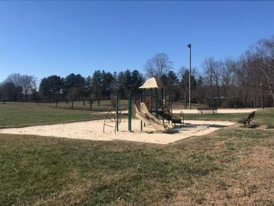
Fishing is a very popular activity on the Obey River, which is stocked with nearly 60,000 rainbow trout annually. Brown and brook trout are stocked as well. The park offers many amenities for visitors. A boat ramp, playground, fitness trail, marble yard and volleyball, basketball and tennis courts are all found on-site.

Facilities

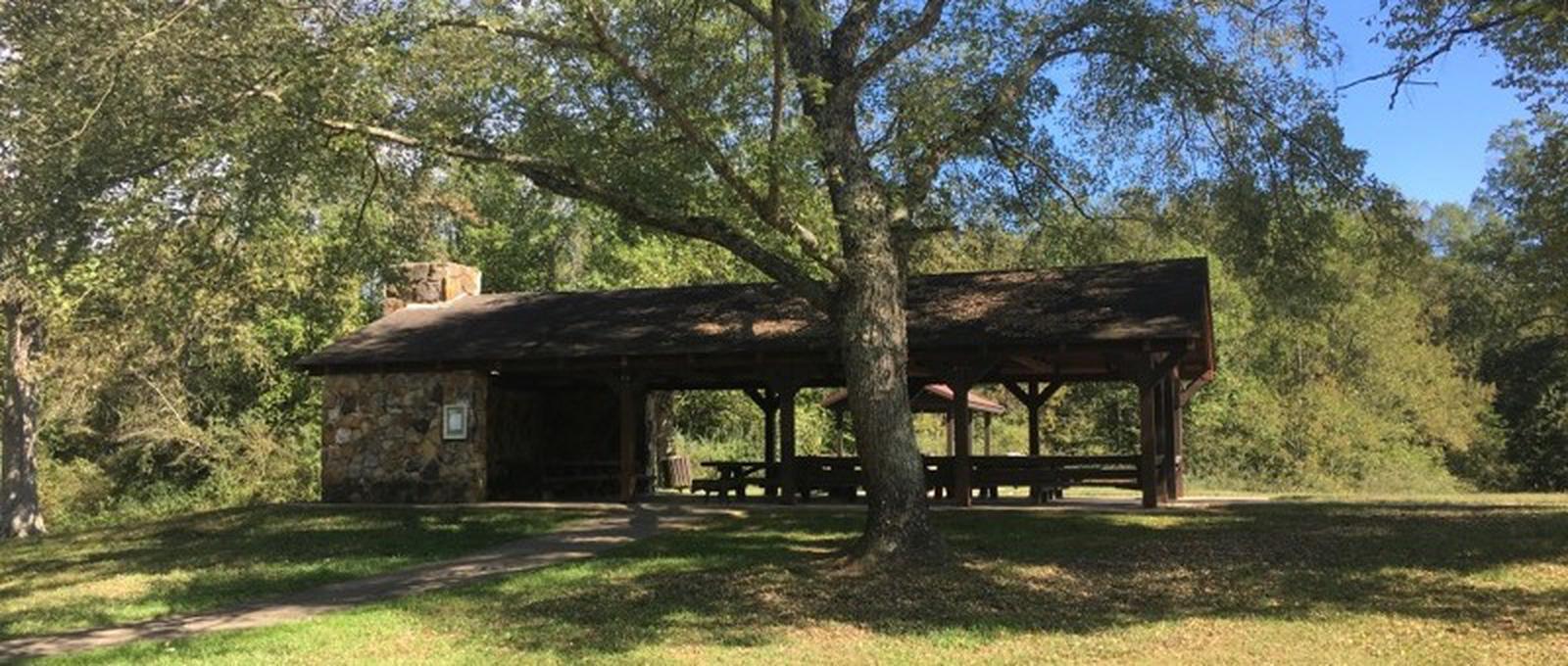
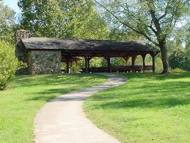
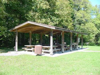
Two accessible picnic shelters with electric hookups are available for reservation at Donaldson Park. Flush toilets and drinking water are also provided.

Natural Features

The park is made up of broad, grassy areas surrounded by large shade trees. An abundance of wildlife can be seen in the area, including white-tailed deer, bald eagles and the occasional beaver.

Nearby Attractions

The National Rolley Hole Marble Championship and Festival is held in nearby Standing Stone State Park. This traditional marbles contest draws some of the country’s best to a tournament where players match wit and skills with special flint spheres on a smooth dirt surface. The festival includes games for kids, marble making, tournament play, demonstrations, music and food.

Charges & Cancellations

Fees for changes and cancellations can be found at https://www.recreation.gov/rules-reservation-policies

Reservation

More from CampingHiking.net:

LANE SPRING RECREATION AREA, Missouri Campground Images, Info & Reservations

Directions From Rolla, Missouri, travel 12 miles south on U.S. Highway 63, then continue 1 mile west on Entrance Road. Phone 417-967-4194 Activities CAMPING, FISHING, HIKING, WATER SPORTS, WILDLIFE VIEWING Keywords LANE,LANE SPRING,LANE SPRINGS,LANE SPRINGS RECREATION AREA,MARK TWAIN NF -FS Related Link(s) Rec Area Info & Images Missouri State Road

RIBBONWOOD EQUESTRIAN CG, California Campground Images, Info & Reservations

Directions From Palm Desert, California, take the Palms to Pines Highway/Highway 74 south for approximately 16 miles to the community of Pinyon. Turn left onto South Pinyon Drive and the entrance to the campground is on the right. Phone (760) 862-9984 Activities CAMPING, FISHING, HORSEBACK RIDING, HORSE CAMPING, MOUNTAIN BIKING

SANTA ROSA ISLAND, California Campground Images, Info & Reservations

Directions Boat transportation can be arranged with Island Packers from Ventura Harbor. Air transportation can be arranged with Channel Islands Aviation from Camarillo airport. To park headquarters in Ventura, California: Highway 101, exit Victoria or Seaward to Ventura Harbor. Phone 805-658-5730 Activities BOATING, HISTORIC & CULTURAL SITE, CAMPING, INTERPRETIVE PROGRAMS,

LOVE, Texas Campground Images, Info & Reservations

Directions From Ennis, Texas: From Interstate 45, exit onto U.S. Highway 287 Bypass (exit #247). Travel 4.5 miles and exit at the Bardwell Lake exit sign. Turn left onto Highway 34 and go 0.2 miles. Turn left onto Lakeview Road. Travel 2.0 miles to the intersection of Beach Road. Make

SPENCE CABIN, Tennessee Campground Images, Info & Reservations

Directions Spence Cabin is located near Elkmont Campground. Drive south from Gatlinburg, TN on Newfound Gap Road (U.S. 441) for 1.7 miles and turn right onto Little River Road toward Cades Cove. Proceed 5 miles to Elkmont Campground road and turn left. Go 1.4 miles and turn left just before