GREENS LAKE, UT Campground Reservation, Info, Images, Map, Directions

GREENS LAKE, Utah Campground Images, Info & Reservations

Directions

Located on Forest Road 095/Red Canyon Road off Highway 44, approximately 40 miles north of Vernal, Utah.

Phone

435-784-3445

Activities

BIKING, BOATING, CAMPING, FISHING, HIKING, WILDLIFE VIEWING, BIRDING

Keywords

GRLK,RED CANYON COMPLEX,FLAMING GORGE,ASHLEY NF – FS,Flaming Gorge National Recreation Area

Related Link(s)

Rec Area Info & Images

Utah State Road Conditions

Utah State Tourism

Forest Service Concessionaire

Overview

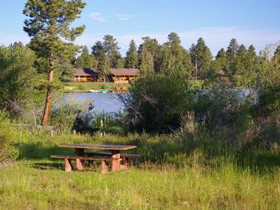
Greens Lake Campground is located next to its scenic namesake along Red Canyon Road at an elevation of 7,400 feet. Visitors enjoy canoeing and fishing on the lake and exploring the Red Canyon Rim Trail.

Recreation

Greens Lake is a small lake for non-motorized watercraft only. It offers great canoeing and fishing for rainbow and brook trout. Red Canyon Lodge sits directly across the lake. Canoe and bike rentals, horseback riding, a restaurant and gift shop are available.

Red Canyon Rim Trail, for hiking and biking, begins at the nearby visitor center, which offers interpretive displays and area information.

Facilities

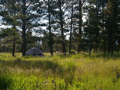
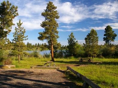
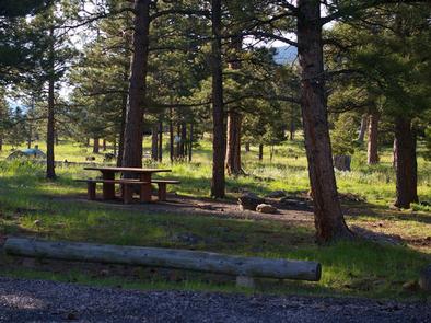
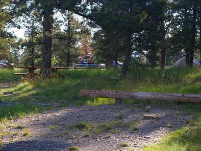
The campground offers one group site that can accommodate up to 40 people. Several single family sites are available as well, each with a picnic table and campfire ring. Some sites have lake views and access. Vault toilets and drinking water are provided.

Natural Features

The campground lies on the shore of Greens Lake, about 1 mile from beautiful cliffs overlooking Flaming Gorge Reservoir. Lodgepole and ponderosa pines and aspens dot the campground, providing partial shade. Summer wildflowers are plentiful.

Nearby Attractions

Flaming Gorge National Recreation Area is known not only for its beautiful red cliffs, but also for its world-class fishing for lake, brown and rainbow trout. Boating, water skiing, jet skiing, canoeing, kayaking, swimming and scuba diving are popular activities on the reservoir.

Flaming Gorge Dam offers guided tours of the working hydroelectric plant and the dam itself; The adjacent visitor center contains area history exhibits.

The Green River below the dam provides spectacular rafting opportunities. A trip down the river offers unique geology, outlaw history and Native American rock art.

Reservation

More from CampingHiking.net:

BEAVER CREEK CABIN (ID), Idaho Campground Images, Info & Reservations

Directions In summer: from Idaho City, travel 20 miles northeast on State Highway 21. Turn right on Forest Road #362 and travel 1/2 mile to the cabin. In winter: from Idaho City, travel approximately 18 miles northeast on State Highway 21 to the Whoop-Um-Up Parking Area. Ski or snowshoe 1.5

CRANESNEST CAMPGROUND (VA), Virginia Campground Images, Info & Reservations

Directions From Clintwood, VA main street turn left onto Rt. 83. Travel 2.6 miles and turn left onto Cranesnest Campground Rd. Travel 2.8 miles to the campground. Phone 276-835-9544 Activities BIKING, BOATING, CAMPING, FISHING, HIKING, HORSEBACK RIDING, PICNICKING, WILDLIFE VIEWING Keywords Related Link(s) Rec Area Info & Images Virginia State

WILBORN CREEK (GROUP CAMP), Illinois Campground Images, Info & Reservations

Directions From Sullivan, Illinois, go west on State Route 121 for 5 miles. Turn left on County Road 5 and drive 3.5 miles, then make a right on County Road 18 and drive 0.75 miles to the campground. Phone 217-774-3951 Activities BOATING, CAMPING, FISHING, SWIMMING SITE Keywords WCGC,LAKE SHELBYVILLE,WILBORN CREEK

OAK RIDGE CAMPGROUND, Virginia Campground Images, Info & Reservations

Directions From Washington, D.C., and points north, take I-95 south to exit 150-B toward VA Route 619/Joplin Road. The park entrance is the second right. It is an additional 15-20 minute drive from the park entrance to Oak Ridge Campground. From Fredericksburg, Virginia, and points south, take I-95 north to

ZIPS PLACE CABIN, Montana Campground Images, Info & Reservations

Directions From Hungry Horse, travel east on U.S. Highway 2 for 48 miles, to mile marker 191. Travel south on Geifer Greek/Lodgepole Lane (a gravel road that veers left initially). Follow the signs to the cabin. During the winter months or when the road conditions are impassable, renters must park