
A US National Historic Site is an area of national historic significance. They usually contain a single feature like a historically significant building.
A National Historical Park usually extends beyond a single property or building.
A National Heritage Area exists to encourage historic preservation and an appreciation of the history and heritage of the site.
Abraham Lincoln Birthplace National Historical Park, Kentucky Camping & Hiking
Listen Directions The Birthplace Unit of the park is located approximately 2 miles south of the town of Hodgenville on U.S. Highway 31E South. The Boyhood Home Unit at Knob Creek is located approximately 10 miles northeast of the Birthplace Unit of the park. Phone (270) 358-3137 Activities HISTORIC & CULTURAL SITE, PICNICKING Camping Reservations Reserve your campsite at these camping areas: Kentucky Campgrounds Hiking Trails Looking for nice hiking areas to take a hike? Choose from these scenic hiking trails: Kentucky Hiking Trails Related Link(s) More Kentucky
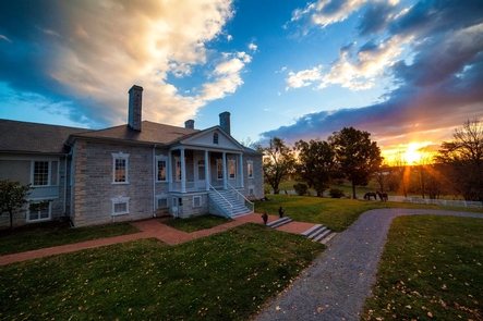
Adams National Historical Park, Massachusetts Camping & Hiking
Listen Directions Traveling on U.S. Interstate 93, take exit 7 – Route 3 South to Braintree and Cape Cod. Take the first exit off Route 3 south – exit 19 – and follow signs toward Quincy Center. Continue straight on Burgin Parkway through six traffic lights. At the seventh traffic light, turn right onto Dimmock Street. Follow Dimmock Street one block and turn right onto Hancock Street. The National Park Service Visitor Center, located at 1250 Hancock Street on your left. Validated parking is in the garage to
Aleutian Islands World War II National Historic Area, Alaska Camping & Hiking
Listen Directions The park is located on Amaknak Island in the Aleutian Island chain. The island is located 800 miles west of Anchorage. The island can be reached by commercial or charter air flights from Anchorage. Commercial flights to Unalaska include Pen Air and Alaska Airlines. The Alaska Marine Highway is a ferry service that is operated by the state that can be used to reach the island. The Aleutian World War II Visitor Center is located at the Unalaska airport. Phone (907) 644-3472 Activities WILDLIFE VIEWING Camping
Allegheny Portage Railroad National Historic Site, Pennsylvania Camping & Hiking
Listen Directions The park is located just off U.S. Route 22 approximately 12 miles west of Altoona and 10 miles east of Ebensburg. Take the Gallitzin Exit and turn right, following the signs. Visitors prior to 1992 accessed the park in other ways, but the GALLITZIN EXIT of US Route 22 is now the way to access the visitor center and historic area. Phone (814) 886-6150 Activities BIKING, HISTORIC & CULTURAL SITE, HIKING Camping Reservations Reserve your campsite at these camping areas: Pennsylvania Campgrounds Hiking Trails Looking for
Andersonville National Historic Site, Georgia Camping & Hiking
Listen Directions Andersonville National Historic Site is located in southwest Georgia. The park is approximately 12 miles north of Americus and 11 miles south of Montezuma on GA-49. Phone (229) 924-0343 Activities AUTO TOURING, HISTORIC & CULTURAL SITE, PICNICKING, WILDLIFE VIEWING Camping Reservations Reserve your campsite at these camping areas: Georgia Campgrounds Hiking Trails Looking for nice hiking areas to take a hike? Choose from these scenic hiking trails: Georgia Hiking Trails Related Link(s) More Georgia Recreation Areas Andersonville National Historic Site Official Website Andersonville National Historic Site
Andrew Johnson National Historic Site, Tennessee Camping & Hiking
Listen Directions GPS The GPS setting for Andrew Johnson NHS may be listed as 121 Monument Ave, which is the park HQ in the National Cemetery. To arrive at the Visitor Center, use 101 North College Street, Greeneville, TN. Plane The closest airport is the Tri-Cities Regional Airport, 43 miles NE of Greeneville. From the airport, take I-81 South to exit 36 and follow the signs to Greeneville. Car From I-81S take exit 36 to Rt. 172 south to Greeneville. From I-81N take exit 23 to Rt. 11E
Appomattox Court House National Historical Park, Virginia Camping & Hiking
Listen Directions Appomattox Court House NHP is located 3 miles east of U.S. Highway 460, and 3 miles east of the modern town of Appomattox, Virginia along Rt. 24. Phone (434) 352-8987 Activities AUTO TOURING, HISTORIC & CULTURAL SITE, HIKING, PICNICKING, WILDLIFE VIEWING Camping Reservations Reserve your campsite at these camping areas: Virginia Campgrounds Hiking Trails Looking for nice hiking areas to take a hike? Choose from these scenic hiking trails: Virginia Hiking Trails Related Link(s) More Virginia Recreation Areas Appomattox Court House National Historical Park Official Website
Atchafalaya National Heritage Area, Louisiana Camping & Hiking
Listen Directions There are several visitor locations in the Atchafalaya NHA, please visit www.atchafalaya.org for exact locations and directions. Phone (337) 228-1094 Activities BIKING, BOATING, CAMPING, FISHING, HIKING, PICNICKING, WILDLIFE VIEWING, PADDLING Camping Reservations Reserve your campsite at these camping areas: Louisiana Campgrounds Hiking Trails Looking for nice hiking areas to take a hike? Choose from these scenic hiking trails: Louisiana Hiking Trails Related Link(s) More Louisiana Recreation Areas Atchafalaya National Heritage Area Official Website Atchafalaya National Heritage Area Map Our country™s landscape is rich and mysterious. It
Augusta Canal National Heritage Area, Georgia Camping & Hiking
Listen Directions To Augusta Canal Discovery Center (1450 Greene Street, Augusta, GA 30901): From I-20 Exit 200, turn left onto GA-104/Riverwatch Parkway (signs for Downtown Augusta). In approximately 4.5 miles, use the right lane to take the ramp to Downtown Augusta/Medical District. Continue straight onto Greene Street. Continue for approximately 0.4 miles. Enterprise Mill and the Discovery Center will be on your right. Phone 706-823-0440 / 1-888-659-8926 Activities BIKING, BOATING, FISHING, PICNICKING, WILDLIFE VIEWING, PADDLING Camping Reservations Reserve your campsite at these camping areas: Georgia Campgrounds Hiking Trails
Baltimore National Heritage Area, Maryland Camping & Hiking
Listen Directions The 18.2 square miles of the Baltimore National Heritage Area encompass the city’s oldest neighborhoods as well as the downtown and waterfront areas. Phone (410) 878-6411 Camping Reservations Reserve your campsite at these camping areas: Maryland Campgrounds Hiking Trails Looking for nice hiking areas to take a hike? Choose from these scenic hiking trails: Maryland Hiking Trails Related Link(s) More Maryland Recreation Areas Baltimore National Heritage Area Official Website Baltimore National Heritage Area Map For nearly three centuries, Baltimore has stood as a center of commerce
Bent’s Old Fort National Historic Site, Colorado Camping & Hiking
Listen Directions The park is accessed via U.S. Highway 50 and Highway 194. From La Junta, Colorado on U.S. Highway 50, take Colorado Highway 109 north 1 mile to Colorado Highway 194, then east on Colorado Highway 194 six miles to the fort. From Las Animas, Colorado, on U.S. Highway 50, take Colorado Highway 194 west 13 miles. Set your GPS to 35110 State Highway 194 E., La Junta, CO. Phone (719) 383-5010 Activities HISTORIC & CULTURAL SITE, HIKING, WILDLIFE VIEWING Camping Reservations Reserve your campsite at these
Blue Ridge National Heritage Area, North Carolina Camping & Hiking
Listen Directions The Blue Ridge Parkway Visitor Center is located at Parkway milepost 384, which is about a mile south of the US 70 intersection (or one mile north of the US 74-A intersection) and about 8 miles east of downtown Asheville. The Folk Art Center is located nearby, two miles to the north along the Parkway. Phone (828) 298-5330 Activities AUTO TOURING, BIKING, HISTORIC & CULTURAL SITE, CAMPING, FISHING, HIKING, PICNICKING, WILDLIFE VIEWING, PADDLING, SWIMMING Camping Reservations Reserve your campsite at these camping areas: North Carolina Campgrounds
Boston African American National Historic Site, Massachusetts Camping & Hiking
Listen Directions Site administrative offices are located at 15 State Street. However, Ranger programs begin at either the Robert Gould Shaw Memorial on Beacon Street, or at the Museum of African American History at 46 Joy Street on Beacon Hill. Phone (617) 742-5415 Camping Reservations Reserve your campsite at these camping areas: Massachusetts Campgrounds Hiking Trails Looking for nice hiking areas to take a hike? Choose from these scenic hiking trails: Massachusetts Hiking Trails Related Link(s) More Massachusetts Recreation Areas Boston African American National Historic Site Official Website
Boston National Historical Park, Massachusetts Camping & Hiking
Listen Directions Visitor Centers are located at Historic Faneuil Hall, 1 Faneuil Hall Sq, and the Charlestown Navy Yard, Building 5. Go to the Directions page for more detailed information. Phone (617) 242-5601 Camping Reservations Reserve your campsite at these camping areas: Massachusetts Campgrounds Hiking Trails Looking for nice hiking areas to take a hike? Choose from these scenic hiking trails: Massachusetts Hiking Trails Related Link(s) More Massachusetts Recreation Areas Boston National Historical Park Official Website Boston National Historical Park Map Discover how one city could be the
Brown v. Board of Education National Historic Site, Kansas Camping & Hiking
Listen Directions The site is located in downtown Topeka, Kansas at 1515 SE Monroe Street. Phone (785) 354-4273 Camping Reservations Reserve your campsite at these camping areas: Kansas Campgrounds Hiking Trails Looking for nice hiking areas to take a hike? Choose from these scenic hiking trails: Kansas Hiking Trails Related Link(s) More Kansas Recreation Areas Brown v. Board of Education National Historic Site Official Website Brown v. Board of Education National Historic Site Map The story of Brown v. Board of Education, which ended legal segregation in public
California National Historic Trail – Nobles Emigrant segment, California Camping & Hiking
Listen Directions From Susanville travel North on Hwy 395 for app. 25 miles. Turn East (right) on Smoke Creek Road. The trail parallels Smoke Creek Road. Phone 530-257-0456 Activities AUTO TOURING, BIKING, CAMPING, HIKING, HORSEBACK RIDING, HUNTING, WILDLIFE VIEWING, PHOTOGRAPHY Camping Reservations Reserve your campsite at these camping areas: California Campgrounds Hiking Trails Looking for nice hiking areas to take a hike? Choose from these scenic hiking trails: California Hiking Trails Related Link(s) More California Recreation Areas The Nobles Trail is a branch of the California National Historic
California National Historic Trail, Utah Camping & Hiking
Listen Directions Follow Interstate 80 west from Salt Lake City to Wendover via Grantsville, Skull Valley, Cedar Mountains-Hastings Pass, and Silver Island Mountains-Donner Reed Pass. Phone 801-977-4300 Activities AUTO TOURING, BIKING, HISTORIC & CULTURAL SITE, CAMPING, HIKING, HORSEBACK RIDING, HUNTING, WILDLIFE VIEWING, PHOTOGRAPHY Camping Reservations Reserve your campsite at these camping areas: Utah Campgrounds Hiking Trails Looking for nice hiking areas to take a hike? Choose from these scenic hiking trails: Utah Hiking Trails Related Link(s) More Utah Recreation Areas The Hastings Cutoff route was used from 1846
Cane River Creole National Historical Park, Louisiana Camping & Hiking
Listen Directions To reach Oakland Plantation, take I-49 to Exit 127, Flora/Cypress. Head east on LA Highway 120 toward Cypress. Cross over LA Highway 1 onto LA Highway 494. The parking lot and entrance pavilion for Oakland is 4.5 miles east of Highway 1 on the left. To reach the grounds of Magnolia Plantation, take I-49 to Exit 119, Derry. Head east on LA Highway 119. Cross over LA Highway 1 and proceed for 1.1 miles. The parking area of Magnolia Plantation is on the right just before
Cane River National Heritage Area, Louisiana Camping & Hiking
Listen Directions Cane River National Heritage Area in northwestern Louisiana is a largely rural, agricultural landscape known for its historic plantations, its distinctive Creole architecture, and its multi-cultural legacy. The central corridor of the heritage area begins just south of Natchitoches, and extends along both sides of Cane River Lake for approximately 35 miles. The heritage area includes Cane River Creole National Historical Park, seven National Historic Landmarks, three State Historic Sites, and other places. Phone (318) 356-5555 Activities HISTORIC & CULTURAL SITE, FISHING, HIKING, PICNICKING, WILDLIFE VIEWING,
Canyon Pintado National Historic District, Colorado Camping & Hiking
Listen Directions From Rangely, Colorado (junction of State Highways 64 and 139), travel south on Highway 139. The District begins about 3 miles south and continues for 15 miles. Phone (970) 878-3800 Activities HISTORIC & CULTURAL SITE, HIKING, PICNICKING Camping Reservations Reserve your campsite at these camping areas: Colorado Campgrounds Hiking Trails Looking for nice hiking areas to take a hike? Choose from these scenic hiking trails: Colorado Hiking Trails Related Link(s) More Colorado Recreation Areas Canyon Pintado National Historic District Canyon Pintado Canyon Pintado National Historic District
Cape Henry Memorial Part of Colonial National Historical Park, Virginia Camping & Hiking
Listen Directions Located on the south side of the Chesapeake Bay, Cape Henry Memorial sits within the Joint Expeditionary Base Little Creek-Fort Story. From Interstate 64 E take exit 282 to merge onto US-13N/Northhampton Boulevard towards the Chesapeake Bay Bridge. Then take US-60 E/Shore Drive exit toward Beaches, this is the last exit before the Chesapeake Bay Bridge. Follow Shore Drive and turn left onto Atlantic Ave and proceed to Gate 8. Follow Atlantic Ave to Cape Henry Memorial. Phone (757) 898-2410 Camping Reservations Reserve your campsite at
Captain John Smith Chesapeake National Historic Trail, Maryland Camping & Hiking
Listen Directions For an internet map search or GPS, use the following: Yorktown Battlefield Visitor Center, 1000 Colonial Parkway, Yorktown, Virginia 23690. Historic Jamestowne Visitor Center, 1368 Colonial Parkway, Jamestown, Virginia 23081. Phone (757) 898-3400 Activities BOATING, PADDLING Camping Reservations Reserve your campsite at these camping areas: Maryland Campgrounds Hiking Trails Looking for nice hiking areas to take a hike? Choose from these scenic hiking trails: Maryland Hiking Trails Related Link(s) More Maryland Recreation Areas Captain John Smith Chesapeake National Historic Trail Official Website Captain John Smith Chesapeake
Carl Sandburg Home National Historic Site, North Carolina Camping & Hiking
Listen Directions The park is located three miles south of Hendersonville, NC on Little River Road off of the Greenville Highway/Rt. 225 in Flat Rock, NC. Visitors using GPS or mapping software should use 1800 Little River Road and look for the signs directing you to the visitor parking lot on Little River Road. Phone (828) 693-4178 Camping Reservations Reserve your campsite at these camping areas: North Carolina Campgrounds Hiking Trails Looking for nice hiking areas to take a hike? Choose from these scenic hiking trails: North Carolina
Carter G. Woodson Home National Historic Site, District of Columbia Camping & Hiking
Listen Directions From The National Mall travel east onto Constitution Avenue NW, until you come to 12th Street (which is a one-way street). Make a left turn onto 12th Street. Continue traveling north on 12th Street NW, until you come to Rhode Island Avenue. Make a right turn onto Rhode Island Avenue. Keep straight on Rhode Island Avenue, until you come to 9th Street. Make a right turn onto 9th Street. Keep straight and 1538 9th Street will be the third house on the right (the red brick
Cedar Creek & Belle Grove National Historical Park, Virginia Camping & Hiking
Listen Directions The National Park Service Visitor Contact Station is located at 7712 Main Street, Middletown, Virginia 22645 in the Middletown Courts plaza. The park is located near the intersection of Interstates 81 and 66 in the northern Shenandoah Valley. Phone (540) 869-3051 Activities HISTORIC & CULTURAL SITE Camping Reservations Reserve your campsite at these camping areas: Virginia Campgrounds Hiking Trails Looking for nice hiking areas to take a hike? Choose from these scenic hiking trails: Virginia Hiking Trails Related Link(s) More Virginia Recreation Areas Cedar Creek &
Chaco Culture National Historical Park, New Mexico Camping & Hiking
Listen Directions Road conditions can be rough or impassable. Please call in advance for updates. Phone (505) 786-7014 Activities CAMPING, HIKING Camping Reservations Reserve your campsite at these camping areas: New Mexico Campgrounds GALLO CAMPGROUND Hiking Trails Looking for nice hiking areas to take a hike? Choose from these scenic hiking trails: New Mexico Hiking Trails Related Link(s) More New Mexico Recreation Areas Chaco Culture National Historical Park Official Website Chaco Culture National Historical Park Map Today the massive buildings of the Ancestral Puebloan people still testify to
Charles Pinckney National Historic Site, South Carolina Camping & Hiking
Listen Directions The park is located on the south side of Long Point Road .7 miles from US Highway 17, or 3 miles if coming from I-526. Phone (843) 881-5516 Activities BOATING, HISTORIC & CULTURAL SITE, PICNICKING, WILDLIFE VIEWING Camping Reservations Reserve your campsite at these camping areas: South Carolina Campgrounds Hiking Trails Looking for nice hiking areas to take a hike? Choose from these scenic hiking trails: South Carolina Hiking Trails Related Link(s) More South Carolina Recreation Areas Charles Pinckney National Historic Site Official Website Charles Pinckney
Chesapeake & Ohio Canal National Historical Park, Maryland Camping & Hiking
Listen Directions There are many access point along the Chesapeake and Ohio Canal National Historical Park. There is no main entrance. Please visit our directions page to determine how to get to your closest access point. Phone (301) 739-4200 Activities BIKING, BOATING, CAMPING, FISHING, HIKING, HORSEBACK RIDING, WILDLIFE VIEWING, PADDLING Camping Reservations Reserve your campsite at these camping areas: Maryland Campgrounds Hiking Trails Looking for nice hiking areas to take a hike? Choose from these scenic hiking trails: Maryland Hiking Trails Related Link(s) More Maryland Recreation Areas Chesapeake
Clara Barton National Historic Site, Maryland Camping & Hiking
Listen Directions By Car: Capital Beltway (I-495), Maryland outer loop exit 40 Cabin John Parkway to Clara Barton Parkway; Virginia inner loop exit 41 Clara Barton Parkway East; follow Clara Barton Parkway to MacArthur Boulevard and Glen Echo exit, left onto MacArthur Boulevard, straight across traffic circle at Goldsboro Road, next left onto Oxford Road, end of street, parking lots on the left. By Metro: Red Line to Bethesda or Friendship Heights Station, transfer to Montgomery County Ride-On Bus # 29, Glen Echo stop. Phone (301) 320-1400 Camping
Colonial National Historical Park, Virginia Camping & Hiking
Listen Directions For an internet map search or GPS, use the following: Yorktown Battlefield Visitor Center, 1000 Colonial Parkway, Yorktown, Virginia 23690. Historic Jamestowne Visitor Center, 1368 Colonial Parkway, Jamestown, Virginia 23081. Phone (757) 898-3400 Camping Reservations Reserve your campsite at these camping areas: Virginia Campgrounds Hiking Trails Looking for nice hiking areas to take a hike? Choose from these scenic hiking trails: Virginia Hiking Trails Related Link(s) More Virginia Recreation Areas Colonial National Historical Park Official Website Colonial National Historical Park Map On May 13, 1607, Jamestown
Cumberland Gap National Historical Park, Kentucky Camping & Hiking
Listen Directions By Plane The closest major airport is located in Knoxville, Tennessee approximately 85 miles away. Flights can also be made into Lexington, Kentucky approximately 130 miles away. By Car The park entrance is located on Highway 25E just south of Middlesboro Kentucky. Phone (606) 248-2817 Activities BIKING, CAMPING, HIKING, WILDLIFE VIEWING Camping Reservations Reserve your campsite at these camping areas: Kentucky Campgrounds Hiking Trails Looking for nice hiking areas to take a hike? Choose from these scenic hiking trails: Kentucky Hiking Trails Related Link(s) More Kentucky
Dayton Aviation Heritage National Historical Park, Ohio Camping & Hiking
Listen Directions From I-75, take U.S. Route 35 West (Exit 52b). Keep right and follow signs for State Route 4/Germantown. Turn slightly right onto S. Williams St. Continue to Fourth Street & turn right and proceed into parking lot on your left. Visitor Center will be directly next to parking lot. Phone (937) 225-7705 Activities BIKING Camping Reservations Reserve your campsite at these camping areas: Ohio Campgrounds Hiking Trails Looking for nice hiking areas to take a hike? Choose from these scenic hiking trails: Ohio Hiking Trails Related
Delaware & Lehigh National Heritage Corridor, Pennsylvania Camping & Hiking
Listen Directions For details and directions on places of interest in the Delaware and Leigh National Heritage Corridor, visit, http://delawareandlehigh.org/. Phone (610) 923-3548 Camping Reservations Reserve your campsite at these camping areas: Pennsylvania Campgrounds Hiking Trails Looking for nice hiking areas to take a hike? Choose from these scenic hiking trails: Pennsylvania Hiking Trails Related Link(s) More Pennsylvania Recreation Areas Delaware & Lehigh National Heritage Corridor Official Website Delaware & Lehigh National Heritage Corridor Map Come journey through five Pennsylvania counties bursting with heritage and brimming with outdoor
Ebey’s Landing National Historical Reserve, Washington Camping & Hiking
Listen Directions Ebey’s Landing National Historical Reserve is on Whidbey Island in the Puget Sound. The island is easily accessible from the mainland by vehicle via Washington State Route 20 from Burlington and aboard the Washington State Ferries from either Mukilteo or Port Townsend. Phone (360) 678-6084 Activities BIKING, BOATING, CAMPING, FISHING, HIKING, HORSEBACK RIDING, PICNICKING, WILDLIFE VIEWING, PADDLING, DIVING Camping Reservations Reserve your campsite at these camping areas: Washington Campgrounds Hiking Trails Looking for nice hiking areas to take a hike? Choose from these scenic hiking trails:
Edgar Allan Poe National Historic Site, Pennsylvania Camping & Hiking
Listen Directions The Edgar Allan Poe National Historic Site is located at 532 N. 7th Street, Philadelphia, PA 19123. It sits in an urban area served by Interstates 95 and 676. On- street parking is usually available near the site. The site is also easily accessible by public transportation. See the directions web page for more information. Phone (215) 965-2305 Camping Reservations Reserve your campsite at these camping areas: Pennsylvania Campgrounds Hiking Trails Looking for nice hiking areas to take a hike? Choose from these scenic hiking trails:
Eisenhower National Historic Site, Pennsylvania Camping & Hiking
Listen Directions There is no parking available on site. Access to the site is only available via shuttle buses that leave from the Gettysburg National Military Park Visitor Center (at 1195 Baltimore Street, Gettysburg, PA 17325) throughout the day. Phone (717) 338-9114 Activities HISTORIC & CULTURAL SITE Camping Reservations Reserve your campsite at these camping areas: Pennsylvania Campgrounds Hiking Trails Looking for nice hiking areas to take a hike? Choose from these scenic hiking trails: Pennsylvania Hiking Trails Related Link(s) More Pennsylvania Recreation Areas Eisenhower National Historic Site
El Camino Real de Tierra Adentro National Historic Trail, New Mexico Camping & Hiking
Listen Directions From the north, take I-25 exit Phone 505-954-2000 Activities AUTO TOURING, CAMPING, HIKING, HORSEBACK RIDING, HUNTING, WILDLIFE VIEWING Camping Reservations Reserve your campsite at these camping areas: New Mexico Campgrounds Hiking Trails Looking for nice hiking areas to take a hike? Choose from these scenic hiking trails: New Mexico Hiking Trails Related Link(s) More New Mexico Recreation Areas BLM New Mexico Flickr BLM New Mexico Twitter BLM New Mexico Twitter BLM New Mexico Facebook Page BLM New Mexico YouTube Channel BLM New Mexico YouTube Channel BLM
Eleanor Roosevelt National Historic Site, New York Camping & Hiking
Listen Directions Eleanor Roosevelt National Historic Site is located on Route 9G in the Town of Hyde Park, NY. Phone (845) 229-9422 Activities HIKING Camping Reservations Reserve your campsite at these camping areas: New York Campgrounds Hiking Trails Looking for nice hiking areas to take a hike? Choose from these scenic hiking trails: New York Hiking Trails Related Link(s) More New York Recreation Areas Eleanor Roosevelt National Historic Site Official Website Eleanor Roosevelt National Historic Site Map “The greatest thing I have learned is how good it is
Erie Canalway National Heritage Corridor, New York Camping & Hiking
Listen Directions Begin your journey in the east, west, or right in the middle of New York State, you can’t go wrong– the canal’s treasures are strong together along the waterway like gems on a necklace. The canal is accessible by CAR, RAIL, BIKE, and BOAT and from major airports: Albany International (ALB), Syracuse Hancock International (SYR), Greater Rochester International (ROC), and Buffalo-Niagara International (BUF). Phone (518) 237-7000 Camping Reservations Reserve your campsite at these camping areas: New York Campgrounds Hiking Trails Looking for nice hiking areas to
Essex National Heritage Area, Massachusetts Camping & Hiking
Listen Directions Heading north of Boston, Interstate 93 and state Routes 1 and 1A traverse the length of the ENHA. South from New Hampshire, take Routes 1, 3 and Interstates 93 and 95. West from the Massachusetts Turnpike (I-90), take Interstates 495 north or Interstate 95/Route 128. From the northwest, take state Route 2. The Essex National Heritage Commission has placed brown highway signs on all major roads to guide visitors to local sites and visitor centers. They are easy to see and easy to follow! Phone (978)
Eugene O’Neill National Historic Site, California Camping & Hiking
Listen Directions Due to the nature of the The Eugene O’Neill NHS, visitors are not able to drive directly to the park site. Instead, reservations are required and we offer a free shuttle that will pick up the visitor in downtown Danville, CA. The shuttle meets at 205 Railroad Avenue in downtown Danville, just outside the Museum of the San Ramon Valley. Parking is available next to the museum. More information will be given once you call and make a reservation with the park staff. Danville, CA, is
Fallen Timbers Battlefield and Fort Miamis National Historic Site, Ohio Camping & Hiking
Listen Directions The Battlefield in Maumee Ohio at the intersection of US23/I-475 and US24 (Anthony Wayne Trail). A parking lot and visitors center are located on Jerome Road, where the 1.4 Northwest Territory Trail loops through the wooded area where the 1795 Battle of Fallen Timbers took place. Phone (419) 407-9700 Camping Reservations Reserve your campsite at these camping areas: Ohio Campgrounds Hiking Trails Looking for nice hiking areas to take a hike? Choose from these scenic hiking trails: Ohio Hiking Trails Related Link(s) More Ohio Recreation Areas
First Ladies National Historic Site, Ohio Camping & Hiking
Listen Directions The First Ladies National Historic Site is located in downtown Canton, Ohio. Free parking is available behind the Saxton House or at our gated lot on the corner of Market Avenue South and 3rd Street SW. Please begin your visit at the education center at 205 Market Avenue South. Phone (330) 452-0876 Activities HISTORIC & CULTURAL SITE Camping Reservations Reserve your campsite at these camping areas: Ohio Campgrounds Hiking Trails Looking for nice hiking areas to take a hike? Choose from these scenic hiking trails: Ohio
Ford’s Theatre National Historic Site, District of Columbia Camping & Hiking
Listen Directions Ford’s Theatre National Historic Site is located on 10th Street between E and F streets. The site is within walking distance of the Metro stops at Metro Center and Gallery Place. Parking garages and metered street parking are located nearby. Phone (202) 426-6924 Activities HISTORIC & CULTURAL SITE Camping Reservations Reserve your campsite at these camping areas: District of Columbia Campgrounds Hiking Trails Looking for nice hiking areas to take a hike? Choose from these scenic hiking trails: District of Columbia Hiking Trails Related Link(s) More
Fort Bowie National Historic Site, Arizona Camping & Hiking
Listen Directions From Willcox, AZ / points west on I-10: drive 23 miles east of Willcox on Interstate 10 to the the town of Bowie. Exit at the first Bowie exit and drive through the town. Follow the signs for Fort Bowie National Historic Site and turn south on Apache Pass Road. Drive 13 miles to the Fort Bowie Trailhead (the last mile of the road is unpaved). Be prepared to walk the three miles round trip to the ruins and back to your car. Phone (520) 847-2500
Fort Davis National Historic Site, Texas Camping & Hiking
Listen Directions We are approximately 2.5 hours south of Midland/Odessa starting on I-20 to HWY 17, 3.5 hours North West of Del Rio starting on HWY 90 to HWY 118, 4 hours east of El Paso starting on I-10 to HWY 118 and 7 hours west of San Antonio starting on I-10 to HWY 17. Phone (432) 426-3224 Activities HISTORIC & CULTURAL SITE, HIKING, WILDLIFE VIEWING Camping Reservations Reserve your campsite at these camping areas: Texas Campgrounds Hiking Trails Looking for nice hiking areas to take a hike?
Fort Egbert National Historic Site, Alaska Camping & Hiking
Listen Phone 907-474-2200 Activities AUTO TOURING, INTERPRETIVE PROGRAMS, HIKING, WILDLIFE VIEWING, PHOTOGRAPHY Camping Reservations Reserve your campsite at these camping areas: Alaska Campgrounds Hiking Trails Looking for nice hiking areas to take a hike? Choose from these scenic hiking trails: Alaska Hiking Trails Related Link(s) More Alaska Recreation Areas BLM Alaska YouTube Channel BLM Alaska Twitter BLM Alaska Facebook Page In 1899 the Fortymile region and upper Yukon valley were awash with gold miners and settlers lured in by the Klondike Gold Rush. Reports of lawlessness among the
Fort Laramie National Historic Site, Wyoming Camping & Hiking
Listen Directions The park is located in Southeast Wyoming approximately 100 miles north of Cheyenne, Wyoming and 55 miles west of Scottsbluff, Nebraska. From Interstate-25, take exit 92 to U.S. Highway 26, proceed east to the town of Fort Laramie; turn right on State Route 160 and travel 3 miles to the park entrance. Phone (307) 837-2221 Activities HISTORIC & CULTURAL SITE Camping Reservations Reserve your campsite at these camping areas: Wyoming Campgrounds Hiking Trails Looking for nice hiking areas to take a hike? Choose from these scenic
Fort Larned National Historic Site, Kansas Camping & Hiking
Listen Directions Fort Larned National Historic Site is located on KS Hwy 156, six miles west of Larned, Kansas. Phone (620) 285-6911 Activities HISTORIC & CULTURAL SITE, PICNICKING Camping Reservations Reserve your campsite at these camping areas: Kansas Campgrounds Hiking Trails Looking for nice hiking areas to take a hike? Choose from these scenic hiking trails: Kansas Hiking Trails Related Link(s) More Kansas Recreation Areas Fort Larned National Historic Site Official Website Fort Larned National Historic Site Map Discover a complete and authentic army post from the 1860s
Fort McHenry National Monument and Historic Shrine, Maryland Camping & Hiking
Listen Directions The park is three miles southeast of the Baltimore Inner Harbor and just off I-95. Follow the brown Fort McHenry directional signs along all major routes to the park. From I-95 northbound, take Exit 55 Key Highway and follow Fort McHenry signs. Phone (410) 962-4290 Camping Reservations Reserve your campsite at these camping areas: Maryland Campgrounds Hiking Trails Looking for nice hiking areas to take a hike? Choose from these scenic hiking trails: Maryland Hiking Trails Related Link(s) More Maryland Recreation Areas Fort McHenry National Monument
Fort Point National Historic Site, California Camping & Hiking
Listen Directions Fort Point is located at the south anchorage of the Golden Gate Bridge at the end of Marine Drive on the Presidio of San Francisco. By car take Highway 101 N or S, exit at the Golden Gate Bridge toll plaza at south end of bridge. From S turn right at end of exit ramp, or from N go straight on Merchant Drive. Turn left onto Lincoln Boulevard. Take a left onto Long Avenue and follow onto Marine Drive. Phone (415) 561-4959 Activities HISTORIC & CULTURAL
Fort Raleigh National Historic Site, North Carolina Camping & Hiking
Listen Directions Fort Raleigh National Historic Site is located on the northern end of Roanoke Island, north of the town of Manteo, NC. Phone (252) 473-2111 Activities HISTORIC & CULTURAL SITE, PICNICKING Camping Reservations Reserve your campsite at these camping areas: North Carolina Campgrounds Hiking Trails Looking for nice hiking areas to take a hike? Choose from these scenic hiking trails: North Carolina Hiking Trails Related Link(s) More North Carolina Recreation Areas Fort Raleigh National Historic Site Official Website Fort Raleigh National Historic Site Map Fort Raleigh National
Fort Scott National Historic Site, Kansas Camping & Hiking
Listen Directions Fort Scott National Historic Site is located in downtown Fort Scott, Kansas. U.S. Highways 69 and 54 intersect here. Fort Scott is about 90 miles south of Kansas City and 60 miles northwest of Joplin, Missouri. It is 4 miles from the Kansas-Missouri border. Signs directing visitors to Fort Scott are posted on highway 69 for visitors coming from the north and the south and on highway 54 for visitors coming from the east and the west. Highway 69 between Fort Scott and Kansas City is
Fort Smith National Historic Site, Arkansas Camping & Hiking
Listen Directions From Interstate 40 Eastbound: Exit at Roland, and drive six miles on highway 64 to downtown Fort Smith. From Interstate 40 Westbound & from North I 540 & Fayetteville, take Interstate 40 westbound to I 540 south. Exit west on Rogers Ave. and continue to downtown. In the downtown area: On Rogers or Garrison Ave turn south at 4th St. Turn right onto Garland Ave. At the end of the next block is the entrance to the main parking lot. Parking is also available on Third
Fort Sumter and Fort Moultrie National Historical Park, South Carolina Camping & Hiking
Listen Directions Fort Sumter is accessible only by ferry boat. Boats depart at scheduled times from two locations. The primary departure point is the Fort Sumter Visitor Education Center, 340 Concord Street, Charleston. Boats also depart from Patriots Point, 40 Patriots Point Boulevard, Mount Pleasant. There is a fee for riding the concession-operated ferry. Fort Moultrie and park headquarters is accessible by car. The address is 1214 Middle Street, Sullivan’s Island. A park entrance fee is charged for the park. Phone (843) 883-3123 Activities BOATING, HISTORIC & CULTURAL
Fort Union Trading Post National Historic Site, North Dakota Camping & Hiking
Listen Directions Located on North Dakota 1804, the park is 25 miles southwest of Williston, ND, and 24 miles northeast of Sidney, MT. Phone (701) 572-9083 Activities HISTORIC & CULTURAL SITE Camping Reservations Reserve your campsite at these camping areas: North Dakota Campgrounds Hiking Trails Looking for nice hiking areas to take a hike? Choose from these scenic hiking trails: North Dakota Hiking Trails Related Link(s) More North Dakota Recreation Areas Fort Union Trading Post National Historic Site Official Website Fort Union Trading Post National Historic Site Map
Fort Vancouver National Historic Site, Washington Camping & Hiking
Listen Directions From I-5, take the Mill Plain Boulevard exit (Exit 1-C) and head east. Turn south onto Fort Vancouver Way. At the traffic circle, go east on Evergreen Boulevard and follow signs to the Fort Vancouver Visitor Center. From I-205, go west on Highway 14 about six miles, then take I-5 north. From I-5, take the Mill Plain Boulevard exit (Exit 1-C) and head east. At the traffic circle, go east on Evergreen Boulevard and follow signs to the Fort Vancouver Visitor Center. Phone (360) 816-6230 Activities
Frederick Douglass National Historic Site, District of Columbia Camping & Hiking
Listen Directions The site can be reached by car, public transportation, or on foot. See the directions page of the website for more detailed information. Phone (202) 426-5961 Camping Reservations Reserve your campsite at these camping areas: District of Columbia Campgrounds Hiking Trails Looking for nice hiking areas to take a hike? Choose from these scenic hiking trails: District of Columbia Hiking Trails Related Link(s) More District of Columbia Recreation Areas Frederick Douglass National Historic Site Official Website Frederick Douglass National Historic Site Map Frederick Douglass spent his
Frederick Law Olmsted National Historic Site, Massachusetts Camping & Hiking
Listen Directions Site is located on the southwest corner of Warren and Dudley Streets in Brookline, south of Route 9, near the Brookline Reservoir. Site is 0.7 miles from the Brookline Hills MBTA stop on the Green Line, D Branch. Phone (617) 566-1689 Camping Reservations Reserve your campsite at these camping areas: Massachusetts Campgrounds Hiking Trails Looking for nice hiking areas to take a hike? Choose from these scenic hiking trails: Massachusetts Hiking Trails Related Link(s) More Massachusetts Recreation Areas Frederick Law Olmsted National Historic Site Official Website
Friendship Hill National Historic Site, Pennsylvania Camping & Hiking
Listen Directions Friendship Hill NHS is located on PA 166 three miles north of Point Marion, Pennsylvania. Phone (724) 329-2501 Activities HIKING, WILDLIFE VIEWING Camping Reservations Reserve your campsite at these camping areas: Pennsylvania Campgrounds Hiking Trails Looking for nice hiking areas to take a hike? Choose from these scenic hiking trails: Pennsylvania Hiking Trails Related Link(s) More Pennsylvania Recreation Areas Friendship Hill National Historic Site Official Website Friendship Hill National Historic Site Map Albert Gallatin is best remembered for his thirteen year tenure as Secretary of the
George Rogers Clark National Historical Park, Indiana Camping & Hiking
Listen Directions The George Rogers Clark National Historical Park is located within the city of Vincennes, Indiana. Evansville is approximately 50 miles to the south and Terre Haute is approximately 50 miles to the north. Highway 41 provides good roads from the north or south. Highway 50 provides access from the east and west. From Hwy 50 east and west or from Hwy 41 from the north use the 6th Street exit. On Hwy 41 from the South use the Willow Street exit. From there follow the blue
Gloria Dei Church National Historic Site, Pennsylvania Camping & Hiking
Listen Directions The Gloria Dei Church is accessed from Christian Street in South Philadelphia. As in any city, use your street smarts and do not leave any valuables visible in your car. Several SEPTA bus routes serve the vicinity of the site. Visit the website for more information. Phone (215) 389-1513 Camping Reservations Reserve your campsite at these camping areas: Pennsylvania Campgrounds Hiking Trails Looking for nice hiking areas to take a hike? Choose from these scenic hiking trails: Pennsylvania Hiking Trails Related Link(s) More Pennsylvania Recreation Areas
Golden Spike National Historical Park, Utah Camping & Hiking
Listen Directions From Interstate 15 headed north, take exit 365 via Utah State Highway 13/83; approximately 32 miles west of Brigham City. From Interstate 15 headed south, take exit 40 via Utah State Highway 102 to highway 83; approximately 32 miles west of Tremonton. From Interstate 84 headed south, take exit 26 via Utah Sate Highway 83; approximately 22 miles form Howell. Phone (435) 471-2209 Activities AUTO TOURING, HISTORIC & CULTURAL SITE Camping Reservations Reserve your campsite at these camping areas: Utah Campgrounds Hiking Trails Looking for nice
Grant-Kohrs Ranch National Historic Site, Montana Camping & Hiking
Listen Directions Arriving from the east: Take Interstate 90, exit 187. Drive through town, approximately 2.5 miles. Turn left onto Grant Circle and enter the park. Arriving from the west: Take Interstate 90, exit 184. Turn right. Drive approximately 3/4 of a mile. Turn right on to Grant Circle and enter the park. Phone (406) 846-2070 Activities HISTORIC & CULTURAL SITE, HIKING, WILDLIFE VIEWING Camping Reservations Reserve your campsite at these camping areas: Montana Campgrounds Hiking Trails Looking for nice hiking areas to take a hike? Choose from
Hampton National Historic Site, Maryland Camping & Hiking
Listen Directions Hampton is easy to get to because it’s close to three interstate highways–routes 695, 70, and 95. From the Baltimore Beltway (I 695) eastbound or westbound: Take Exit 27B, Dulaney Valley Road northbound. Take the first right turn onto Hampton Lane. The park will be on your right, about one mile from the intersection. PUBLIC TRANSPORTATION: Bus #11 stops at Goucher College, less than one mile from Hampton. The Light Rail stop at Lutherville is approximately three miles from Hampton NHS. Phone (410) 823-1309 Activities HISTORIC
Harpers Ferry National Historical Park, West Virginia Camping & Hiking
Listen Directions Harpers Ferry NHP’s Visitor Center is located along US Route 340 in West Virginia. The park entrance is 8 miles east of Charles Town, WV and 20 miles southwest of Frederick, MD. Phone (304) 535-6029 Activities HISTORIC & CULTURAL SITE, HIKING Camping Reservations Reserve your campsite at these camping areas: West Virginia Campgrounds Hiking Trails Looking for nice hiking areas to take a hike? Choose from these scenic hiking trails: West Virginia Hiking Trails Related Link(s) More West Virginia Recreation Areas Harpers Ferry National Historical Park
Harriet Tubman National Historical Park, New York Camping & Hiking
Listen Directions The Harriet Tubman National Historical Park includes the Thompson Memorial African Methodist Episcopal Zion Church, the Harriet Tubman Visitor Center, the Tubman Home for the Aged, and the Harriet Tubman Residence. A related Tubman site that lies outside of the national historical park is the Fort Hill Cemetery where Tubman is buried. View directions to each of these five sites on our directions page. Phone (315) 882-8060 Activities PICNICKING Camping Reservations Reserve your campsite at these camping areas: New York Campgrounds Hiking Trails Looking for nice
Harry S Truman National Historic Site, Missouri Camping & Hiking
Listen Directions The Visitor Center is located at the intersection of Truman Road and Main Street, in Historic Fire Station No.1. From the north or south, take I-435 to Truman Road (State Hwy 12), exit 60. Travel east on Truman Road three miles; you’ll pass the Truman Home at Delaware Street. From the east or west, take I-70 to the Noland Road exit (12). Travel north on Noland Road four miles to Truman Road. Turn west on Truman Road and travel two blocks. The Truman Home is five
Herbert Hoover National Historic Site, Iowa Camping & Hiking
Listen Directions Take exit 254 off Interstate 80 to West Branch, Iowa. The Visitor Center is 0.3 mile north of Interstate 80. Phone (319) 643-2541 Activities HISTORIC & CULTURAL SITE, HIKING, PICNICKING, WILDLIFE VIEWING Camping Reservations Reserve your campsite at these camping areas: Iowa Campgrounds Hiking Trails Looking for nice hiking areas to take a hike? Choose from these scenic hiking trails: Iowa Hiking Trails Related Link(s) More Iowa Recreation Areas Herbert Hoover National Historic Site Official Website Herbert Hoover National Historic Site Map Orphaned at age nine,
Historic Jamestowne Part of Colonial National Historical Park, Virginia Camping & Hiking
Listen Directions Situated on the banks of the James River, Jamestown is a short distance from many major roadways and highways. For a google map search or GPS, use the following address: 1368 Colonial Parkway, Jamestown, Virginia 23081. Phone (757) 856-1200 Activities HISTORIC & CULTURAL SITE Camping Reservations Reserve your campsite at these camping areas: Virginia Campgrounds Hiking Trails Looking for nice hiking areas to take a hike? Choose from these scenic hiking trails: Virginia Hiking Trails Related Link(s) More Virginia Recreation Areas Historic Jamestowne Part of Colonial
Home Of Franklin D Roosevelt National Historic Site, New York Camping & Hiking
Listen Directions The Home of Franklin D. Roosevelt National Historic Site is located on Route 9 in Hyde Park, NY about 90 miles north of New York City and 70 miles south of Albany. Phone (845) 229-5320 Camping Reservations Reserve your campsite at these camping areas: New York Campgrounds Hiking Trails Looking for nice hiking areas to take a hike? Choose from these scenic hiking trails: New York Hiking Trails Related Link(s) More New York Recreation Areas Home Of Franklin D Roosevelt National Historic Site Official Website Home
Honouliuli National Historic Site, Hawaii Camping & Hiking
Listen Directions There are currently no directions to the Honouliuli National Historic Site as the monument remains closed to the public due to accessibility issues in the process of being resolved. Phone (808) 725-6149 Camping Reservations Reserve your campsite at these camping areas: Hawaii Campgrounds Hiking Trails Looking for nice hiking areas to take a hike? Choose from these scenic hiking trails: Hawaii Hiking Trails Related Link(s) More Hawaii Recreation Areas Honouliuli National Historic Site Official Website Honouliuli National Historic Site Map Although not yet open to the
Hopewell Culture National Historical Park, Ohio Camping & Hiking
Listen Directions Take U.S. 23. Exit U.S. 23 at State Route 207 and turn right. Continue on S.R. 207 for 2 miles until it merges with S.R. 104 (Make no turns, continue straight on road as it turns into S.R. 104). Follow S.R. 104, turn left into park (approximately 1.8 miles past the S.R. 104 & S.R. 207 intersection), follow entrance road to visitor center. Phone (740) 774-1126 Activities BIKING, HISTORIC & CULTURAL SITE Camping Reservations Reserve your campsite at these camping areas: Ohio Campgrounds Hiking Trails Looking
Hopewell Furnace National Historic Site, Pennsylvania Camping & Hiking
Listen Directions On PA Route 345, 5 miles South of Birdsboro, Pennsylvania. Phone (610) 582-8773 Activities HISTORIC & CULTURAL SITE, HIKING, PICNICKING, WILDLIFE VIEWING Camping Reservations Reserve your campsite at these camping areas: Pennsylvania Campgrounds Hiking Trails Looking for nice hiking areas to take a hike? Choose from these scenic hiking trails: Pennsylvania Hiking Trails Related Link(s) More Pennsylvania Recreation Areas Hopewell Furnace National Historic Site Official Website Hopewell Furnace National Historic Site Map Hopewell Furnace showcases an early American industrial landscape from natural resource extraction to enlightened
Hubbell Trading Post National Historic Site, Arizona Camping & Hiking
Listen Directions Hubbell Trading Post National Historic Site is located at mile post 446.3 on AZ state route 264. Visitors traveling on I-40 can take U.S. Highway 191 North to Ganado and drive west on Hwy. 264. If you are traveling from Gallup, New Mexico, you may take U.S. Highway 491 North to U.S. Highway 264 west toward Ganado, through Window Rock,Arizona. When you are driving south from Chinle, Arizona on Hwy. 191 you will drive east when you reach Hwy. 264. Phone (928) 755-3475 Activities HISTORIC &
Hudson River Valley National Heritage Area, New York Camping & Hiking
Listen Directions For directions to particular sites within the Hudson River Valley National Heritage Area, visit http://www.hudsonrivervalley.com Phone (518) 473-3835 Camping Reservations Reserve your campsite at these camping areas: New York Campgrounds Hiking Trails Looking for nice hiking areas to take a hike? Choose from these scenic hiking trails: New York Hiking Trails Related Link(s) More New York Recreation Areas Hudson River Valley National Heritage Area Official Website Hudson River Valley National Heritage Area Map Maurice D. Hinchey Hudson River Valley National Heritage Area stretches from New York
Iditarod National HistoricTrail Recreation Management Area, Alaska Camping & Hiking
Listen Directions Phone 907-267-1246 Activities BIKING, CAMPING, OFF HIGHWAY VEHICLE, WINTER SPORTS Camping Reservations Reserve your campsite at these camping areas: Alaska Campgrounds Hiking Trails Looking for nice hiking areas to take a hike? Choose from these scenic hiking trails: Alaska Hiking Trails Related Link(s) More Alaska Recreation Areas Website The Iditarod National Historic Trail celebrates a 2,300 mile system of winter routes that first connected ancient Native Alaskan villages, and later opened Alaska to the last great American gold rush. The Trail is still in use today
Independence National Historical Park, Pennsylvania Camping & Hiking
Listen Directions Independence National Historical Park is located in an urban area served by Interstates 95 and 676. The park is also easily accessible by public transportation, including SEPTA and PATCO mass transit routes. Whether you choose driving, the bus or the train, we recommend that you start your visit at the Independence Visitor Center at 6th and Market Streets. See the park’s website for specific directions. Phone (215) 965-2305 Camping Reservations Reserve your campsite at these camping areas: Pennsylvania Campgrounds Hiking Trails Looking for nice hiking areas
James A Garfield National Historic Site, Ohio Camping & Hiking
Listen Directions From Interstate 90 – exit at Route 306 and head north to Route 20. East on Route 20 about 1.5 miles. Site is on north side of Mentor Avenue. From Route 2 – exit at Route 306 and head south to Route 20. East on Route 20 about 1.5 miles. Site is on the north side of Mentor Avenue. Phone (440) 255-8722 Activities HISTORIC & CULTURAL SITE Camping Reservations Reserve your campsite at these camping areas: Ohio Campgrounds Hiking Trails Looking for nice hiking areas to
Jean Lafitte National Historical Park and Preserve, Louisiana Camping & Hiking
Listen Directions Jean Lafitte’s headquarters and the park’s French Quarter Visitor Center is located at 419 Decatur St. in New Orleans. There are five other park sites scattered throughout south Louisiana. For information on all of the park sites and visitor centers, see the Directions URL. Phone (504) 589-3882 Activities HISTORIC & CULTURAL SITE, FISHING, HUNTING, WILDLIFE VIEWING Camping Reservations Reserve your campsite at these camping areas: Louisiana Campgrounds Hiking Trails Looking for nice hiking areas to take a hike? Choose from these scenic hiking trails: Louisiana Hiking
Jimmy Carter National Historic Site, Georgia Camping & Hiking
Listen Directions The Jimmy Carter National Historic Site, Plains High School Museum and Visitor Center is located in Plains, Georgia. The address is 300 North Bond Street. The zip code is 31780 Phone (229) 824 – 4104 Activities WILDLIFE VIEWING Camping Reservations Reserve your campsite at these camping areas: Georgia Campgrounds Hiking Trails Looking for nice hiking areas to take a hike? Choose from these scenic hiking trails: Georgia Hiking Trails Related Link(s) More Georgia Recreation Areas Jimmy Carter National Historic Site Official Website Jimmy Carter National Historic
John Fitzgerald Kennedy National Historic Site, Massachusetts Camping & Hiking
Listen Directions By Subway: Take Green line (“C” -Cleveland Circle) trolley to Coolidge Corner stop. Walk four blocks north on Harvard Street, turn right on Beals Street and continue to number 83. By Car: From Exit 18 (I-90 E) or Exit 20 (1-90 W) follow the Allston/Brighton exit ramp, merge onto Cambridge Street and go one mile. At the fourth light, turn left on Harvard Street and proceed about one mile. Turn left on Beals Street and go to number 83. Limited Street Parking available. Phone (617) 566-7937
John H. Chafee Blackstone River Valley National Heritage Corridor, Massachusetts Camping & Hiking
Listen Directions The Heritage Corridor is in Linwood Mill Suite #10, located on Linwood Avenue in the town of Northbridge, MA. It is just to the northwest of the intersection of Linwood Avenue and Rt. 122. Phone (508) 234-4242 Activities BIKING, BOATING, HISTORIC & CULTURAL SITE, CAMPING, FISHING, HIKING, WILDLIFE VIEWING, PADDLING Camping Reservations Reserve your campsite at these camping areas: Massachusetts Campgrounds Hiking Trails Looking for nice hiking areas to take a hike? Choose from these scenic hiking trails: Massachusetts Hiking Trails Related Link(s) More Massachusetts Recreation
John Muir National Historic Site, California Camping & Hiking
Listen Directions Please visit our main website for specific directions to our park. You may call the John Muir Visitor Center for additional information. Phone (925) 228-8860 Activities HIKING, WILDLIFE VIEWING Camping Reservations Reserve your campsite at these camping areas: California Campgrounds Hiking Trails Looking for nice hiking areas to take a hike? Choose from these scenic hiking trails: California Hiking Trails Related Link(s) More California Recreation Areas John Muir National Historic Site Official Website John Muir National Historic Site Map John Muir played many roles in his
Kalaupapa National Historical Park, Hawaii Camping & Hiking
Listen Directions Kalaupapa is an extremely isolated place, surrounded on three sides by ocean and two-thousand foot cliffs on the fourth. Consequently, there is no road access into the peninsula. Kalaupapa cannot be reached by automobile. To get to the park, visitors must travel by air, mule, or on foot. See the park’s Direction and Transportation webpage for additional information. Phone (808) 567-6802 Activities HISTORIC & CULTURAL SITE Camping Reservations Reserve your campsite at these camping areas: Hawaii Campgrounds Hiking Trails Looking for nice hiking areas to take
Kaloko-Honokōhau National Historical Park, Hawaii Camping & Hiking
Listen Directions Kaloko-Honokohau National Historical Park is located on the west coast of the island of Hawai’i, approximately 3 miles south of the Keahole International Airport and 3 miles north of the town of Kailua-Kona, on the ocean side of Highway 19. The visitor center, Hale Ho’okipa, is located half a mile north of the entrance to Honokohau Harbor. The Kaloko road gate is located across the highway from the Kaloko New Industrial Park (across from the big yellow “Kona Trade Center” building). Phone (808) 329-6881 Activities HISTORIC
Keweenaw National Historical Park, Michigan Camping & Hiking
Listen Directions Keweenaw National Historical Park is located is located on the Keweenaw Peninsula, the northernmost part of Upper Michigan. Phone (906) 337-3168 Camping Reservations Reserve your campsite at these camping areas: Michigan Campgrounds Hiking Trails Looking for nice hiking areas to take a hike? Choose from these scenic hiking trails: Michigan Hiking Trails Related Link(s) More Michigan Recreation Areas Keweenaw National Historical Park Official Website Keweenaw National Historical Park Map From 7,000 years ago to the 1900s people mined Keweenaw copper. Native peoples made copper into tools
Klondike Gold Rush – Seattle Unit National Historical Park, Washington Camping & Hiking
Listen Directions The park and visitor center are located on the northwest corner of 2nd Ave South and South Jackson Street in the former Cadillac Hotel. The Pioneer Square neighborhood is serviced by several public transportation options. Visit your directions page for more information about parking. Phone (206) 220-4240 Activities HISTORIC & CULTURAL SITE Camping Reservations Reserve your campsite at these camping areas: Washington Campgrounds Hiking Trails Looking for nice hiking areas to take a hike? Choose from these scenic hiking trails: Washington Hiking Trails Related Link(s) More
Klondike Gold Rush National Historical Park, Alaska Camping & Hiking
Listen Directions Park headquarters and visitor center are located at 2nd and Broadway in Skagway, Alaska. To get to Skagway by car: you can access the park via the Alaska Marine Highway or the South Klondike Highway. By plane: you can fly into the Skagway Airport. By water: You can visit the park by cruise ship, tour boat, or ferry. The park visitor center is less than half a mile from all docks. Phone (907) 983-9200 Camping Reservations Reserve your campsite at these camping areas: Alaska Campgrounds Hiking
Knife River Indian Villages National Historic Site, North Dakota Camping & Hiking
Listen Directions Plane Fly into Bismarck or Minot, ND. Hazen, ND (15 miles from site) has an airport for small planes. Car One-half mile north of Stanton, ND on County Road 37. One hour northwest of Bismarck, ND and one and a half hours southwest of Minot, ND. Public Transportation Charter and tour bus parking available at Visitor Center parking lot. Phone (701) 745-3300 Activities HISTORIC & CULTURAL SITE, FISHING, HIKING, PICNICKING, WILDLIFE VIEWING Camping Reservations Reserve your campsite at these camping areas: North Dakota Campgrounds Hiking Trails
Lewis & Clark National Historic Trail, Nebraska Camping & Hiking
Listen Directions Lewis & Clark National Historic Trail Headquarters Visitor Center is located inside the National Park Service Mid-West Regional Office. We are right on the Missouri River next to the Bob Kerrey Pedestrian Bridge in downtown Omaha, NE. Phone (402) 661-1804 Camping Reservations Reserve your campsite at these camping areas: Nebraska Campgrounds Hiking Trails Looking for nice hiking areas to take a hike? Choose from these scenic hiking trails: Nebraska Hiking Trails Related Link(s) More Nebraska Recreation Areas Lewis & Clark National Historic Trail Official Website Lewis
Lewis and Clark National Historic Trail, Idaho Camping & Hiking
Listen Directions Learn more: http://www.nps.gov/lecl/planyourvisit/leclvcidaho.htm. Phone 208-373-4000 Activities AUTO TOURING, CAMPING, HIKING Camping Reservations Reserve your campsite at these camping areas: Idaho Campgrounds Hiking Trails Looking for nice hiking areas to take a hike? Choose from these scenic hiking trails: Idaho Hiking Trails Related Link(s) More Idaho Recreation Areas BLM Idaho Facebook Page BLM Idaho YouTube Idaho National Scenic and Historic Trail photos BLM Idaho Twitter The Lewis and Clark Backcountry Byway and Adventure Road is a 36-mile loop drive through a beautiful and historic landscape following the
Lewis and Clark National Historical Park, Oregon Camping & Hiking
Listen Directions From Portland: Take Highway 26 West to Seaside. Go north on Highway 101 through Seaside. Turn right at the stop light on SE Ensign Lane. Continue to drive about one mile, turn right onto Fort Clatsop Road, the entrance will be on your left. Phone (503) 861-2471 Camping Reservations Reserve your campsite at these camping areas: Oregon Campgrounds Hiking Trails Looking for nice hiking areas to take a hike? Choose from these scenic hiking trails: Oregon Hiking Trails Related Link(s) More Oregon Recreation Areas Lewis and
Lincoln Home National Historic Site, Illinois Camping & Hiking
Listen Directions By car: The Visitor Center is located at 426 South Seventh Street. Use this address when seeking GPS or on-line directions. The 4-block Lincoln Home Neighborhood is open to pedestrians and closed to vehicles. For specific directions go to http://www.nps.gov/liho/planyourvisit/directions.htm Phone (217) 492-4241 Activities HISTORIC & CULTURAL SITE, WILDLIFE VIEWING Camping Reservations Reserve your campsite at these camping areas: Illinois Campgrounds Hiking Trails Looking for nice hiking areas to take a hike? Choose from these scenic hiking trails: Illinois Hiking Trails Related Link(s) More Illinois Recreation
Little Rock Central High School National Historic Site, Arkansas Camping & Hiking
Listen Directions From I-630, take Exit 2B – Dr. Martin Luther King Drive – south (away from the Arkansas State Capitol) to Daisy L. Gatson Bates Drive. Turn right (head west) and continue 0.5 miles. The National Historic Site Visitor Center is on the right at the corner of Daisy L. Gatson Bates Drive and Park St. Parking lot entrance is located just before the intersection with Park Street, directly across from the historic Magnolia Gas Station and diagonally across from Central High, which is still an operating
Longfellow House Washington’s Headquarters National Historic Site, Massachusetts Camping & Hiking
Listen Directions Longfellow House-Washington’s Headquarters NHS is located in a residential section of Cambridge, MA. There is very little public parking in the area and onsite parking is limited to vehicles with handicapped parking permits. However, the site is a short walk from Harvard Square, where there are paid parking lots and a station for the MBTA Red Line and numerous bus routes. The use of public transportation to the site is highly recommended. Follow the link for detailed instructions. Phone (617) 876-4491 Activities HISTORIC & CULTURAL SITE
Lowell National Historical Park, Massachusetts Camping & Hiking
Listen Directions From Interstate Route 495 take Exit 35C on to the Lowell Connector. From Route 3 take Exit 30A if traveling southbound, Exit 30B if traveling northbound. ¢ Take the Lowell Connector to Exit 5B (Thorndike Street). ¢ Continue right on to Thorndike Street, which becomes Dutton Street. ¢ At the third traffic light continue straight under the overpass. ¢ At the next light turn right into the Visitor Center Parking Lot. Take a ticket at the gate and bring the ticket inside for free validation. Phone
Lowry Ruins National Historic Landmark, Colorado Camping & Hiking
Listen Directions From Cortez, travel about 18 miles north on U.S. Highway 491 (666) to the “Pleasant View and Lowry” sign (Rd. CC). Turn west (left) on Rd. CC and follow the signs. Phone 970-882-5600 Activities HISTORIC & CULTURAL SITE, PICNICKING Camping Reservations Reserve your campsite at these camping areas: Colorado Campgrounds Hiking Trails Looking for nice hiking areas to take a hike? Choose from these scenic hiking trails: Colorado Hiking Trails Anasazi Heritage Center Related Link(s) More Colorado Recreation Areas LOWRY RUINS NATIONAL HISTORICAL LANDMARK Lowry Ruins
Lyndon B Johnson National Historical Park, Texas Camping & Hiking
Listen Directions By car to National Park Headquarters and the Visitor Center in Johnson City: From Austin, take Highway 290 west. From San Antonio, take Highway 281 north. From Fredericksburg, take Highway 290 east. By car to the LBJ Ranch and LBJ State Park and Historic Site: From Johnson City, take Highway 290 fourteen miles west to the LBJ State Park. From Fredericksburg, take Highway 290 sixteen miles east to the LBJ State Park. The nearest major airports are in Austin and San Antonio. Phone (830) 868-7128 Camping
Maggie L Walker National Historic Site, Virginia Camping & Hiking
Listen Directions Traveling north on I-95 take exit 76A, Chamberlayne Avenue, turn left at the light, go to the first light and turn left onto West Leigh Street. Go 3 blocks to 2nd Street; the site is located on the left. Traveling south on I-95, take exit 76B at Belvidere and turn left at the stop sign onto West Leigh Street. Go approximately 8 blocks to 2nd Street; the site is located on the left. Traveling east on I-64: follow directions for traveling south on I-95. Traveling west
Manhattan Project National Historical Park, Colorado Camping & Hiking
Listen Directions The office of the Manhattan Project NHP superintendent is located in Denver, Colorado. Locations of NPS visitor centers and any other park facilities are currently being determined and will be evaluated as part of the park planning process. For directions to the Manhattan Project NHP site in Hanford, WA; Los Alamos, NM; and Oak Ridge, TN, please visit http://www.nps.gov/mapr/planyourvisit/directions.htm. Phone (505) 661-6277 Camping Reservations Reserve your campsite at these camping areas: Colorado Campgrounds Hiking Trails Looking for nice hiking areas to take a hike? Choose from
Manzanar National Historic Site, California Camping & Hiking
Listen Directions Manzanar is located on the west side of U.S. Highway 395, 9 miles north of Lone Pine, California and 6 miles south of Independence, CA. Phone (760) 878-2194 Activities WILDLIFE VIEWING Camping Reservations Reserve your campsite at these camping areas: California Campgrounds Hiking Trails Looking for nice hiking areas to take a hike? Choose from these scenic hiking trails: California Hiking Trails Related Link(s) More California Recreation Areas Manzanar National Historic Site Official Website Manzanar National Historic Site Map In 1942, the United States government ordered
Marsh – Billings – Rockefeller National Historical Park, Vermont Camping & Hiking
Listen Directions The three closest major airports are Burlington, VT (95 miles from park), Manchester, NH (97 miles), and Boston, MA (143 miles). There are small regional airports in Rutland, VT (37 miles) and West Lebanon, NH (16 miles). Dartmouth Coach offers shuttle service from Boston’s Logan Airport to Hanover, NH (20 miles) and Lebanon, NH (16 miles). No other airports are connected to this area by shuttle service. (The Dartmouth Coach also offers service from New York City to Hanover, NH and Lebanon, NH.) Phone (802) 457-3368
Martin Luther King, Jr. National Historical Park, Georgia Camping & Hiking
Listen Directions The park is accessible via public transportation and by car. Phone (404) 331-5190 Activities HISTORIC & CULTURAL SITE Camping Reservations Reserve your campsite at these camping areas: Georgia Campgrounds Hiking Trails Looking for nice hiking areas to take a hike? Choose from these scenic hiking trails: Georgia Hiking Trails Related Link(s) More Georgia Recreation Areas Martin Luther King, Jr. National Historical Park Official Website Martin Luther King, Jr. National Historical Park Map A young boy grows up in a time of segregation¦A dreamer is moved by
Martin Van Buren National Historic Site, New York Camping & Hiking
Listen Directions The park entrance road is located off of route 9H two miles south of Kinderhook Village. GPS Coordinates: 42° 22′ 52” N -73° 42′ 13” W Phone (518) 758-9689 Activities HISTORIC & CULTURAL SITE, PICNICKING, WILDLIFE VIEWING Camping Reservations Reserve your campsite at these camping areas: New York Campgrounds Hiking Trails Looking for nice hiking areas to take a hike? Choose from these scenic hiking trails: New York Hiking Trails Related Link(s) More New York Recreation Areas Martin Van Buren National Historic Site Official Website Martin
Mary McLeod Bethune Council House National Historic Site, District of Columbia Camping & Hiking
Listen Directions From Baltimore and Points North: Take the Baltimore-Washington Parkway south to US Route 50 west (which becomes New York Avenue). Take New York Avenue to Massachusetts Avenue and continue west. Turn right onto 13th Street. Go one block and turn left onto ‘N’ Street. Go another block and turn right onto Vermont Avenue. 1318 is one half block up the street on the left. Street parking is limited and restricted. Please read the street signs carefully. Phone (202) 673-2402 Camping Reservations Reserve your campsite at these
Minidoka National Historic Site, Idaho Camping & Hiking
Listen Directions Minidoka National Historic Site is located between the towns of Twin Falls and Jerome, Idaho in south central Idaho. There are minimal facilities and services at the site. Many buildings and features that were part of the center are located on private property surrounding the Historic Site. Please do not enter any private property. Phone (208) 825-4169 Camping Reservations Reserve your campsite at these camping areas: Idaho Campgrounds Hiking Trails Looking for nice hiking areas to take a hike? Choose from these scenic hiking trails: Idaho
Minute Man National Historical Park, Massachusetts Camping & Hiking
Listen Directions North Bridge Visitor Center is located at 174 Liberty St. Concord MA 01742 For Minute Man Visitor Center please use the following addresses: Google Maps: 250 North Great Rd. Lincoln MA 01773. IMaps or MapQuest: 3151 Marrett Rd. Lexington MA 02421 “Warning about GPS Systems! Vehicle Navigation Systems and GPS units may provide inaccurate information. Please follow brown informational signs from Interstate exits for wayfinding.” Phone (978) 369-6993 Activities HISTORIC & CULTURAL SITE, HIKING Camping Reservations Reserve your campsite at these camping areas: Massachusetts Campgrounds Hiking
Minuteman Missile National Historic Site, South Dakota Camping & Hiking
Listen Directions Minuteman Missile National Historic Site is located at three sites along a fifteen mile stretch of Interstate 90 in western South Dakota. The Visitor Center is located immediately north of I-90, exit 131. The two historic sites which make up the park are four miles (Launch Control Facility Delta-01) and 15 miles (Launch Facility Delta-09) from the Visitor Center. No public transportation systems serve the park. Phone (605) 433-5552 Camping Reservations Reserve your campsite at these camping areas: South Dakota Campgrounds Hiking Trails Looking for nice
Mississippi Delta National Heritage Area, Mississippi Camping & Hiking
Listen Directions The Mississippi Delta National Heritage Area includes 18 counties that contain land located in the alluvial floodplain of the Mississippi Delta: Bolivar, Carroll, Coahoma, DeSoto, Holmes, Humphreys, Issaquena, Leflore, Panola, Quitman, Sharkey, Sunflower, Tallahatchie, Tate, Tunica, Warren, Washington and Yazoo. There are many places to visit. Phone (662) 846-4312 Activities HISTORIC & CULTURAL SITE, FISHING, WILDLIFE VIEWING, PADDLING, SWIMMING Camping Reservations Reserve your campsite at these camping areas: Mississippi Campgrounds Hiking Trails Looking for nice hiking areas to take a hike? Choose from these scenic hiking
Mississippi Gulf National Heritage Area, Mississippi Camping & Hiking
Listen Directions The heritage area is located along the Mississippi gulf coast. Interstate I-10 runs east and west while I-59 cuts across the northwest corner of the NHA. The Gulfport-Biloxi International Airport allows visitors to fly directly into Mississippi Gulf NHA as well. Phone (228) 523-4150 Activities BOATING, HISTORIC & CULTURAL SITE, FISHING, WILDLIFE VIEWING, PADDLING, SWIMMING Camping Reservations Reserve your campsite at these camping areas: Mississippi Campgrounds Hiking Trails Looking for nice hiking areas to take a hike? Choose from these scenic hiking trails: Mississippi Hiking Trails
Mississippi Hills National Heritage Area, Mississippi Camping & Hiking
Listen Directions The corridor is located in north central Mississippi. Phone (662) 844-1278 Activities BIKING, BOATING, HISTORIC & CULTURAL SITE, CAMPING, FISHING, HIKING, PADDLING, SWIMMING Camping Reservations Reserve your campsite at these camping areas: Mississippi Campgrounds Hiking Trails Looking for nice hiking areas to take a hike? Choose from these scenic hiking trails: Mississippi Hiking Trails Related Link(s) More Mississippi Recreation Areas Mississippi Hills National Heritage Area Official Website Mississippi Hills National Heritage Area Map See the birthplace where Elvis made his entrance to the world stage …
Morristown National Historical Park, New Jersey Camping & Hiking
Listen Directions Morristown National Historical Park is the easiest to see by car. We have 4 different locations throughout the greater Morristown area. Washington’s Headquarters Museum and Ford Mansion as well as Jockey Hollow Visitor Center and Wick House are the two main areas of the Park. Detailed directions are on the park website. They are the best places to start and Rangers can give you directions to the Cross Estate Gardens/New Jersey Brigade Area and Fort Nonsense Area of the park. Phone (973) 539-2016 Camping Reservations Reserve
Motor Cities National Heritage Area, Michigan Camping & Hiking
Listen Directions The MotorCities National Heritage Area encompasses over 10,000 square miles in southeast and central Michigan. The Partnership’s administrative headquarters are in Detroit. Phone (313) 259-3425 Camping Reservations Reserve your campsite at these camping areas: Michigan Campgrounds Hiking Trails Looking for nice hiking areas to take a hike? Choose from these scenic hiking trails: Michigan Hiking Trails Related Link(s) More Michigan Recreation Areas Motor Cities National Heritage Area Official Website Motor Cities National Heritage Area Map If you are interested in automotive history, then MotorCities National Heritage
Muscle Shoals National Heritage Area, Alabama Camping & Hiking
Listen Directions There is a lot to see and do in Muscle Shoals NHA. Visit the Muscle Shoals’ NHA website to help plan your trip. Phone (256) 765-5028 Activities AUTO TOURING, BIKING, HISTORIC & CULTURAL SITE, FISHING, WILDLIFE VIEWING Camping Reservations Reserve your campsite at these camping areas: Alabama Campgrounds Hiking Trails Looking for nice hiking areas to take a hike? Choose from these scenic hiking trails: Alabama Hiking Trails Related Link(s) More Alabama Recreation Areas Muscle Shoals National Heritage Area Official Website Muscle Shoals National Heritage Area
Natchez National Historical Park, Mississippi Camping & Hiking
Listen Directions Natchez National Historical Park Headquarters and the Natchez Visitor Center is located at the intersection of U.S. Highway 84 and Canal Street in Natchez, MS. Melrose Estate is located at 1 Melrose-Montebello Parkway, Natchez, MS 39120. The William Johnson House is located at 212 State Street, Natchez, MS 39120. Phone (601) 446-5790 Camping Reservations Reserve your campsite at these camping areas: Mississippi Campgrounds Hiking Trails Looking for nice hiking areas to take a hike? Choose from these scenic hiking trails: Mississippi Hiking Trails Related Link(s) More
National Aviation Heritage Area, Ohio Camping & Hiking
Listen Directions The National Aviation Heritage Area has multiple sites located throughout eight counties in the Dayton, Ohio and western Ohio area. Please be sure to visit a specific National Aviation Heritage Area website for directions and/or maps to each location. Phone (937) 225-7705 Camping Reservations Reserve your campsite at these camping areas: Ohio Campgrounds Hiking Trails Looking for nice hiking areas to take a hike? Choose from these scenic hiking trails: Ohio Hiking Trails Related Link(s) More Ohio Recreation Areas National Aviation Heritage Area Official Website National
New Bedford Whaling National Historical Park, Massachusetts Camping & Hiking
Listen Directions From I-195 East or West take Exit 15 (Route 18 / Downtown). Take exit 15 to merge onto MA-18 S toward Downtown/New Bedford Continue straight onto MA-18 Turn right at the first set of lights, Elm St. Turn left onto Acushnet Ave Turn left onto William St Destination will be on the left Phone (508) 996-4095 Activities HISTORIC & CULTURAL SITE Camping Reservations Reserve your campsite at these camping areas: Massachusetts Campgrounds Hiking Trails Looking for nice hiking areas to take a hike? Choose from these
New Orleans Jazz National Historical Park, Louisiana Camping & Hiking
Listen Directions The park’s main visitor center is in New Orleans’ French Quarter, near the Mississippi River levee on North Peters Street between Dumaine Street and St. Phillip Street. The park also produces educational concerts at the New Orleans Jazz Museum at 400 Esplanade Avenue. Phone (504) 589-4841 Activities HISTORIC & CULTURAL SITE Camping Reservations Reserve your campsite at these camping areas: Louisiana Campgrounds Hiking Trails Looking for nice hiking areas to take a hike? Choose from these scenic hiking trails: Louisiana Hiking Trails Related Link(s) More Louisiana
Nez Perce National Historical Park, Idaho Camping & Hiking
Listen Directions Driving south bound on U.S. Highway 95 you will find the Visitor Center 10 miles from Lewiston, ID. Roughly one mile after crossing the Clearwater River you will find the park entrance on your left. When driving north on U.S. Highway 95 the Visitor Center will be 3 miles north of Lapwai, ID. The park entrance will be on your right. Phone (208) 843-7009 Activities HISTORIC & CULTURAL SITE, CAMPING, FISHING, PICNICKING, WILDLIFE VIEWING Camping Reservations Reserve your campsite at these camping areas: Idaho Campgrounds Hiking
Niagara Falls National Heritage Area, New York Camping & Hiking
Listen Directions From the South: Take I-90 to I-290 north to I-190. Follow the signs to Niagara Falls. From Canada: Cross the Niagara River on either Ontario Provincial Highway 420 in Niagara Falls, Ontario, or Provincial Highway 405 north of Niagara Falls, Ontario. Phone (716) 286-8579 Camping Reservations Reserve your campsite at these camping areas: New York Campgrounds Hiking Trails Looking for nice hiking areas to take a hike? Choose from these scenic hiking trails: New York Hiking Trails Related Link(s) More New York Recreation Areas Niagara Falls
Nicodemus National Historic Site, Kansas Camping & Hiking
Listen Directions Nicodemus National Historic Site is located in northwestern Kansas on Highway 24 between Hill City and Stockton. Phone (785) 839-4233 Camping Reservations Reserve your campsite at these camping areas: Kansas Campgrounds Hiking Trails Looking for nice hiking areas to take a hike? Choose from these scenic hiking trails: Kansas Hiking Trails Related Link(s) More Kansas Recreation Areas Nicodemus National Historic Site Official Website Nicodemus National Historic Site Map Formerly enslaved African Americans left Kentucky in organized colonies at the end of the of post-Civil War Reconstruction
Ninety Six National Historic Site, South Carolina Camping & Hiking
Listen Directions 2 miles south of Ninety Six, SC on Hwy 248. For more detailed information, click on “Directions Details” below. Phone (864) 543-4068 Activities HISTORIC & CULTURAL SITE Camping Reservations Reserve your campsite at these camping areas: South Carolina Campgrounds Hiking Trails Looking for nice hiking areas to take a hike? Choose from these scenic hiking trails: South Carolina Hiking Trails Related Link(s) More South Carolina Recreation Areas Ninety Six National Historic Site Official Website Ninety Six National Historic Site Map Settlers struggled against the harsh backcountry
Ocmulgee Mounds National Historical Park, Georgia Camping & Hiking
Listen Directions Drive on I-75 to Macon. Exit I-75 onto I-16 east (exit on left) . Get off I-16 at exit 2 (Coliseum Drive), take a left under the highway and proceed to where Coliseum Dr. ends at Emery Highway. Turn right on Emery Highway and proceed to the third light. Our entrance is on the right side of the road. Phone (478) 752-8257 Activities BIKING, FISHING, PICNICKING, WILDLIFE VIEWING Camping Reservations Reserve your campsite at these camping areas: Georgia Campgrounds Hiking Trails Looking for nice hiking areas
Oil Region National Heritage Area, Pennsylvania Camping & Hiking
Listen Directions Oil Region National Heritage Area is located in northwestern Pennsylvania. Commuter air service lands at the Venango Regional Airport in Franklin, Pennsylvania at the center of the Oil Region. Vehicle drivers who access Exits 29, 35, 42, and 45 of I-80 immediately enter the southern edge of the Oil Region National Heritage Area. Major communities are Emlenton, Barkeyville, Cranberry, Franklin, Oil City, and Titusville. Phone (814) 677-3152 Camping Reservations Reserve your campsite at these camping areas: Pennsylvania Campgrounds Hiking Trails Looking for nice hiking areas to
Old Spanish Trail National Historic Trail, New Mexico Camping & Hiking
Listen Directions Please check map for directions. Phone 505-954-2000 Activities CAMPING, HIKING, WILDLIFE VIEWING Camping Reservations Reserve your campsite at these camping areas: New Mexico Campgrounds Hiking Trails Looking for nice hiking areas to take a hike? Choose from these scenic hiking trails: New Mexico Hiking Trails Related Link(s) More New Mexico Recreation Areas BLM New Mexico Flickr BLM New Mexico YouTube Channel BLM New Mexico Twitter BLM New Mexico Facebook Page BLM New Mexico YouTube Channel BLM New Mexico Twitter BLM New Mexico Facebook Page The Old
Old Spanish Trail National Historic Trail, Utah Camping & Hiking
Listen Directions The Old Spanish Trail crosses the state of Utah including eight BLM Field Offices. The trail also crosses six states. Phone 801-539-4075 Activities AUTO TOURING, BIKING, CAMPING, HIKING, HORSEBACK RIDING, HUNTING, WILDLIFE VIEWING, PHOTOGRAPHY Camping Reservations Reserve your campsite at these camping areas: Utah Campgrounds Hiking Trails Looking for nice hiking areas to take a hike? Choose from these scenic hiking trails: Utah Hiking Trails Related Link(s) More Utah Recreation Areas The Old Spanish Trail is an historical trade route that connected the northern New Mexico
Oregon, Mormon Pioneer, California & Pony Express National Historic Trails Corridor, Wyoming Camping & Hiking
Listen Directions There are several ways to view the trail. Three highways traverse the segment’s corridor. Highway 220 follows the corridor from Independence Rock to Muddy Gap Junction, Highway 287 follows it from Muddy Gap to Sweetwater Station, and Highway 28 parallels the segment from its crossing of South Pass to its end at Farson. In some places these highways cross the actual trails or closely follow them. Phone statewide Activities AUTO TOURING, BIKING, CAMPING, INTERPRETIVE PROGRAMS, FISHING, HIKING, HORSEBACK RIDING, WILDLIFE VIEWING, ENVIRONMENTAL EDUCATION, PHOTOGRAPHY Camping Reservations
Overmountain Victory National Historic Trail, South Carolina Camping & Hiking
Listen Directions The trail travels over 330 miles through four states. Phone (864) 461-2828 Activities HISTORIC & CULTURAL SITE, HIKING Camping Reservations Reserve your campsite at these camping areas: South Carolina Campgrounds Hiking Trails Looking for nice hiking areas to take a hike? Choose from these scenic hiking trails: South Carolina Hiking Trails Related Link(s) More South Carolina Recreation Areas Overmountain Victory National Historic Trail Official Website Overmountain Victory National Historic Trail Map Stretching 330 miles through four states (Virginia, Tennessee, North and South Carolina) the Overmountain Victory
Palo Alto Battlefield National Historical Park, Texas Camping & Hiking
Listen Directions The park is located on Brownsville’s north side, near the city of Los Fresnos. It is just north of the intersection of FM 1847 (Paredes Line Rd.) and FM 511/FM 550. Phone (956) 541-2785 Activities BIKING, HISTORIC & CULTURAL SITE, HIKING, WILDLIFE VIEWING Camping Reservations Reserve your campsite at these camping areas: Texas Campgrounds Hiking Trails Looking for nice hiking areas to take a hike? Choose from these scenic hiking trails: Texas Hiking Trails Related Link(s) More Texas Recreation Areas Palo Alto Battlefield National Historical Park
Paterson Great Falls National Historical Park, New Jersey Camping & Hiking
Listen Directions From: Garden State Parkway (New Jersey) North: Take exit 155P on left to Route 19 TO WEST Route 80 Paterson. South: Take Exit 159 (Saddlebrook) on your right. After taking the exit, make your second right onto I-80 West (Paterson). From: Interstate 80 I-80 West: Take Exit 57 A-B. Taking (Exit 57- B) (Downtown Paterson) follow the Downtown Paterson sign. I-80 East: Take (Exit 57- B), take exit Route 80 west Grand St./ Del Water Gap KEEP RIGHT exit. Stay to the right for Grand Street
Pecos National Historical Park, New Mexico Camping & Hiking
Listen Directions Pecos National Historical Park is 25 miles east of Santa Fe, New Mexico off of Interstate 25. Visitors travelling north on I-25: take exit 299 on to HWY 50 to Pecos village and south two miles on State Road 63. Those travelling south on I-25: take exit 307 and proceed four miles north to the Park on State Road 63. Phone (505) 757-7241 Activities HISTORIC & CULTURAL SITE, FISHING, HIKING Camping Reservations Reserve your campsite at these camping areas: New Mexico Campgrounds Hiking Trails Looking for
Pennsylvania Avenue National Historic Site, District of Columbia Camping & Hiking
Listen Directions Pennsylvania Avenue National Historic Site is part of National Mall and Memorial Parks. The avenue is among the world’s more famous streets and is known the world over as the heart of the Nation’s Capital, extending through the corridors of Federal power and influence. “America’s Main Street” visually connects, yet separates, the White House from the U.S. Capitol and the U.S. Supreme Court buildings. Phone (202) 426-6841 Camping Reservations Reserve your campsite at these camping areas: District of Columbia Campgrounds Hiking Trails Looking for nice hiking
Pony Express National Historic Trail, Utah Camping & Hiking
Listen Directions From Interstate 15, Exit 279 Lehi, drive west on SR 73 for 25 miles, turn west onto the Pony Express Backcountry Byway Phone 801-977-4300 Activities AUTO TOURING, BIKING, CAMPING, INTERPRETIVE PROGRAMS, HIKING, HORSEBACK RIDING, HUNTING, WILDLIFE VIEWING, ENVIRONMENTAL EDUCATION, PHOTOGRAPHY Camping Reservations Reserve your campsite at these camping areas: Utah Campgrounds Hiking Trails Looking for nice hiking areas to take a hike? Choose from these scenic hiking trails: Utah Hiking Trails Related Link(s) More Utah Recreation Areas The Pony Express National Historic Trail was a cross-country
Prehistoric Trackways National Monument, New Mexico Camping & Hiking
Listen Directions Coming from the North (I-25): At the DoÑa Ana Exit: From NM320 (Thorpe Road) in DoÑa Ana, go west to US 85, then go north about a half a mile to Shalem Colony Road. Turn west on Shalem Colony Trail, which curves to the south. Go about 1.5 miles until you cross over the Rio Grande, and take a right onto county road, Rocky Acres Trail. After turning on Rocky Acres Trail, go approximately 1/4 mile, and then turn left onto the only dirt road (Permian
President William Jefferson Clinton Birthplace Home National Historic Site, Arkansas Camping & Hiking
Listen Directions President William Jefferson Clinton Birthplace Home NHS is located in Hope, Arkansas. Hope is 30 miles from Texarkana (TX, AR) and 110 miles from Little Rock. From I-30, take exit 30 and travel south on Hwy 278 (Hervey Street) for approximately 2 miles. The park is located on the corner of 2nd Street and S Hervey Street. Parking is available on West Division Street. Phone (870) 777-4455 Activities BIKING, PICNICKING Camping Reservations Reserve your campsite at these camping areas: Arkansas Campgrounds Hiking Trails Looking for nice
Pu`uhonua O Hōnaunau National Historical Park, Hawaii Camping & Hiking
Listen Directions From Kailua-Kona: Take Highway 11 south, approximately 20 miles. Between mileposts 103 and 104, at the Honaunau Post Office, turn right towards the ocean onto Hwy 160. Travel 3.5 miles and turn left at the Pu’uhonua o Honaunau National Historical Park sign. Travel times will vary due to ongoing construction in North Kona. Phone (808) 328-2326 Activities HIKING Camping Reservations Reserve your campsite at these camping areas: Hawaii Campgrounds Hiking Trails Looking for nice hiking areas to take a hike? Choose from these scenic hiking trails:
Pu`ukoholā Heiau National Historic Site, Hawaii Camping & Hiking
Listen Directions From Keahole (Kona) International Airport: Head east on HI-19 toward HI-19 26.0 mi Turn left onto HI-270 0.4 mi Turn left 0.3 mi (Approximately 34 minute drive) Phone (808) 882-7218 Camping Reservations Reserve your campsite at these camping areas: Hawaii Campgrounds Hiking Trails Looking for nice hiking areas to take a hike? Choose from these scenic hiking trails: Hawaii Hiking Trails Related Link(s) More Hawaii Recreation Areas Pu`ukoholā Heiau National Historic Site Official Website Pu`ukoholā Heiau National Historic Site Map How many places in America can
Rivers Of Steel National Heritage Area, Pennsylvania Camping & Hiking
Listen Directions The Bost Building is located at 623 E. Eighth Avenue in Homestead, PA. Phone (412) 464-4020 Camping Reservations Reserve your campsite at these camping areas: Pennsylvania Campgrounds Hiking Trails Looking for nice hiking areas to take a hike? Choose from these scenic hiking trails: Pennsylvania Hiking Trails Related Link(s) More Pennsylvania Recreation Areas Rivers Of Steel National Heritage Area Official Website Rivers Of Steel National Heritage Area Map Situated in southwestern Pennsylvania, the Rivers of Steel National Heritage Area reveals how one region, in a sustained
Rosie the Riveter WWII Home Front National Historical Park, California Camping & Hiking
Listen Directions Please visit the “Directions and Transportation” link on the main website at http://www.nps.gov/rori/planyourvisit/directions.htm Phone (510) 232-5050 Activities HISTORIC & CULTURAL SITE Camping Reservations Reserve your campsite at these camping areas: California Campgrounds Hiking Trails Looking for nice hiking areas to take a hike? Choose from these scenic hiking trails: California Hiking Trails Related Link(s) More California Recreation Areas Rosie the Riveter WWII Home Front National Historical Park Official Website Rosie the Riveter WWII Home Front National Historical Park Map Explore and honor the efforts and sacrifices
Sagamore Hill National Historic Site, New York Camping & Hiking
Listen Directions Take either the Northern State Parkway to Exit 35N or the Long Island Expressway (I-495) to Exit 41N. At those exits, take Route 106 North for approximately 6 miles to downtown Oyster Bay. Turn right onto East Main Street (at Nobman’s Hardware Store) and travel 2 miles on East Main Street/Cove Road. Turn left onto Cove Neck Road and drive 1.5 miles to Sagamore Hill National Historic Site. Phone (516) 922-4788 Activities BIKING, HISTORIC & CULTURAL SITE, HIKING, PICNICKING, WILDLIFE VIEWING Camping Reservations Reserve your campsite
Saint Croix Island International Historic Site, Maine Camping & Hiking
Listen Directions Saint Croix Island International Historic Site is best reached by private vehicle. The site is located 8 miles (13 km) south of Calais, Maine, on US Route 1, and can be reached either by Route 9 from Bangor or US Route 1, the coastal route from Portland and points south. From US Route 1, turn onto St. Croix Drive. The entrance gate is on the right. The visitor center is inside the ranger station. Phone (207) 454-3871 Activities WILDLIFE VIEWING, PADDLING Camping Reservations Reserve your campsite
Saint Paul’s Church National Historic Site, New York Camping & Hiking
Listen Directions Take the 5 Lexington Avenue (green) line to the Dyre Avenue station in the Bronx, the last stop. Proceed north to E. 233rd Street and make a right, going east. Walk several blocks. Make a left onto Provost, heading north. Provost becomes S. Third Ave. Continue north on S. Third Avenue to the stop sign on the right at the Salvation Army. Make a right at stop sign onto S. Columbus. Saint Paul’s will be on your right. Walk from the subway to the site should
Saint-Gaudens National Historical Park, New Hampshire Camping & Hiking
Listen Directions From West Lebanon, NH, (at Exit 20 of Interstate Rt 89) take Route 12A south for about 12 miles, Saint-Gaudens Road will be on the left. Proceed up Saint-Gaudens Road .5 miles. The parking lot will be on your right. From Windsor, Vermont, For passenger vehicles, take bridge Street cross the Connecticut River via the covered bridge. Caution: the bridge is closed to RVs, trucks and busses. At the end of the covered Bridge in New Hampshire, turn left. Saint Gaudens Road will be on you
Salem Maritime National Historic Site, Massachusetts Camping & Hiking
Listen Directions From Route 128, take exit 25A, Route 114 East to Salem. Follow Route 114 into Salem where it will become North Street, then Summer Street (pass the Witch House on the right). Turn left onto Norman Street and then stay straight through the traffic light onto Derby Street (note: Route 114 will turn right at this corner toward Marblehead). Follow Derby Street throught the traffic light straight past the Beverly Cooperative Bank to the next intersection. Phone (978) 740-1650 Camping Reservations Reserve your campsite at these
Salt River Bay National Historic Park and Ecological Preserve, NULL Camping & Hiking
Listen Directions There are several air carriers to St Croix arriving at the Henry E. Rohlesen Airport. The park is five miles from Christiansted National Historic Site and can be reached by car via Rt. 75 from Christiansted, connecting to Route 80. Cars may be rented at the airport and various other island locations. Ask your lodging hosts for information about guided land tours. Phone (340) 773-1460 Camping Reservations Reserve your campsite at these camping areas: NULL Campgrounds Hiking Trails Looking for nice hiking areas to take a
San Antonio Missions National Historical Park, Texas Camping & Hiking
Listen Directions Park Headquarter’s is located 4 miles south of downtown San Antonio. The four mission sites lay as a chain south of downtown. Mission Concepción is 3 miles, Mission San José and the park visitor center is 6 miles south, Mission San Juan is 3 miles south of San José, and Mission Espada lays another mile beyond. Written directions and GPS addresses can be found at the link below. Phone (210) 932-1001 Activities BIKING Camping Reservations Reserve your campsite at these camping areas: Texas Campgrounds Hiking Trails
San Francisco Maritime National Historical Park, California Camping & Hiking
Listen Directions The park is located within the city limits of San Francisco, in the Fisherman’s Wharf neighborhood, on the shoreline of San Francisco Bay. Phone (415) 561-7000 Activities BOATING, HISTORIC & CULTURAL SITE Camping Reservations Reserve your campsite at these camping areas: California Campgrounds Aquatic Park Cove San Francisco Maritime NHP Hiking Trails Looking for nice hiking areas to take a hike? Choose from these scenic hiking trails: California Hiking Trails Related Link(s) More California Recreation Areas San Francisco Maritime National Historical Park Official Website San Francisco
San Juan Island National Historical Park, Washington Camping & Hiking
Listen Directions San Juan Island is served by Washington State Ferries, several private cruise and shuttle craft and two air carriers (one of which has both land and seaplane service). The Washington State Ferries terminal is 85 miles north of Seattle and 90 miles south of Vancouver, BC in Anacortes, WA. Phone (360) 378-2240 Activities HISTORIC & CULTURAL SITE, HIKING, PICNICKING, WILDLIFE VIEWING Camping Reservations Reserve your campsite at these camping areas: Washington Campgrounds Hiking Trails Looking for nice hiking areas to take a hike? Choose from these
San Juan National Historic Site, Puerto Rico Camping & Hiking
Listen Directions From Luis Muñoz MarÃn International Airport – Get on Expreso Román Baldorioty de Castro/PR-26 from Av. Aeropuerto – Merge onto Expreso Román Baldorioty de Castro/PR-26 – Follow Avenida Luis Muñoz Rivera to Calle Norzagaray, Old San Juan Phone (787) 729-6777 Activities HISTORIC & CULTURAL SITE, PICNICKING, WILDLIFE VIEWING Camping Reservations Reserve your campsite at these camping areas: Puerto Rico Campgrounds Hiking Trails Looking for nice hiking areas to take a hike? Choose from these scenic hiking trails: Puerto Rico Hiking Trails Related Link(s) More Puerto Rico
Sand Creek Massacre National Historic Site, Colorado Camping & Hiking
Listen Directions The Sand Creek Massacre is located in Kiowa County, Colorado. To visit the site, follow Colorado State Highway 96 east off Highway 287 near Eads, or west off Highway 385 at Sheridan Lake. Near Chivington, turn north onto County Road 54/Chief White Antelope Way or at Brandon, turn north onto County Road 59. Follow these roads to their intersections with County Road W. The park entrance is along CR W a mile east (right) of CR 54 or several miles west (left) of CR 59. Eight
Saratoga National Historical Park, New York Camping & Hiking
Listen Directions Saratoga National Historical Park is located between U.S. Route 4 and N.Y. Route 32, about 4 miles north of the Village of Stillwater, N.Y. The park is roughly 40 miles north of Albany, N.Y. and 14 miles southeast of Saratoga Springs, N.Y. More detailed directions, and downloadable maps, are available on our website. Phone (518) 670-2985 Activities BIKING, HISTORIC & CULTURAL SITE, HIKING, HORSEBACK RIDING, PICNICKING, WILDLIFE VIEWING, SNOWPARK Camping Reservations Reserve your campsite at these camping areas: New York Campgrounds Hiking Trails Looking for nice
Saugus Iron Works National Historic Site, Massachusetts Camping & Hiking
Listen Directions From Interstate 95 Northbound: Take exit 43 to Walnut Street. Turn right onto Walnut Street. Dive 2.3 miles, then turn right onto Central Street. Stay on Central Street for 1.1 miles. Turn left to stay on Central Street (road makes a sharp turn). From Interstate 95 Southbound: Take exit 43 to Walnut Street. Turn left onto Walnut Street. Drive 2.3 miles and turn right onto Central Street. Stay on Central Street for 1.1 Miles. Turn left to stay on Central Street (road makes a sharp turn).
Selma To Montgomery National Historic Trail, Alabama Camping & Hiking
Listen Directions March Route – The National Historic Trail follows the actual march route which began at Brown Chapel, A.M.E. Church in Selma, AL, located on Martin Luther King, Jr. Street. Follow the Trail markers to U.S. Hwy. 80 through Lowndes County, AL. Continue on U.S. Hwy. 80 to Montgomery concluding at the Alabama State Capitol in Montgomery, AL, located on Dexter Avenue. Phone (334) 877-1983 Camping Reservations Reserve your campsite at these camping areas: Alabama Campgrounds Hiking Trails Looking for nice hiking areas to take a hike?
Sitka National Historical Park, Alaska Camping & Hiking
Listen Directions Sitka National Historical Park is located in downtown Sitka, Alaska. Sitka is situated on Baranof Island, on the outer coast of Alaska’s Inside Passage. No roads connect the city to the mainland; Sitka can be reached only by air or sea. Visitors can travel to Sitka by scheduled and charter air services, ferry, and cruise ships. Phone (907) 747-0110 Activities HISTORIC & CULTURAL SITE, FISHING, HIKING, PICNICKING, WILDLIFE VIEWING Camping Reservations Reserve your campsite at these camping areas: Alaska Campgrounds Hiking Trails Looking for nice hiking
South Carolina National Heritage Corridor, South Carolina Camping & Hiking
Listen Directions The heritage area is located throughout the state of South Carolina. Phone (803) 824-9000 Activities BIKING, CAMPING, FISHING, HIKING, WILDLIFE VIEWING, PADDLING, SWIMMING Camping Reservations Reserve your campsite at these camping areas: South Carolina Campgrounds Hiking Trails Looking for nice hiking areas to take a hike? Choose from these scenic hiking trails: South Carolina Hiking Trails Related Link(s) More South Carolina Recreation Areas South Carolina National Heritage Corridor Official Website South Carolina National Heritage Corridor Map Designated in 1996, the South Carolina National Heritage Corridor is
Springfield Armory National Historic Site, Massachusetts Camping & Hiking
Listen Directions The entrance to Armory Square is on Federal Street in Springfield, MA. Armory Square is shared by Springfield Armory NHS and Springfield Technical Community College (STCC). The park is located on the STCC campus. Follow the one way roadway around until you see the entrance sign for the park. If stopped by campus security let them know you are visiting the park. Parking is available in front of the Springfield Armory visitor center. Phone (413) 734-8551 Camping Reservations Reserve your campsite at these camping areas: Massachusetts
Star-Spangled Banner National Historic Trail, Maryland Camping & Hiking
Listen Directions To find the trail, download a map guide. Phone (410) 962-4290 Camping Reservations Reserve your campsite at these camping areas: Maryland Campgrounds Hiking Trails Looking for nice hiking areas to take a hike? Choose from these scenic hiking trails: Maryland Hiking Trails Related Link(s) More Maryland Recreation Areas Star-Spangled Banner National Historic Trail Official Website Star-Spangled Banner National Historic Trail Map For three years the young United States was embroiled in the War of 1812 and the Chesapeake Bay region felt the brunt of it, choked
Steamtown National Historic Site, Pennsylvania Camping & Hiking
Listen Directions Our GPS coordinates are: N 41.410730 (latitude), W 75.671329 (longitude) using our park entrance, Lackawanna Ave at Cliff St, 18503 Be careful NOT to use the park’s MAILING address with a GPS unit as there is no entrance at that location. If the location info above fails, you can try 350 Cliff St with ZIP Code 18503 (the bookstore mail address). General Driving Directions Take I-81 to exit 185. At first traffic light turn left on Lackawanna Avenue. Continue on Lackawanna Ave to Cliff St and
Tennessee Civil War National Heritage Area, Tennessee Camping & Hiking
Listen Directions The heritage corridor is located throughout the state of Tennessee. Phone (615) 898-2947 Activities HISTORIC & CULTURAL SITE Camping Reservations Reserve your campsite at these camping areas: Tennessee Campgrounds Hiking Trails Looking for nice hiking areas to take a hike? Choose from these scenic hiking trails: Tennessee Hiking Trails Related Link(s) More Tennessee Recreation Areas Tennessee Civil War National Heritage Area Official Website Tennessee Civil War National Heritage Area Map Experience the powerful stories of military conflict in a divided state, the demands of the homefront
Theodore Roosevelt Birthplace National Historic Site, New York Camping & Hiking
Listen Directions Theodore Roosevelt Birthplace National Historic Site is conveniently located in New York City at 28 East 20th Street, between Park Avenue South and Broadway. Phone (212) 260-1616 Camping Reservations Reserve your campsite at these camping areas: New York Campgrounds Hiking Trails Looking for nice hiking areas to take a hike? Choose from these scenic hiking trails: New York Hiking Trails Related Link(s) More New York Recreation Areas Theodore Roosevelt Birthplace National Historic Site Official Website Theodore Roosevelt Birthplace National Historic Site Map This is the boyhood
Theodore Roosevelt Inaugural National Historic Site, New York Camping & Hiking
Listen Directions The TR Inaugural Site is located on the north edge of downtown Buffalo on Delaware Avenue, between Allen and North Streets. Free parking is available to the rear. For details, see http://www.nps.gov/thri/planyourvisit/directions.htm Phone (716) 884-0095 Camping Reservations Reserve your campsite at these camping areas: New York Campgrounds Hiking Trails Looking for nice hiking areas to take a hike? Choose from these scenic hiking trails: New York Hiking Trails Related Link(s) More New York Recreation Areas Theodore Roosevelt Inaugural National Historic Site Official Website Theodore Roosevelt Inaugural
Thomas Cole National Historic Site, New York Camping & Hiking
Listen Directions The Thomas Cole National Historic Site is located at 218 Spring Street, near the western entrance to the Rip Van Winkle Bridge, in the village of Catskill, New York, at the foot of the Catskill Mountains in the Hudson Valley. Phone (518) 943-7465 Activities HISTORIC & CULTURAL SITE, WILDLIFE VIEWING Camping Reservations Reserve your campsite at these camping areas: New York Campgrounds Hiking Trails Looking for nice hiking areas to take a hike? Choose from these scenic hiking trails: New York Hiking Trails Related Link(s) More
Thomas Edison National Historical Park, New Jersey Camping & Hiking
Listen Directions From the Garden State Parkway take exit 145 or from the New Jersey Turnpike take Exit 15W to Route 280 West. Take Route 280 West to Exit 10. Turn right onto Northfield Avenue. At second light turn left onto Main Street. Go about 0.75 mile to parking on left and Laboratory Complex on the right. From Route 280 East take exit 9. Turn left onto Mt. Pleasant Avenue. At second traffic light turn left onto Main Street. Go about 0.50 mile to parking on left and
Thomas Stone National Historic Site, Maryland Camping & Hiking
Listen Directions Thomas Stone NHS is located on Rose Hill Road, between Maryland state routes 225 and 6, four miles west of LaPlata, MD. Phone (301) 392-1776 Activities HISTORIC & CULTURAL SITE Camping Reservations Reserve your campsite at these camping areas: Maryland Campgrounds Hiking Trails Looking for nice hiking areas to take a hike? Choose from these scenic hiking trails: Maryland Hiking Trails Related Link(s) More Maryland Recreation Areas Thomas Stone National Historic Site Official Website Thomas Stone National Historic Site Map Prior to the Revolutionary War, Thomas
Touro Synagogue National Historic Site, Rhode Island Camping & Hiking
Listen Directions For direction information please visit: http://www.tourosynagogue.org/visit/directions Phone (401) 847-4794 Activities HISTORIC & CULTURAL SITE Related Link(s) More Rhode Island Recreation Areas Touro Synagogue National Historic Site Official Website Touro Synagogue National Historic Site Map Touro Synagogue, a building of exquisite beauty and design, steeped in history and ideals, and one of the most historically significant Jewish buildings in America, was designated a National Historic Site in 1946. Dedicated in 1763, it still serves an active congregation and each year greets over 30,000 visitors who come to
Tumacácori National Historical Park, Arizona Camping & Hiking
Listen Directions Tumacácori National Historical Park is located off of Exit 29 of Interstate 19, forty-five miles (80 kilometers) south of Tucson, Arizona, and eighteen miles (26 kilometers) north of Nogales, Arizona. Phone (520) 377-5060 Activities HISTORIC & CULTURAL SITE, HIKING, WILDLIFE VIEWING Camping Reservations Reserve your campsite at these camping areas: Arizona Campgrounds Hiking Trails Looking for nice hiking areas to take a hike? Choose from these scenic hiking trails: Arizona Hiking Trails Related Link(s) More Arizona Recreation Areas Tumacácori National Historical Park Official Website Tumacácori National
Tuskegee Airmen National Historic Site, Alabama Camping & Hiking
Listen Directions To reach Tuskegee Airmen National Historic Site… From Atlanta, GA – Take I-85S towards Montgomery, AL for approximately 127 miles to Exit 38. Turn left at the stop sign and travel 1/2 mile and turn left on Chappie James Ave. Follow the signs to the Parking Area on left. Follow the path downhill to the Historic Site. From Montgomery, AL – Take I-85N towards Atlanta, GA for approximately 36 miles to Exit 38. Turn right at the stop sign and travel 1/2 mile and turn left
Tuskegee Institute National Historic Site, Alabama Camping & Hiking
Listen Directions From Atlanta – Follow I-85S towards Montgomery, AL Take Exit 32 and turn left on the overpass onto Pleasant Springs Dr. Travel approximately 2 miles and turn left on Franklin Rd. (Co. Rd. 30). Follow Franklin Rd. for 3 miles to the traffic light. Park headquarters on the left corner.. Phone (334) 727-3200 Camping Reservations Reserve your campsite at these camping areas: Alabama Campgrounds Hiking Trails Looking for nice hiking areas to take a hike? Choose from these scenic hiking trails: Alabama Hiking Trails Related Link(s)
Ulysses S Grant National Historic Site, Missouri Camping & Hiking
Listen Directions Ulysses S. Grant is located in south St. Louis County on Grant Road, near Gravois Road to the south. Watson Road is to the north, I-270 is to the west, and Laclede Station Road is to the east. Phone (314) 842-1867 Activities HISTORIC & CULTURAL SITE Camping Reservations Reserve your campsite at these camping areas: Missouri Campgrounds Hiking Trails Looking for nice hiking areas to take a hike? Choose from these scenic hiking trails: Missouri Hiking Trails Related Link(s) More Missouri Recreation Areas Ulysses S Grant
Valley Forge National Historical Park, Pennsylvania Camping & Hiking
Listen Directions The park is conveniently located off of U.S. Route 422. The main entrance to the park is at the intersection of State Route 23 and North Gulph Road. From the Pennsylvania Turnpike, take Exit 326. From Interstate I-76, take Route 422 West to Route 23 West/Valley Forge. From State Route 252, take State Route 23 East. Phone (610) 783-1000 Activities BIKING, HISTORIC & CULTURAL SITE, HIKING, WILDLIFE VIEWING Camping Reservations Reserve your campsite at these camping areas: Pennsylvania Campgrounds Hiking Trails Looking for nice hiking areas
Vanderbilt Mansion National Historic Site, New York Camping & Hiking
Listen Directions Located on Route 9 in the town of Hyde Park, NY. Phone (845) 229-7770 Activities HISTORIC & CULTURAL SITE, HIKING Camping Reservations Reserve your campsite at these camping areas: New York Campgrounds Hiking Trails Looking for nice hiking areas to take a hike? Choose from these scenic hiking trails: New York Hiking Trails Related Link(s) More New York Recreation Areas Vanderbilt Mansion National Historic Site Official Website Vanderbilt Mansion National Historic Site Map Vanderbilt Mansion NHS, in terms of architecture, interiors, mechanical systems, road systems and
Washita Battlefield National Historic Site, Oklahoma Camping & Hiking
Listen Directions Cheyenne is situated in western Oklahoma approximately 140 miles west of Oklahoma City and 128 miles east of Amarillo, Texas; just 22 miles north of I-40 on State Highway 283. The town of Cheyenne is the county seat of Roger Mills and inhabits 23.3% of the entire county population.Cheyenne is approximately 30 miles north of I-40 on Hwy 283 and approxima Phone (580) 497-2742 Activities HISTORIC & CULTURAL SITE Camping Reservations Reserve your campsite at these camping areas: Oklahoma Campgrounds Hiking Trails Looking for nice hiking
Weir Farm National Historic Site, Connecticut Camping & Hiking
Listen Directions If you are coming to Weir Farm National Historic Site as part of a group that will require three or more vehicles, please call in advance to arrange a group visit. -Follow Route 7 the Branchville section of Ridgefield. -Turn onto Route 102 West at a traffic light. -Take 2nd left onto Old Branchville Road. -Turn left at first stop sign onto Nod Hill Road. -Follow Nod Hill Road one mile; continue straight after stop sign at Pelham Lane to 735 Nod Hill Road Phone (203)
Wheeling National Heritage Area, West Virginia Camping & Hiking
Listen Directions We are located at 1400 Main Street, Wheeling, WV 26003. Phone (304) 232-3087 Camping Reservations Reserve your campsite at these camping areas: West Virginia Campgrounds Hiking Trails Looking for nice hiking areas to take a hike? Choose from these scenic hiking trails: West Virginia Hiking Trails Related Link(s) More West Virginia Recreation Areas Wheeling National Heritage Area Official Website Wheeling National Heritage Area Map The Wheeling National Heritage Area celebrates the city™s dramatic setting along the Ohio River, providing experiences in Victorian architecture, waterfront park development,
Whitman Mission National Historic Site, Washington Camping & Hiking
Listen Directions The site can be reached from US Highway 12, 8 miles west of Walla Walla, Wa. Airports are located in Walla Walla (11 miles east of park), Pasco (43 miles west), and Pendleton, Oregon (46 miles south). Phone (509) 522-6360 Camping Reservations Reserve your campsite at these camping areas: Washington Campgrounds Hiking Trails Looking for nice hiking areas to take a hike? Choose from these scenic hiking trails: Washington Hiking Trails Related Link(s) More Washington Recreation Areas Whitman Mission National Historic Site Official Website Whitman Mission
William Howard Taft National Historic Site, Ohio Camping & Hiking
Listen Directions From I-71 north; Take Exit 2 (Reading Road and Eden Park Drive). Stay in right lane; turn left at first stoplight onto Dorchester Avenue, and go to the top of the hill. Turn right on Auburn Avenue and go 1 ½ blocks to the site. Park will be on the right. From I-71S, take Exit 3 (Taft Road). Follow Taft Road westbound. Go 0.75 mile to Auburn Avenue. Turn left and go 0.5 mile to the site. Park will be on the left. Phone (513) 684-3262
Women’s Rights National Historical Park, New York Camping & Hiking
Listen Directions From the New York State Thruway (I-90) take exit 41 (Route 414). Turn right onto Route 414 South after exiting the tollbooth. Follow Route 414 South for approximately four miles. At the intersections of Route 414 and Routes 5 & 20, turn left onto Route 5 & 20 East. Follow for approximately one and a half miles into the Village of Seneca Falls. The Visitor Center is on the left at 136 Fall Street, Seneca Falls, NY 13148. Phone (315) 568-0024 Camping Reservations Reserve your campsite
Yorktown Battlefield Part of Colonial National Historical Park, Virginia Camping & Hiking
Listen Directions For an internet map search or GPS, use the following: Yorktown Battlefield Visitor Center, 1000 Colonial Parkway, Yorktown, Virginia 23690. Eastbound from the Richmond area via I-64, exit 242B for Yorktown, to the Colonial Parkway. Follow the parkway to its end. West bound Interstate 64 from the Virginia Beach/Norfolk/Hampton area for Yorktown should take Route 105 East (Fort Eustis Boulevard east), exit 250B to Route 17. Turn left onto Route 17. Follow the signs to Yorktown Battlefield. Phone (757) 898-2410 Activities BIKING, HISTORIC & CULTURAL SITE