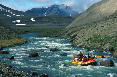
A United States National Monument is a protected area that is similar to a national park. They can be created from any land owned or controlled by the federal government.
A United States National Memorial is a designation for an officially recognized area that memorializes a historic person or event.
Click through on each entry below for full details of what each one has to offer.
African American Civil War Memorial National Memorial, District of Columbia Recreation Area Info & Images
Directions The memorial is located at the corner of Vermont Avenue, 10th St, and U Street NW, near the U Street/African-American Civil War Memorial/Cardozo Metro Station. Phone (202) 426-6841 Campground Reservations District of Columbia Campgrounds Hiking Trails District of Columbia Hiking Trails Related Link(s) More District of Columbia Recreation Areas
African Burial Ground National Monument, New York Recreation Area Info & Images
Directions The African Burial Ground National Monument is located on the first floor of the Ted Weiss Federal Building located at 290 Broadway in Lower Manhattan; close to Foley Square and just north of City Hall. Our visitor center is located mid-block on Broadway between the cross streets of Duane
Agate Fossil Beds National Monument, Nebraska Recreation Area Info & Images
Directions If traveling east or west on U.S. Highway 20 go 22 miles south of Harrison, NE on State Hwy 29 then 3 miles east on River Road (paved) If traveling east or west on U.S. Highway 26 go 34 miles north of Mitchell, NE on State Hwy 29 then
Agua Fria National Monument, Arizona Recreation Area Info & Images
Directions The Agua Fria National Monument is located 40 miles north of Phoenix, AZ. It is easily accessed by traveling to Interstate 17 to the Badger Springs (Exit #256), Bloody Basin Road (Exit #259), or Cordes Junction exits. Phone (623) 580-5500 Activities AUTO TOURING, BIKING, HISTORIC & CULTURAL SITE, CAMPING,
Alibates Flint Quarries National Monument, Texas Recreation Area Info & Images
Directions Alibates Flint Quarries is located approximately 35 miles north of Amarillo, Texas. From I-40 in Amarillo, take Lakeside exit north towards Lake Meredith National Recreation Area. Exit on TX 136 north towards Borger. After about 30 miles, turn west from TX 136 onto Cas Johnson Road. Park Service signs
Aniakchak National Monument & Preserve, Alaska Recreation Area Info & Images
Directions Located on the Alaska Peninsula, 450 miles southwest of Anchorage, Aniakchak National Monument and Preserve is inaccessible by road. Notoriously bad weather makes access to Aniakchak unpredictable. Drop-offs and/or pick-ups may be significantly delayed. Phone (907) 246-3305 Activities CLIMBING, CAMPING, HIKING, WILDLIFE VIEWING Campground Reservations Alaska Campgrounds Hiking Trails
Arkansas Post National Memorial, Arkansas Recreation Area Info & Images
Directions Arkansas Post National Memorial is located in southeastern Arkansas. The entrance to the park is on Arkansas Hwy 169, seven miles south of Gillett, via US Hwy 165 (The Great River Road), and about 20 miles northeast of Dumas, via US 165. Phone (870) 548-2207 Activities BOATING, HISTORIC &
Aztec Ruins National Monument, New Mexico Recreation Area Info & Images
Directions From Albuquerque/Bloomfield, NM: Follow Hwy 550 north into Aztec, turn left onto Highway 516, drive 3/4 mile, then turn right onto Ruins Road. Follow Ruins Road 1/2 mile to the monument. From Durango, CO: Follow Hwy 550 south into Aztec, where it will become 516. Turn right onto Ruins
Bandelier National Monument, New Mexico Recreation Area Info & Images
Directions From NM285 US84 in Pojaque NM. West on NM502, West on NM4 to White rock. Then 12 miles to the monument entrance on the south side of the road. Phone (505) 672-3861 Activities HISTORIC & CULTURAL SITE, CAMPING, HIKING, PICNICKING, WILDLIFE VIEWING Campground Reservations New Mexico Campgrounds | PONDEROSA
Bears Ears National Monument, Utah Recreation Area Info & Images
Directions There is no visitor center for the National Monument. The nearest communities are Monument Valley, Mexican Hat, Bluff, Blanding, and Monticello. Highways 191, 211, 95, 261, and 163 all provide access to portions of National Monument. Major commercial airlines serve Salt Lake City and St. George, Utah; Grand Junction,
Belmont-Paul Women’s Equality National Monument, District of Columbia Recreation Area Info & Images
Directions The Belmont-Paul Women’s Equality NM is located on Capitol Hill at the corner of Constitution Avenue and 2nd Street, NE, next to the Hart Senate Office building. It is a free-standing, federal style brick house surrounded by a black cast-iron fence. The entrance for museum tours and the museum
Booker T Washington National Monument, Virginia Recreation Area Info & Images
Directions The monument is located on AV 122 (Booker T. Washington Highway), 22 miles southeast of Roanoke, VA. From I-81 take I-581, then U.S. 220 south from Roanoke to VA 122. From the Blule Ridge Parkway take VA 43 south to VA 122. From Lynchburg take U.S. 460 west to
Browns Canyon National Monument, Colorado Recreation Area Info & Images
Directions The National Monument is centered along the Arkansas River between the communities of Buena Vista and Salida. Phone 719-539-8500 Activities CAMPING, FISHING, HIKING, HORSEBACK RIDING, HUNTING, WATER SPORTS, WILDLIFE VIEWING, PHOTOGRAPHY Campground Reservations Colorado Campgrounds Hiking Trails Colorado Hiking Trails Related Link(s) More Colorado Recreation Areas | Plan Your
César E. Chávez National Monument, California Recreation Area Info & Images
Directions The monument is located near the small town of Keene, California on Highway 58. From Highway 58, take exit 138 toward Keene, then turn right on Woodford-Tehachapi Road. César E. Chávez National Monument will be on your left. Phone (661) 823-6134 Campground Reservations California Campgrounds Hiking Trails California Hiking
Cabrillo National Monument, California Recreation Area Info & Images
Directions FROM DOWNTOWN SAN DIEGO Take Harbor Drive past the airport Turn left onto Rosecrans Street Turn right onto Canon Street Turn left onto Catalina Blvd. (also known as Cabrillo Memorial Drive) Follow Catalina Blvd. all the way to the end Phone (619) 523-4285 Activities HISTORIC & CULTURAL SITE, HIKING,
California Coastal National Monument, California Recreation Area Info & Images
Directions From Monterey take CA Hwy 1 8.5 miles to exit 408/Imjin Parkway exit. Merge left and take a left on the 1st stoplight 2nd avenue. Take the 1st right into the parking area. Phone 831-582-2200 Activities INTERPRETIVE PROGRAMS, FISHING, WILDLIFE VIEWING, ENVIRONMENTAL EDUCATION, PHOTOGRAPHY, SNORKELING Campground Reservations California Campgrounds
Canyon de Chelly National Monument, Arizona Recreation Area Info & Images
Directions The recommended route to the park is from Highway 191 in Chinle then turning east on Route 7. The park entrance and Visitor Center is about 3 miles from Highway 191. An alternative is entering the park on the East side via Route 64. There are 3 overlooks to
Canyons of the Ancient National Monument, Colorado Recreation Area Info & Images
Directions All visitors to the monument are encouraged to contact the Anasazi Heritage Center before visiting the monument. From Dolores, Colorado, travel west on State Highway 145, then turn west (right) on State Highway 184. Or if you are coming from Cortez, travel north on State Highway 145, then turn
Cape Henry Memorial Part of Colonial National Historical Park, Virginia Recreation Area Info & Images
Directions Located on the south side of the Chesapeake Bay, Cape Henry Memorial sits within the Joint Expeditionary Base Little Creek-Fort Story. From Interstate 64 E take exit 282 to merge onto US-13N/Northhampton Boulevard towards the Chesapeake Bay Bridge. Then take US-60 E/Shore Drive exit toward Beaches, this is the
Cape Krusenstern National Monument, Alaska Recreation Area Info & Images
Directions Cape Krusenstern National Monument lies within a remote area of northwest Alaska and is bordered by the Arctic Ocean and Chukchi Sea. Visitors generally access the monument via the regional hub in Kotzebue. Commercial airlines provide daily service from Anchorage to Kotzebue. Chartered flights with licensed air taxi services,
Capulin Volcano National Monument, New Mexico Recreation Area Info & Images
Directions Capulin Volcano National Monument is located in northeast New Mexico. The monument is located 34 miles east of Raton, NM, and 60 miles west of Clayton, NM on NM325 North of US64. No public transportation systems serve the park. Phone (575) 278-2201 Activities BIKING, HIKING, WILDLIFE VIEWING Campground Reservations
Carrizo Plain National Monument, California Recreation Area Info & Images
Directions Carrizo Plain National Monument is west of Bakersfield, California. This area is very remote and undeveloped, therefore it is recommended that you do not rely on GPS or other mapping programs to lead you to the park. Phone Visitor Center: 805-475-2131 Office: 661-391-6000 Activities BIKING, CAMPING, HORSEBACK RIDING, HUNTING,
Casa Grande Ruins National Monument, Arizona Recreation Area Info & Images
Directions Transportation is by private vehicle. The park is in Coolidge, Arizona, about an hour-long drive from either Phoenix or Tucson. From Interstate 10 take the Coolidge exits and follow the signs to the park entrance. Phone (520) 723-3172 Activities HISTORIC & CULTURAL SITE, PICNICKING Campground Reservations Arizona Campgrounds Hiking
Cascade-Siskiyou National Monument, Oregon Recreation Area Info & Images
Directions Phone 541-618-2200 Activities CAMPING, HIKING, HORSEBACK RIDING, PICNICKING, WILDLIFE VIEWING Campground Reservations Oregon Campgrounds Hiking Trails Oregon Hiking Trails Related Link(s) More Oregon Recreation Areas The Cascade-Siskiyou National Monument was created to protect an array of biological, geological, hydrological, archeological and historic resources. Although important individually, collectively these resources
Castillo De San Marcos National Monument, Florida Recreation Area Info & Images
Directions On State Route A1A overlooking Matanzas Bay in the heart of the historic district of Saint Augustine, the Castillo is approximately a five mile drive from Interstate 95. Phone (904) 829-6506 Activities HISTORIC & CULTURAL SITE Campground Reservations Florida Campgrounds Hiking Trails Florida Hiking Trails Related Link(s) More Florida
Castle Clinton National Monument, New York Recreation Area Info & Images
Directions Castle Clinton is located in historic Battery Park. It is only directly accessible by foot, bicycle, or wheelchair. You cannot drive directly to the site. Local parking is nearly impossible to find and expensive. All public transportation options are located outside of Battery Park. Phone (212) 344-7220 Activities HISTORIC
Castle Mountains National Monument, California Recreation Area Info & Images
Directions You can approach Castle Mountains from Walking Box Ranch Road off of Nevada State Rd 164 (Nipton Road) or from several unnamed dirt roads off of Lanfair Road in Mojave National Preserve. Phone (760) 252-6100 Activities CAMPING Campground Reservations California Campgrounds Hiking Trails California Hiking Trails Related Link(s) More
Cedar Breaks National Monument, Utah Recreation Area Info & Images
Directions Driving S on I-15: Exit 78 to Parowan Turn L onto E Cntr St Turn R onto UT Hwy 143 E Drive 15 miles to Cedar Breaks Driving N on I-15: Exit 57 to Cedar City Travel N on Main St Turn R onto E Cntr St /UT Hwy
Chamizal National Memorial, Texas Recreation Area Info & Images
Directions From the west take exit 21 off of I-10 toward Piedras Street. Turn right onto Piedras and follow it to Paisano Drive. Turn left onto Paisano and then turn right onto San Marcial Street. From the north take exit 20A off of US-54 for US-62 toward Paisano Drive. Turn
Charles Young Buffalo Soldiers National Monument, Ohio Recreation Area Info & Images
Directions “Youngsholm” is located in Wilberforce, Ohio near Wilberforce University. It is situated less than one mile west of the Wilberforce University and Central State University campuses on U.S. Route 42 at 1120 US Route 42 E. Phone (937) 352-6757 Activities AUTO TOURING Campground Reservations Ohio Campgrounds Hiking Trails Ohio
Chiricahua National Monument, Arizona Recreation Area Info & Images
Directions Chiricahua National Monument is located 120 miles southeast of Tucson. Take I-10 east from Tucson to the first exit for Willcox. Travel 3 miles into town to the stoplight and turn right. You will follow Arizona State Highway 186 for 32 miles to the junction of Arizona State Highway
Colorado National Monument, Colorado Recreation Area Info & Images
Directions Driving Westbound on Highway I-70 towards Grand Junction, Exit 31 (Horizon Drive). Follow signs through Grand Junction to the east entrance. The visitor center and campground are 19 miles from the east entrance. Eastbound on Highway I-70 take Exit 19 (Fruita). Turn south on Highway 340 to the west
Coronado National Memorial, Arizona Recreation Area Info & Images
Directions From the city of Sierra Vista continue south on Hwy 92 about 20 miles and turn right onto S. Coronado Memorial Drive. Follow Coronado Memorial Drive (it will turn into E Montezuma Canyon Rd) 5 miles to the Visitor Center. Phone (520) 366-5515 Campground Reservations Arizona Campgrounds Hiking Trails
Craters Of The Moon National Monument & Preserve, Idaho Recreation Area Info & Images
Directions Visitor Center and Loop Drive are located 18 miles southwest of Arco, Idaho on U.S. Highway 20/26/93, 24 miles northeast of Carey, Idaho on U.S. Highway 20/26/93, 84 miles from Idaho Falls, and 90 miles from Twin Falls. Physical address is 1266 Craters Loop Road(Lat/Long: 43° 27.711’N/113° 33.7) Access
Craters of the Moon National Monument, Idaho Recreation Area Info & Images
Directions From Idaho Falls, follow U.S. Highway 20 west about 68 miles to Arco. Follow U.S. Highway 93 about 18 miles southwest to the Craters of the Moon Visitor Center. Other parts of the monument can be accessed on unpaved roads from the town of Carey, also located on U.S.
Craters of the Moon National Monument, Idaho Recreation Area Info & Images
Directions 18 miles southwest of Arco, Idaho on Highway 20/26/93, 24 miles northeast of Carey, Idaho on Highway 20/26/93, 84 miles from Idaho Falls, and 90 miles from Twin Falls. Phone 208-527-1335 Activities AUTO TOURING, BIKING, CAMPING, INTERPRETIVE PROGRAMS, HIKING, HORSEBACK RIDING, HUNTING, WINTER SPORTS, WILDLIFE VIEWING, ENVIRONMENTAL EDUCATION, PHOTOGRAPHY
David Berger National Memorial, Ohio Recreation Area Info & Images
Directions The David Berger National Memorial is located on the grounds of the Mandel Jewish Community Center of Cleveland. Phone (330) 657-2752 Campground Reservations Ohio Campgrounds Hiking Trails Ohio Hiking Trails Related Link(s) More Ohio Recreation Areas | David Berger National Memorial Official Website | David Berger National Memorial Map
De Soto National Memorial, Florida Recreation Area Info & Images
Directions Driving Directions: From I-75 Take exit 220 SR 64/Manatee Ave, Gulf Beaches exit. Travel west on SR 64 for approximately 12 miles to 75th St. W. Turn right onto 75th St. W. travel north approximately 2 miles to the northern terminus 75th St. W. turns into De Soto Memorial
Devils Postpile National Monument, California Recreation Area Info & Images
Directions Shuttle Bus: Most visitors must park at the Mammoth Mountain Ski Area and use the mandatory shuttle. The shuttle bus operates from mid-June through the Wednesday after Labor Day. By car: From U.S. Highway 395, drive 10 miles west on S.R. 203 to Minaret Vista and then another 8
Devils Tower National Monument, Wyoming Recreation Area Info & Images
Directions The park entrance is located 33 miles northeast of Moorcroft, 27 miles northwest of Sundance, and 52 miles southwest of Belle Fourche, SD. If approaching from the east or west, take US Hwy 14 to WY 24 (follow the signs from I-90). If approaching from the north, take WY
Dinosaur National Monument, Colorado Recreation Area Info & Images
Directions Dinosaur National Monument is located on the Colorado and Utah border with a parts of the monument in both states. Dinosaur fossils are not visible in the Colorado portion of the monument – only on the Utah side. The Quarry Visitor Center and Exhibit Hall (where you see the
Effigy Mounds National Monument, Iowa Recreation Area Info & Images
Directions Located 3 miles north of Marquette, Iowa on Hwy 76. Phone (563) 873-3491 Activities HIKING, WILDLIFE VIEWING Campground Reservations Iowa Campgrounds Hiking Trails Iowa Hiking Trails Related Link(s) More Iowa Recreation Areas | Effigy Mounds National Monument Official Website | Effigy Mounds National Monument Map The mounds preserved here
El Malpais National Monument, New Mexico Recreation Area Info & Images
Directions Take exit 85 of I-40 in Grants, New Mexico. After you exit, head south on Santa Fe Ave, and continue straight over the freeway overpass. Take a left at the entrance sign for El Malpais Visitor Center. Continue 300 yards until you reach the parking lot. Phone (505) 876-2783
El Morro National Monument, New Mexico Recreation Area Info & Images
Directions From Albuquerque, NM, or from the east: take Interstate 40 west to Grants. At exit 81, go south on Highway 53 for 42 miles to El Morro National Monument. From Flagstaff, AZ, or from the west: take Interstate 40 east to Gallup. At exit 20, go south on Highway
Ellis Island Part of Statue of Liberty National Monument, New Jersey Recreation Area Info & Images
Directions Ellis Island is located in New York Harbor, and can only be reached by boat. Ferries are operated by Statue Cruises, and depart from Battery Park in Lower Manhattan in New York City. Ferries are also available from Liberty State Park in Jersey City, New Jersey. Phone (212) 363-3200
Federal Hall National Memorial, New York Recreation Area Info & Images
Directions The main entrance of Federal Hall is located at 26 Wall Street, near the corner of Wall Street and Nassau Street in Manhattan’s Financial District. The rear entrance, which is wheelchair accessible, is located at 15 Pine Street, near the intersection of Pine Street and Nassau Street. It is
First State National Monument, Delaware Recreation Area Info & Images
Directions Seven sites make up First State National Historical Park in Delaware and southeastern Pennsylvania. For details and directions for each site, please visit the visitor centers page below. Phone (302) 544-6363 Activities BIKING, HISTORIC & CULTURAL SITE, FISHING, HIKING, HORSEBACK RIDING, PICNICKING Campground Reservations Delaware Campgrounds Hiking Trails Delaware
Flight 93 National Memorial, Pennsylvania Recreation Area Info & Images
Directions The entrance to the memorial is located on US Route 30/Lincoln Highway. Traveling east on the PA Turnpike take exit 110 – Somerset and follow the signs. Traveling west on the PA Turnpike take exit 146 – Bedford. GPS Address: 6424 Lincoln Highway, Stoystown, PA 15563. Please note mapping
Florissant Fossil Beds National Monument, Colorado Recreation Area Info & Images
Directions Visitors traveling north/south on I-25: Exit at US 24 West, travel 35 miles to town of Florissant, then follow signs two miles south on Teller County Road 1 to the Visitor Center. Visitors traveling from town of Cripple Creek: Follow Teller County Road 1 north for 16 miles. Phone
Fort Caroline National Memorial, Florida Recreation Area Info & Images
Directions From Downtown Jacksonville, take Union Street to the Mathews Bridge to the Arlington Expressway to the flyover exit for the Southside Connector. Take the connector to Merrill Road and turn right. Merrill Road becomes Fort Caroline Road in approximately 1/2 mile. Continue on Fort Caroline Road, passing through the
Fort Frederica National Monument, Georgia Recreation Area Info & Images
Directions South on I 95 to U.S. 17: Exit 38 and Left onto Spur 25. Follow Spur 25 until U.S. 17. Take a right on U.S. 17 (south). North on I 95 to U.S. 17: Exit 29 and Right onto U.S. 17. From US 17: Take Causeway to St. Simons
Fort Matanzas National Monument, Florida Recreation Area Info & Images
Directions Fort Matanzas is 14 miles south of Saint Augustine on State Route A1A. Phone (904) 471-0116 Activities HISTORIC & CULTURAL SITE Campground Reservations Florida Campgrounds Hiking Trails Florida Hiking Trails Related Link(s) More Florida Recreation Areas | Fort Matanzas National Monument Official Website | Fort Matanzas National Monument Map
Fort McHenry National Monument and Historic Shrine, Maryland Recreation Area Info & Images
Directions The park is three miles southeast of the Baltimore Inner Harbor and just off I-95. Follow the brown Fort McHenry directional signs along all major routes to the park. From I-95 northbound, take Exit 55 Key Highway and follow Fort McHenry signs. Phone (410) 962-4290 Campground Reservations Maryland Campgrounds
Fort Monroe National Monument, Virginia Recreation Area Info & Images
Directions From I-64 East or West take Exit 268 (169 East Mallory St/Ft. Monroe) (Going East: Last Exit prior to Hampton Roads Bridge Tunnel, going West: first Exit after it.) Top of Exit Left at light onto S Mallory St (0.1 mile). Right at 2nd light onto E Mellen St.
Fort Ord National Monument, California Recreation Area Info & Images
Directions Creekside Terrace Trailhead is just off Highway 68 near the intersection of Reservation Road and Portola Road. Badger Hills Trailhead is just off Highway 68 six miles east of Salinas, CA. Phone 831-582-2200 Activities BIKING, INTERPRETIVE PROGRAMS, HIKING, HORSEBACK RIDING, WILDLIFE VIEWING, ENVIRONMENTAL EDUCATION, PHOTOGRAPHY Campground Reservations California Campgrounds
Fort Pulaski National Monument, Georgia Recreation Area Info & Images
Directions From Interstate I-95, take Exit 99 onto Interstate I-16 East (James L Gillis Memorial Hwy) for 7 miles. Take Exit 164A onto Interstate I-516 East toward US-80 East. Take Exit 3 (US-17 S/US-80 E) toward US-80 East. Turn left onto Ocean Highway, Ogeechee Rd (US-17 N, US-80 East). Bear
Fort Stanwix National Monument, New York Recreation Area Info & Images
Directions Take I-90 (NY Thruway) to Exit 33 (Verona-Rome). Turn Right onto Rt. 365 E. Follow Rt. 365, veering left as Rt. 365 merges with Rt 69 at the fork in the road. This will take you over an arterial bridge into the City of Rome. Fort Stanwix NM will
Fort Union National Monument, New Mexico Recreation Area Info & Images
Directions Fort Union National Monument is located in the Northeastern portion of the state of New Mexico. 8 miles off of Interstate I-25 on State Highway NM 161. New Mexico: From Albuquerque (156 miles), Santa Fe (94 miles) or Las Vegas, NM (28 miles) take I-25 North, exit 366 at
Fossil Butte National Monument, Wyoming Recreation Area Info & Images
Directions By car: Travel 9 miles west of Kemmerer, Wyoming on U.S. Highway 30. There is a highway sign near mile post 44; turn right onto Lincoln County Road 300. The Historic Quarry Trail is approximately 1/2 mile on the right. Continue west on County Road 300 for approximately 3
General Grant National Memorial, New York Recreation Area Info & Images
Directions General Grant National Memorial is located in Riverside Park, on the upper west-side of Manhattan. The entrance to the mausoleum is between north-bound and south-bound Riverside Drive, near the intersection of West 122nd Street. The visitor center is located to the west, across south-bound Riverside Drive. Street parking is
George Washington Birthplace National Monument, Virginia Recreation Area Info & Images
Directions George Washington Birthplace is located off two miles from Virginia state route 3 on Virginia state route 204. The park is located 38 miles east of Fredericksburg and 10 miles from Colonial Beach. Phone (804) 224-1732 Activities HISTORIC & CULTURAL SITE, FISHING Campground Reservations Virginia Campgrounds | George Washington
George Washington Carver National Monument, Missouri Recreation Area Info & Images
Directions From I-44 Westbound: Take exit 18-A and travel south on Highway 59 to Diamond. Turn west onto Highway V and travel two miles to Carver Road. Travel south ¾ mile to the park entrance. From I-44 Eastbound: Take exit 11-A and travel south on I-49 to Highway V. Turn
Gila Cliff Dwellings National Monument, New Mexico Recreation Area Info & Images
Directions Passenger vehicles can drive north of Silver City, New Mexico to the monument on NM Hwy 15. The 46 mile trip can take up to two hours due to the narrow and mountainous curving nature of the road. Large RVs and vehicles pulling trailers should NOT use NM Hwy
Governors Island National Monument, New York Recreation Area Info & Images
Directions Governors Island is located in New York Harbor, 1/2 mile from the southern tip of Lower Manhattan and 400 yards west of the end of Brooklyn’s Atlantic Avenue and Red Hook waterfront. It is accessible only via ferry. Ferry service from Manhattan is the main way to access the
Grand Portage National Monument, Minnesota Recreation Area Info & Images
Directions Traveling northeast or southwest on MN Hwy 61 visitors will see signs alerting the approach to Grand Portage National Monument. A right turn exit lane or left turn from Hwy 61 at the Grand Portage Trading Post will take visitors onto Casino Road. Turn left at the first stop
Grand Staircase-Escalante National Monument, Utah Recreation Area Info & Images
Directions Grand Staircase-Escalante National Monument is located in southern Utah, approximately 290 highway miles south of Salt Lake City or 250 miles east of Las Vegas. Two paved roads provide access to the Monument: Highway 89 on the south and Highway 12 on the north. The Monument is REMOTE, and
Hagerman Fossil Beds National Monument, Idaho Recreation Area Info & Images
Directions When visiting Hagerman Fossil Beds NM we recommend you stop at the Visitor Center, located at 221 N State St, to begin your visit. There you get the latest information, see an introductory DVD, view fossils up close, and obtain helpful information about the amenities available in the area.
Hamilton Grange National Memorial, New York Recreation Area Info & Images
Directions Hamilton Grange National Memorial is in Saint Nicholas Park in Manhattan. It is located at 414 West 141st Street, between Convent Avenue and St. Nicholas Avenue. Phone (646) 548-2310 Activities HISTORIC & CULTURAL SITE Campground Reservations New York Campgrounds Hiking Trails New York Hiking Trails Related Link(s) More New
Harriet Tubman Underground Railroad National Monument, Maryland Recreation Area Info & Images
Directions The Harriet Tubman Underground Railroad Visitor Center is located approximately 11 miles south of Cambridge, Maryland. From US 50, turn south on Route 16. Follow Route 16 to Church Creek about 7 miles; turn south on Route 335 / Golden Hill Road. Follow Route 335 about 4.5 miles, and
Homestead National Monument of America, Nebraska Recreation Area Info & Images
Directions The park is 4 miles west of Beatrice on State Highway 4. From the U.S. 77 and U.S. 136 intersection in downtown Beatrice take U.S. 136 approximately 1.2 miles west. Turn right onto Nebraska Highway 4 and follow the signs.After the road has curved west and you have traveled
Hovenweep National Monument, Colorado Recreation Area Info & Images
Directions Do not use GPS to find your way. There are numerous paved and dirt roads intersecting each other in this remote corner of Utah. The Hovenweep Visitor Center is located 40-45 miles from Cortez, Colorado, and Blanding and Bluff, Utah. Follow driving directions on our webpage. Phone (970) 562-4282
Jewel Cave National Monument, South Dakota Recreation Area Info & Images
Directions By car: Jewel Cave National Monument is located 13 miles west of Custer, South Dakota and 24 miles east of Newcastle, Wyoming on U.S. Highway 16. The Monument is about 54 miles from Rapid City, South Dakota via U.S. Highway 16 / 385. By plane: The nearest major airport,
John Day Fossil Beds National Monument, Oregon Recreation Area Info & Images
Directions John Day Fossil Beds encompasses 14,000 acres in three geographically separated units in Oregon: Sheep Rock, Painted Hills, and Clarno. The Sheep Rock Unit is located between the towns of Dayville and Kimberly. The Painted Hills Unit is located 9 miles northwest of of the town of Mitchell. The
Johnstown Flood National Memorial, Pennsylvania Recreation Area Info & Images
Directions Take US Route 219 to the St Michael/Sidman exit. At the end of the exit ramp head East on PA 869 (there is a park sign at the end of the exit ramp). Travel approximately 1.5 miles on PA 869 watching for a left turn onto Lake Road at
Kasha-Katuwe Tent Rocks National Monument, New Mexico Recreation Area Info & Images
Directions From Albuquerque, head north on I-25 and take the exit for Santo Domingo/Cochiti Lake Recreation Area (Exit 259) off I-25 onto NM 22. Follow the signs on NM 22 to Cochiti Pueblo and Kasha-Katuwe Tent Rocks National Monument. From Santa Fe, head south on I-25 and take the Cochiti
Katahdin Woods and Waters National Monument, Maine Recreation Area Info & Images
Directions Katahdin Woods and Waters National Monument is located in north central Maine approximately a 2.5-hour drive west of Acadia National Park in Bar Harbor and 1.5-hour drive north of Bangor, Maine, both of which are served by regional airports. Phone (207) 456-6001 Activities FISHING, HIKING, HUNTING, WILDLIFE VIEWING, PADDLING
Lava Beds National Monument, California Recreation Area Info & Images
Directions Lava Beds is a truly remote park, in a corner of California most people never visit. Most roads into this area wind through mountains, and along rivers, and travel may take longer than expected. Services are few and far between and winter driving conditions can be encountered anytime between
Lincoln Boyhood National Memorial, Indiana Recreation Area Info & Images
Directions From the east or west – From Interstate 64, exit onto US 231, (exit 57A). Travel south on US 231 to Indiana Highway 162. Take the Santa Claus/Gentryville exit. Turn west (right) on Indiana Highway 162; go 1-1/2 miles to the park entrance on the right. From the north
Little Bighorn Battlefield National Monument, Montana Recreation Area Info & Images
Directions Take Interstate I-90 and get off at Crow Agency Exit 510 at Jct 212. To reach Little Bighorn Battlefield National Monument, take Battlefield Tour Road 756 Phone (406) 638-3216 Campground Reservations Montana Campgrounds Hiking Trails Montana Hiking Trails Related Link(s) More Montana Recreation Areas | Little Bighorn Battlefield National
Mariana Trench Marine National Monument, NULL Recreation Area Info & Images
Directions Located in the Mariana Archipelago east of the Philippines. Phone 808-792-9560 Campground Reservations NULL Campgrounds Hiking Trails NULL Hiking Trails Related Link(s) More NULL Recreation Areas | Marianas Trench Marine National Monument Map | Marianas Trench Marine National Monument “On January 6, 2009, President George W. Bush established the
Martin Luther King, Jr. Memorial National Memorial, District of Columbia Recreation Area Info & Images
Directions GPS Coordinates: 38.886298, -77.044415 GPS navigation: 1850 West Basin Drive SW, Washington, D.C. 20024 Nearest Intersection: West Basin Drive SW & Independence Ave. SW Phone (202) 426-6841 Campground Reservations District of Columbia Campgrounds Hiking Trails District of Columbia Hiking Trails Related Link(s) More District of Columbia Recreation Areas |
Mojave Trails National Monument, California Recreation Area Info & Images
Directions From Needles, CA, take I-40 west approx. 10 miles to the U.S. Highway 95 north exit. This is eastern entrance to the monument. Phone 760-326-7000 Activities AUTO TOURING, BIKING, CLIMBING, HISTORIC & CULTURAL SITE, CAMPING, HIKING, HORSEBACK RIDING, HUNTING, PICNICKING, WILDLIFE VIEWING, WILDERNESS, ENVIRONMENTAL EDUCATION, PHOTOGRAPHY Campground Reservations California
Montezuma Castle National Monument, Arizona Recreation Area Info & Images
Directions Montezuma Castle: Follow I-17 to exit 289 (90 minutes north of Phoenix, 45 minutes south of Flagstaff). Drive east (through two traffic circles) for approximately 1/2 mile to the blinking red light. Turn left onto Montezuma Castle Road. Montezuma Well: Follow I-17 to exit 293 (north of the exit
Mount Rushmore National Memorial, South Dakota Recreation Area Info & Images
Directions Visitors traveling by car from the East use Exit 61 off I-90 follow signs. Coming from the West use exit 57 exit at Rapid City and follow U.S. Highway 16 southwest to Keystone and then Highway 244 to Mount Rushmore. Visitors coming from the south should follow Highway 385
Muir Woods National Monument, California Recreation Area Info & Images
Directions From San Francisco Muir Woods is located 11 miles north of the Golden Gate Bridge Take Hwy 101 North Then the Mill Valley/Highway 1/ Stinson Beach Exit Follow the signs to Hwy 1 Follow the signs to Muir Woods From the East Bay Take Hwy 580/Richmond/San Rafael Bridge West
National Mall and Memorial Parks, District of Columbia Recreation Area Info & Images
Directions National Mall and Memorial Parks preserves more than one thousand acres of federal parkland in Washington, DC, including: the Washington Monument, Lincoln Memorial, Jefferson Memorial, Franklin Delano Roosevelt Memorial, Martin Luther King, Jr. Memorial, Vietnam Veterans Memorial, Korean War Veterans Memorial, DC War Memorial, and East and West Potomac
Natural Bridges National Monument, Utah Recreation Area Info & Images
Directions The entrance to Natural Bridges is at the end of UT 275, which is roughly 35 miles west of Blanding, Utah, on UT 95. Driving time from Blanding is roughly 45 minutes. Phone (435) 692-1234 Activities CAMPING, HIKING Campground Reservations Utah Campgrounds Hiking Trails Utah Hiking Trails Related Link(s)
Navajo National Monument, Arizona Recreation Area Info & Images
Directions Drive 9 Miles at the end of AZ Highway 564, off US Highway 160. Phone (928) 672-2700 Activities HISTORIC & CULTURAL SITE, CAMPING, HIKING Campground Reservations Arizona Campgrounds Hiking Trails Arizona Hiking Trails Related Link(s) More Arizona Recreation Areas | Navajo National Monument Official Website | Navajo National Monument
Oklahoma City National Memorial, Oklahoma Recreation Area Info & Images
Directions The Memorial & Museum are located at 6th St. and Harvey Ave in Oklahoma City, OK. Phone (405) 609-8859 Campground Reservations Oklahoma Campgrounds Hiking Trails Oklahoma Hiking Trails Related Link(s) More Oklahoma Recreation Areas | Oklahoma City National Memorial Official Website | Oklahoma City National Memorial Map The outdoor
Oregon Caves National Monument & Preserve, Oregon Recreation Area Info & Images
Directions Take 199 to Cave Junction, Oregon. Turn onto OR-46 (a Chevron gas station is on the corner). Follow OR-46 for 20 miles to the Monument and Preserve. Phone (541) 592-2100 Activities CAMPING, HIKING, HUNTING, PICNICKING, WILDLIFE VIEWING, SWIMMING Campground Reservations Oregon Campgrounds Hiking Trails Oregon Hiking Trails Related Link(s)
Organ Pipe Cactus National Monument, Arizona Recreation Area Info & Images
Directions The Kris Eggle Visitor Center is located on Highway 85, approximately 25 miles south of Why, AZ. Phone (520) 387-6849 Activities AUTO TOURING, BIKING, CAMPING, HIKING, HORSEBACK RIDING, WILDLIFE VIEWING, HORSE CAMPING Campground Reservations Arizona Campgrounds | TWIN PEAKS CAMPGROUND Hiking Trails Arizona Hiking Trails Related Link(s) More Arizona
Papahanaumokuakea Marine National Monument, Hawaii Recreation Area Info & Images
Directions The Monument includes all federally owned or controlled emergent and submerged lands of the Northwestern Hawaiian Islands and the waters that surround and lie atop them. They begin approximately 115 nautical miles (140 miles) northwest of the main Hawaiian Islands, and extend northwest for more than 950 nautical miles
Parashant National Monument, Utah Recreation Area Info & Images
Directions The monument is located in the northwest corner of Arizona, bordering Nevada to the west and near the southern border of Utah. There are no paved roads or visitor services within the monument’s million-plus acres. Visitors should be prepared for travel on rugged dirt roads. Traveling with an appropriate
Pearl Harbor National Memorial, Hawaii Recreation Area Info & Images
Directions Please input our address rather than just “Pearl Harbor,” as this will take you to the active military base, not the Pearl Harbor Visitor Center. Phone (808) 422-3399 Campground Reservations Hawaii Campgrounds Hiking Trails Hawaii Hiking Trails Related Link(s) More Hawaii Recreation Areas | Pearl Harbor National Memorial Official
Perry’s Victory & International Peace Memorial, Ohio Recreation Area Info & Images
Directions Perry’s Victory and International Peace Memorial is located within the Village of Put-in-Bay, Ohio on South Bass Island. The most common way to reach the island is by the Jet Express or Miller Boat Line ferries. When traveling east, use Ohio Turnpike to US 250 north to SR 2
Petroglyph National Monument, New Mexico Recreation Area Info & Images
Directions GPS: Lat: 35.139 Long: -106.711 From Interstate 40, take the Unser Blvd. exit (#154) proceed north 3 miles to Western Trail. Turn left or west onto Western Trail and follow road to the Visitor Information Center parking lot. From Interstate 25, take the Paseo del Norte exit (#232) and
Pipe Spring National Monument, Arizona Recreation Area Info & Images
Directions Pipe Spring National Monument is located 15 miles west of Fredonia, AZ and 45 miles east of Hurricane, UT. From Interstate 15, turn onto Utah State Route 9 in Hurricane, Utah. Take Utah State Route 59 east out of Hurricane. This road turns into Arizona State Route 389 at
Pipestone National Monument, Minnesota Recreation Area Info & Images
Directions Plane: Commercial service – located at Sioux Falls, SD -Joe Foss Field airport. 50 miles from Pipestone National Monument. Rental cars are available at the airport. Non-Commercial service – located at Pipestone MN airport. Courtesy car or transit service available to Pipestone National Monument from the airport. Car: Pipestone
Port Chicago Naval Magazine National Memorial, California Recreation Area Info & Images
Directions The Port Chicago Naval Magazine National Memorial is on an active military base, so it is only accessible by reservation. The shuttle picks up visitors with reservations at the John Muir National Historic Site. Please know that all visitors for the memorial must have a reservation. Please visit our
Poverty Point National Monument, Louisiana Recreation Area Info & Images
Directions By car, from Interstate 20, take the Delhi exit and travel north on LA 17, east on LA 134 and north on LA 577. Phone (318) 926-5492 Campground Reservations Louisiana Campgrounds Hiking Trails Louisiana Hiking Trails Related Link(s) More Louisiana Recreation Areas | Poverty Point National Monument Official Website
Prehistoric Trackways National Monument, New Mexico Recreation Area Info & Images
Directions Coming from the North (I-25): At the DoÑa Ana Exit: From NM320 (Thorpe Road) in DoÑa Ana, go west to US 85, then go north about a half a mile to Shalem Colony Road. Turn west on Shalem Colony Trail, which curves to the south. Go about 1.5 miles
Pullman National Monument, Illinois Recreation Area Info & Images
Directions For detailed directions please visit the park’s website. Phone (773) 468-9310 Campground Reservations Illinois Campgrounds Hiking Trails Illinois Hiking Trails Related Link(s) More Illinois Recreation Areas | Pullman National Monument Official Website | Pullman National Monument Map In a growing Chicago neighborhood, diverse people and stories intertwine. All were
Rainbow Bridge National Monument, Arizona Recreation Area Info & Images
Directions Rainbow Bridge National Monument is located between Glen Canyon National Recreation Area and the Navajo Nation. There are no roads in the vicinity of the monument. Rainbow Bridge can be reached by boat on Lake Powell or by hiking one of two trails around Navajo Mountain on the Navajo
Rio Grande del Norte National Monument, New Mexico Recreation Area Info & Images
Directions The RÍo Grande del Norte National Monument, Wild Rivers Visitor Center is located in Cerro, NM, at 1120 Cerro Road. Go north from Questa on NM 522 and turn left on State Road 378; the Visitor Center is about 17 miles from the turn off. Phone 575-758-8851 Activities AUTO
Roger Williams National Memorial, Rhode Island Recreation Area Info & Images
Directions From Interstate 95 North, take Exit 23 – State Offices. Take a left at the light to the bottom of Orms Street. At light, right onto Charles Street; continue straight through one light, then quick left into memorial parking lot. From Interstate 95 South, take Exit 23 – Charles
Russell Cave National Monument, Alabama Recreation Area Info & Images
Directions Russell Cave National Monument is located at 3729 County Road 98 in Bridgeport, Alabama. It is situated in the northeast corner of Alabama, just south of the Tennessee state line. Phone (256) 495-2672 Activities HISTORIC & CULTURAL SITE, HIKING, WILDLIFE VIEWING Campground Reservations Alabama Campgrounds Hiking Trails Alabama Hiking
Salinas Pueblo Missions National Monument, New Mexico Recreation Area Info & Images
Directions Reach the Mountainair Headquarters by taking I-25 south from Albuquerque to Belen, then NM 47 diagonally to US 60, then east 21 miles to Mountainair. To travel the historic highway route (Turquoise Highway) from the north, take I-40 east from Albuquerque to NM 337, drive south 47 miles (76K)
Sand to Snow National Monument, California Recreation Area Info & Images
Directions The sandy part of Sand to Snow is accessible at the Whitewater Canyon Preserve area within the monument – the turnoff for Whitewater Canyon is five miles west of Palm Springs on Interstate 10. Take Whitewater Canyon Road five miles north to the trailhead. To visit the snowy parts
Santa Rosa and San Jacinto Mountains National Monument, California Recreation Area Info & Images
Directions The Santa Rosa Mountains Visitor Center located off State Highway 74 south of Palm Desert was dedicated in 1996 and open to the public. The Visitor Center address is 51-500 Hwy 74, Palm Desert, CA 92260 and is 4 miles south of the intersection of Highway 74 and Highway
Scotts Bluff National Monument, Nebraska Recreation Area Info & Images
Directions Visitors traveling east-west on Interstate 80 can exit at Kimball, Nebraska and drive 45 miles north on Highway 71. Follow National Park Service signs three miles west of Gering, Nebraska on Old Oregon Trail (State Highway 92 West). Visitors following Old Oregon Trail along the North Platte River using
Sonoran Desert National Monument, Arizona Recreation Area Info & Images
Directions The Sonoran Desert National Monument is in south central Arizona, 60 miles from Phoenix. Interstate 8 provides some access at the Vekol interchange (Exit 144) and the Freeman Interchange (Exit 140). State Highway 238 and the Maricopa Road afford access to the North Maricopa Mountains and the Butterfield Overland
Statue Of Liberty National Monument, New York Recreation Area Info & Images
Directions Liberty Island is located in New York Harbor, and can only be reached by boat. Ferries operated by Statue Cruises depart from Battery Park in Lower Manhattan in New York City, New York and Liberty State Park in Jersey City, New Jersey. Phone (212) 363-3200 Activities BOATING, PICNICKING Campground
Stonewall National Monument, New York Recreation Area Info & Images
Directions Christopher Park is bounded by Christopher, Grove, and West Fourth Streets. By subway, take the Broadway 1 Line – 7th Avenue local to Christopher Street-Sheridan Square Station; or via the 7th Avenue bus line on the M8 or M20. From Jersey City, take the Holland Tunnel to Ericsson Pl,
Sunset Crater Volcano National Monument, Arizona Recreation Area Info & Images
Directions Sunset Crater Volcano and Wupatki National Monuments are connected by loop road FR-545. Visitors can enter the loop road near mile markers 430 (Sunset Crater Volcano) and 444 (Wupatki) on U.S. Highway 89. Phone (928) 526-0502 Campground Reservations Arizona Campgrounds Hiking Trails Arizona Hiking Trails Related Link(s) More Arizona
Thaddeus Kosciuszko National Memorial, Pennsylvania Recreation Area Info & Images
Directions The Thaddeus Kosciuszko National Memorial is located at 301 Pine Street in Philadelphia. It is within walking distance of Independence Hall and the Liberty Bell Center. Parking is quite limited near the site. The site is easily accessible by public transportation. See the park’s web page for directions. Phone
Timpanogos Cave National Monument, Utah Recreation Area Info & Images
Directions From I-15: Take Exit 284 (Alpine-Highland exit), turn east on State Highway 92 and proceed ten miles (16km) to the monument. UT 40 or U.S. 189: Travel UT 189 through Provo Canyon, west on Orem 800 North (UT 52). After 2.4 miles turn right on State Street UT- 89.
Tonto National Monument, Arizona Recreation Area Info & Images
Directions The cliff dwellings at Tonto National Monument are roughly two hours from the Phoenix metro area, located in the Tonto Basin. The monument is off AZ Highway 188 near Roosevelt Lake. The nearest major towns are Globe (30 miles) and Payson (50 miles). See our Directions page for recommendations
Tule Lake National Monument, California Recreation Area Info & Images
Directions The visitor center is located at the Tulelake – Butte Valley Fairgrounds at 800 Main St. Tulelake, CA 96134 Phone 5302600537or5306678113 Campground Reservations California Campgrounds Hiking Trails California Hiking Trails Related Link(s) More California Recreation Areas | Tule Lake National Monument Official Website | Tule Lake National Monument Map
Tule Springs Fossil Beds National Monument, Nevada Recreation Area Info & Images
Directions Because Tule Springs is a new park, there is no visitor center, facilities or parking areas. Right now to access the park, people can park on nearby public roads in the cities of Las Vegas and North Las Vegas, and they can enter the monument on foot. Federal regulations
Tuzigoot National Monument, Arizona Recreation Area Info & Images
Directions From Phoenix or Flagstaff take I-17 to exit 287, and then travel west on Hwy 260 to Cottonwood. Once in Cottonwood travel north through the town on Main Street. Just before Clarkdale you will see signs directing visitors onto Tuzigoot Rd. Phone (928) 634-5564 Activities WILDLIFE VIEWING Campground Reservations
Upper Missouri River Breaks National Monument, Montana Recreation Area Info & Images
Directions The “Breaks” begins at historic Fort Benton on U.S. Highway 87 and ends 149 miles later where the Robinson Bridge on U.S. Highway 191 crosses the Missouri River. Phone 406-538-1900 Activities BOATING, CAMPING, FISHING, HIKING, HUNTING, WATER SPORTS, WILDLIFE VIEWING Campground Reservations Montana Campgrounds Hiking Trails Montana Hiking Trails
Waco Mammoth National Monument, Texas Recreation Area Info & Images
Directions From I-35 North, take exit 339 and head west on Lake Shore Drive. Turn right on Steinbeck Bend Drive and travel 1.5 miles to the Monument. From I-35 South, take exit 335C and head northwest on Martin Luther King, Jr. Boulevard. Continue straight onto Steinbeck Bend Drive and travel
Walnut Canyon National Monument, Arizona Recreation Area Info & Images
Directions Walnut Canyon National Monument is located approximately 7.5 miles (12 km) east of Flagstaff. From Interstate 40, take Exit 204, and turn south. The Walnut Canyon Visitor Center is located at the end of this 3-mile (5 km) road. Phone (928) 526-3367 Campground Reservations Arizona Campgrounds Hiking Trails Arizona
Wright Brothers National Memorial, North Carolina Recreation Area Info & Images
Directions Wright Brothers National Memorial is located along US 158 in the town of Kill Devil Hills on the Outer Banks of North Carolina. Phone (252) 473-2111 Campground Reservations North Carolina Campgrounds Hiking Trails North Carolina Hiking Trails Related Link(s) More North Carolina Recreation Areas | Wright Brothers National Memorial
Wupatki National Monument, Arizona Recreation Area Info & Images
Directions Wupatki and Sunset Crater Volcano National Monuments are connected by loop road FR-545. Visitors can enter the loop road near mile markers 430 (Sunset Crater Volcano) and 444 (Wupatki) on U.S. Highway 89. Phone 9286792365 or 9288561705 Activities HIKING, WILDLIFE VIEWING Campground Reservations Arizona Campgrounds Hiking Trails Arizona Hiking
Yucca House National Monument, Colorado Recreation Area Info & Images
Directions ¢From Cortez, take Hwy. 491 south approximately 8 miles. ¢Take a right on MC County Road B (green sign), which is a dirt road one mile south of MC Road C. ¢Drive 0.8 miles, crossing a paved road (MC Road 21), and take the next dirt road on the